Property Record
112 Goliad St, Benbrook, TX 76126


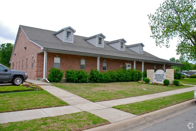

Property Detail
112 Goliad St
Dallas-Fort Worth-Arlington, TX
BENBROOK ESTATES ADDITION BLOCK 3 LOT 1R1
40689808
Tarrant
Commercialnec
Texas
B and X Area of moderate flood hazard, usually the area between the limits of the 100-year and 500-year floods.
1
2023
0.56 AC
2025
West Southwest Ft Worth
110906
Dallas/Ft Worth
6,168 SF
NEARBY LISTINGS FOR SALE OR LEASE
DEMOGRAPHICS near 112 Goliad St
1 mile
3 mile
5 mile
2025 Total Population
7,330
59,316
176,190
2030 Population
7,723
62,534
187,045
Pop Growth 2025-2030
+ 5.36%
+ 5.43%
+ 6.16%
Average Age
41
41
39
2025 Total Households
3,044
26,600
75,212
HH Growth 2025-2030
+ 5.55%
+ 5.60%
+ 6.26%
Median Household Inc
$94,655
$77,214
$70,518
Avg Household Size
2.40
2.20
2.30
2025 Avg HH Vehicles
2.00
2.00
2.00
Median Home Value
$338,277
$384,740
$353,147
Median Year Built
1986
1987
1985
Nearby Places
Map Layers
Map Styles
 Street
 Aerial
Transit
 Traffic
 Biking
Places
Listings with unknown addresses are not visible on the map
- Restaurants
- Banks
- Shops
- Fitness
- Groceries
PUBLIC TRANSPORTATION
AIRPORT
Dallas-Fort Worth International
Drive
Walk
Distance
Dallas-Fort Worth International
48 min
35.3 mi
Nearby Properties
Address
Land Use
TOTAL SIZE
Lot Size
Zoning
Address
Land Use
TOTAL SIZE
Lot Size
Zoning
401,767 SF
20.68 AC
Address
Land Use
TOTAL SIZE
Lot Size
Zoning
373,138 SF
15 AC
Address
Land Use
TOTAL SIZE
Lot Size
Zoning
364,647 SF
17.90 AC
Address
Land Use
TOTAL SIZE
Lot Size
Zoning
344,054 SF
21.30 AC
Address
Land Use
TOTAL SIZE
Lot Size
Zoning
355,125 SF
21.29 AC
Address
Land Use
TOTAL SIZE
Lot Size
Zoning
388,957 SF
20 AC
Address
Land Use
TOTAL SIZE
Lot Size
Zoning
350,654 SF
21.29 AC
Address
Land Use
TOTAL SIZE
Lot Size
Zoning
296,664 SF
14.71 AC
Address
Land Use
TOTAL SIZE
Lot Size
Zoning
100,000 SF
1.60 AC
Address
Land Use
TOTAL SIZE
Lot Size
Zoning
310,935 SF
14.74 AC
Address
Land Use
TOTAL SIZE
Lot Size
Zoning
312,709 SF
16.26 AC
Address
Land Use
TOTAL SIZE
Lot Size
Zoning
244,918 SF
15.52 AC
Address
Land Use
TOTAL SIZE
Lot Size
Zoning
292,450 SF
8.17 AC
Address
Land Use
TOTAL SIZE
Lot Size
Zoning
297,813 SF
13.81 AC
Address
Land Use
TOTAL SIZE
Lot Size
Zoning
267,098 SF
14.06 AC
Address
Land Use
TOTAL SIZE
Lot Size
Zoning
166,474 SF
12.60 AC
Address
Land Use
TOTAL SIZE
Lot Size
Zoning
300,006 SF
15 AC
Address
Land Use
TOTAL SIZE
Lot Size
Zoning
372,523 SF
3.46 AC
Address
Land Use
TOTAL SIZE
Lot Size
Zoning
301,571 SF
14.03 AC
Address
Land Use
TOTAL SIZE
Lot Size
Zoning
252,703 SF
14.35 AC
Address
Land Use
TOTAL SIZE
Lot Size
Zoning
179,980 SF
2.67 AC
Address
Land Use
TOTAL SIZE
Lot Size
Zoning
172,520 SF
2.37 AC
Address
Land Use
TOTAL SIZE
Lot Size
Zoning
309,655 SF
23.99 AC
Address
Land Use
TOTAL SIZE
Lot Size
Zoning
228,609 SF
9.86 AC
Address
Land Use
TOTAL SIZE
Lot Size
Zoning
189,598 SF
8.91 AC
Address
Land Use
TOTAL SIZE
Lot Size
Zoning
226,619 SF
19.15 AC
Address
Land Use
TOTAL SIZE
Lot Size
Zoning
213,808 SF
16.65 AC
Address
Land Use
TOTAL SIZE
Lot Size
Zoning
222,000 SF
12 AC
Address
Land Use
TOTAL SIZE
Lot Size
Zoning
241,464 SF
13.44 AC
Address
Land Use
TOTAL SIZE
Lot Size
Zoning
377,880 SF
25.58 AC
The World's #1 Commercial Real Estate Marketplace
Connect with us
© 2026 CoStar Group
The information above has been obtained from sources believed reliable. While we do not doubt its accuracy we have not verified it and make no guarantee, warranty or representation about it. It is your responsibility to independently confirm its accuracy and completeness. Any projections, opinions, assumptions, or estimates used are for example only and do not represent the current or future performance of the property. The value of this transaction to you depends on tax and other factors which should be evaluated by your tax, financial, and legal advisors. You and your advisors should conduct a careful, independent investigation of the property to determine to your satisfaction the suitability of the property for your needs.