Property Record
112 Harmon Rd, Hurst, TX 76053
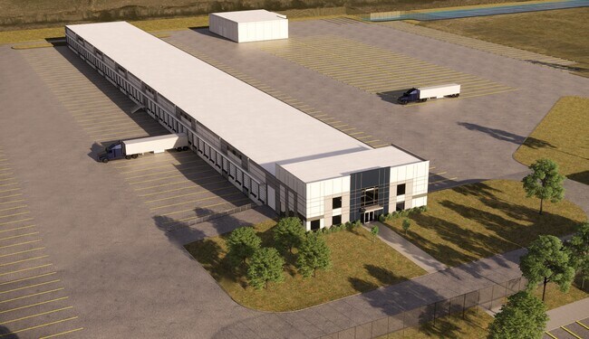


Property Detail
112 Harmon Rd
Dallas-Fort Worth-Arlington, TX
MESILLA VALLEY TRANSPORTATION BLOCK A LOT 1
41462149
TARRANT
Residentialacreage
Texas
B and X Area of moderate flood hazard, usually the area between the limits of the 100-year and 500-year floods.
1
2024
19.95 AC
2025
NE Tarrant/Alliance
113408
Dallas/Ft Worth
66,800 SF
NEARBY LISTINGS FOR SALE OR LEASE
DEMOGRAPHICS near 112 Harmon Rd
1 mile
3 mile
5 mile
2025 Total Population
244
31,772
155,846
2030 Population
270
33,737
168,752
Pop Growth 2025-2030
+ 10.66%
+ 6.18%
+ 8.28%
Average Age
42
35
35
2025 Total Households
87
10,722
50,276
HH Growth 2025-2030
+ 10.34%
+ 6.44%
+ 8.57%
Median Household Inc
$133,035
$109,326
$122,908
Avg Household Size
2.80
2.90
3.10
2025 Avg HH Vehicles
3.00
2.00
2.00
Median Home Value
$607,143
$385,288
$407,249
Median Year Built
2010
2008
2010
Nearby Places
Map Layers
Map Styles
 Street
 Aerial
Transit
 Traffic
 Biking
Places
Listings with unknown addresses are not visible on the map
- Restaurants
- Banks
- Shops
- Fitness
- Groceries
PUBLIC TRANSPORTATION
AIRPORT
Dallas-Fort Worth International
Drive
Walk
Distance
Dallas-Fort Worth International
33 min
23.3 mi
Dallas Love Field
Drive
Walk
Distance
Dallas Love Field
51 min
37.1 mi
SALE & LEASE HISTORY
LISTING DATE
SALE/LEASE

Jan 05, 2021
For Lease
Jan 05, 2021
For Lease
Nearby Properties
Address
Land Use
TOTAL SIZE
Lot Size
Zoning
Address
Land Use
TOTAL SIZE
Lot Size
Zoning
348,270 SF
39.34 AC
Address
Land Use
TOTAL SIZE
Lot Size
Zoning
830,399 SF
11.02 AC
Address
Land Use
TOTAL SIZE
Lot Size
Zoning
564,806 SF
162.94 AC
Address
Land Use
TOTAL SIZE
Lot Size
Zoning
252,365 SF
20.53 AC
Address
Land Use
TOTAL SIZE
Lot Size
Zoning
311,224 SF
8.22 AC
Address
Land Use
TOTAL SIZE
Lot Size
Zoning
471,408 SF
17.56 AC
Address
Land Use
TOTAL SIZE
Lot Size
Zoning
1,150,000 SF
117.10 AC
Address
Land Use
TOTAL SIZE
Lot Size
Zoning
1,141,133 SF
67.79 AC
Address
Land Use
TOTAL SIZE
Lot Size
Zoning
1,179,900 SF
73.58 AC
Address
Land Use
TOTAL SIZE
Lot Size
Zoning
1,037,400 SF
66.56 AC
Address
Land Use
TOTAL SIZE
Lot Size
Zoning
882,565 SF
56.65 AC
Address
Land Use
TOTAL SIZE
Lot Size
Zoning
1,111,500 SF
59.87 AC
Address
Land Use
TOTAL SIZE
Lot Size
Zoning
340,366 SF
53 AC
Address
Land Use
TOTAL SIZE
Lot Size
Zoning
1,001,600 SF
58.47 AC
Address
Land Use
TOTAL SIZE
Lot Size
Zoning
259,825 SF
14.95 AC
Address
Land Use
TOTAL SIZE
Lot Size
Zoning
1,140,525 SF
45.79 AC
Address
Land Use
TOTAL SIZE
Lot Size
Zoning
202.10 AC
Address
Land Use
TOTAL SIZE
Lot Size
Zoning
807,229 SF
46.10 AC
Address
Land Use
TOTAL SIZE
Lot Size
Zoning
295,161 SF
257.32 AC
Address
Land Use
TOTAL SIZE
Lot Size
Zoning
279,612 SF
18.46 AC
Address
Land Use
TOTAL SIZE
Lot Size
Zoning
727,900 SF
40.15 AC
Address
Land Use
TOTAL SIZE
Lot Size
Zoning
707,940 SF
35.33 AC
Address
Land Use
TOTAL SIZE
Lot Size
Zoning
677,700 SF
42.17 AC
Address
Land Use
TOTAL SIZE
Lot Size
Zoning
589,850 SF
29.30 AC
Address
Land Use
TOTAL SIZE
Lot Size
Zoning
267,831 SF
17.40 AC
Address
Land Use
TOTAL SIZE
Lot Size
Zoning
634,042 SF
35.88 AC
Address
Land Use
TOTAL SIZE
Lot Size
Zoning
546,000 SF
33.60 AC
Address
Land Use
TOTAL SIZE
Lot Size
Zoning
562,500 SF
29.64 AC
Address
Land Use
TOTAL SIZE
Lot Size
Zoning
731,548 SF
56.18 AC
Address
Land Use
TOTAL SIZE
Lot Size
Zoning
219,469 SF
13.52 AC
The World's #1 Commercial Real Estate Marketplace
Connect with us
© 2026 CoStar Group
The information above has been obtained from sources believed reliable. While we do not doubt its accuracy we have not verified it and make no guarantee, warranty or representation about it. It is your responsibility to independently confirm its accuracy and completeness. Any projections, opinions, assumptions, or estimates used are for example only and do not represent the current or future performance of the property. The value of this transaction to you depends on tax and other factors which should be evaluated by your tax, financial, and legal advisors. You and your advisors should conduct a careful, independent investigation of the property to determine to your satisfaction the suitability of the property for your needs.