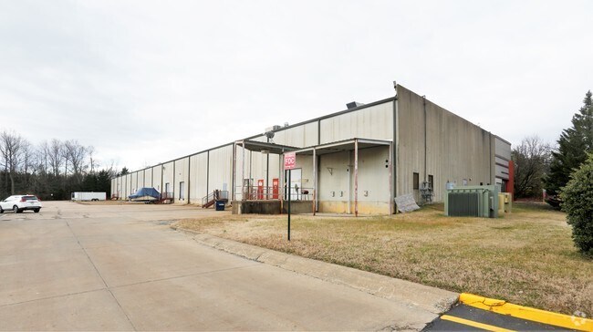
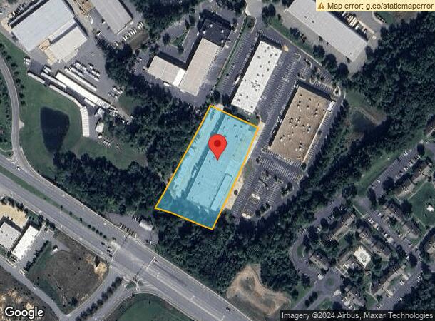
Property Record
112 Juliad Ct, Fredericksburg, VA 22406

NEARBY LISTINGS FOR SALE OR LEASE
Property Detail
112 Juliad Ct
Washington-Arlington-Alexandria, DC-VA-MD-WV
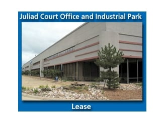
Dominion Business Center Phase 1
44-103E
PARCEL B 3.4506 AC DOMINION BUSINESS CENTER PHASE 1(STAFFORD IND PK)
Warehouse
Stafford
X
Virginia
51179C0182F
b
2024
3.45 AC
2025
Stafford County
010305
Washington, DC
60,000 SF
DEMOGRAPHICS near 112 Juliad Ct
1 Mile
3 Mile
5 Mile
2024 Total Population
6,482
28,562
67,985
2029 Population
7,211
31,811
74,798
Pop Growth 2024-2029
+ 11.25%
+ 11.38%
+ 10.02%
Average Age
36
38
38
2024 Total Households
2,404
10,574
25,059
HH Growth 2024-2029
+ 11.36%
+ 11.49%
+ 10.09%
Median Household Inc
$86,062
$86,155
$90,501
Avg Household Size
2.60
2.70
2.60
2024 Avg HH Vehicles
2.00
2.00
2.00
Median Home Value
$359,160
$385,882
$392,805
Median Year Built
1997
2003
1996
Nearby Places
Map Layers
Map Styles
 Street
 Aerial
- Restaurants
- Banks
- Shops
- Fitness
- Groceries
PUBLIC TRANSPORTATION
COMMUTER RAIL
Fredericksburg (Fredericksburg Line - Virginia Railway Express)
DRIVE
WALK
Distance
Fredericksburg (Fredericksburg Line - Virginia Railway Express)
15 min
6.6 mi
Leeland Road (Fredericksburg Line - Virginia Railway Express)
DRIVE
WALK
Distance
Leeland Road (Fredericksburg Line - Virginia Railway Express)
17 min
7.6 mi
AIRPORT
Ronald Reagan Washington Ntl
DRIVE
WALK
Distance
Ronald Reagan Washington Ntl
66 min
49.3 mi
SALE & LEASE HISTORY
LISTING DATE
SALE/LEASE

Sep 24, 2016
For Lease
Sep 24, 2016
For Sale
Nearby Properties
Address
Land Use
TOTAL SIZE
Lot Size
Zoning
Address
Land Use
TOTAL SIZE
Lot Size
Zoning
427,478 SF
15.36 AC
PDC
Address
Land Use
TOTAL SIZE
Lot Size
Zoning
282,451 SF
110.89 AC
A1
Address
Land Use
TOTAL SIZE
Lot Size
Zoning
271,103 SF
16.84 AC
PDC
Address
Land Use
TOTAL SIZE
Lot Size
Zoning
248,662 SF
8.56 AC
PDC
Address
Land Use
TOTAL SIZE
Lot Size
Zoning
607,877 SF
47.89 AC
B2
Address
Land Use
TOTAL SIZE
Lot Size
Zoning
188 SF
14.96 AC
R2
Address
Land Use
TOTAL SIZE
Lot Size
Zoning
200 SF
17.92 AC
B2
Address
Land Use
TOTAL SIZE
Lot Size
Zoning
21.89 AC
PDC
Address
Land Use
TOTAL SIZE
Lot Size
Zoning
200,453 SF
14.73 AC
RBC
Address
Land Use
TOTAL SIZE
Lot Size
Zoning
168 SF
11.77 AC
R2
Address
Land Use
TOTAL SIZE
Lot Size
Zoning
51.20 AC
B2
Address
Land Use
TOTAL SIZE
Lot Size
Zoning
610,866 SF
37.59 AC
M1
Address
Land Use
TOTAL SIZE
Lot Size
Zoning
186,909 SF
9.91 AC
RBC
Address
Land Use
TOTAL SIZE
Lot Size
Zoning
340 SF
20.86 AC
R2
Address
Land Use
TOTAL SIZE
Lot Size
Zoning
164,579 SF
11.81 AC
M1
Address
Land Use
TOTAL SIZE
Lot Size
Zoning
102,451 SF
11.99 AC
R3
Address
Land Use
TOTAL SIZE
Lot Size
Zoning
194,051 SF
9.71 AC
LC
Address
Land Use
TOTAL SIZE
Lot Size
Zoning
120 SF
9.46 AC
R2
Address
Land Use
TOTAL SIZE
Lot Size
Zoning
101,137 SF
48.17 AC
R1
Address
Land Use
TOTAL SIZE
Lot Size
Zoning
161,672 SF
11.15 AC
R3
Address
Land Use
TOTAL SIZE
Lot Size
Zoning
65,988 SF
216.41 AC
B2
Address
Land Use
TOTAL SIZE
Lot Size
Zoning
146,349 SF
39.98 AC
R2
Address
Land Use
TOTAL SIZE
Lot Size
Zoning
8.14 AC
R2
Address
Land Use
TOTAL SIZE
Lot Size
Zoning
192,254 SF
23.57 AC
B2
Address
Land Use
TOTAL SIZE
Lot Size
Zoning
140,400 SF
20.60 AC
M1
Address
Land Use
TOTAL SIZE
Lot Size
Zoning
87,900 SF
20 AC
M1
Address
Land Use
TOTAL SIZE
Lot Size
Zoning
56,774 SF
9.87 AC
B2
Address
Land Use
TOTAL SIZE
Lot Size
Zoning
Address
Land Use
TOTAL SIZE
Lot Size
Zoning
137,587 SF
18.08 AC
M1
Address
Land Use
TOTAL SIZE
Lot Size
Zoning
115,200 SF
18.32 AC
PDC
The World's #1 Commercial Real Estate Marketplace
Connect with us
© 2025 CoStar Group
The information above has been obtained from sources believed reliable. While we do not doubt its accuracy we have not verified it and make no guarantee, warranty or representation about it. It is your responsibility to independently confirm its accuracy and completeness. Any projections, opinions, assumptions, or estimates used are for example only and do not represent the current or future performance of the property. The value of this transaction to you depends on tax and other factors which should be evaluated by your tax, financial, and legal advisors. You and your advisors should conduct a careful, independent investigation of the property to determine to your satisfaction the suitability of the property for your needs.