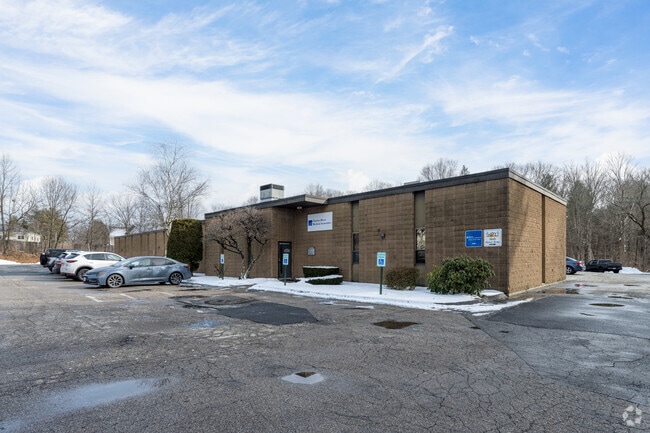
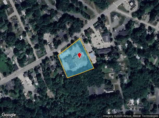
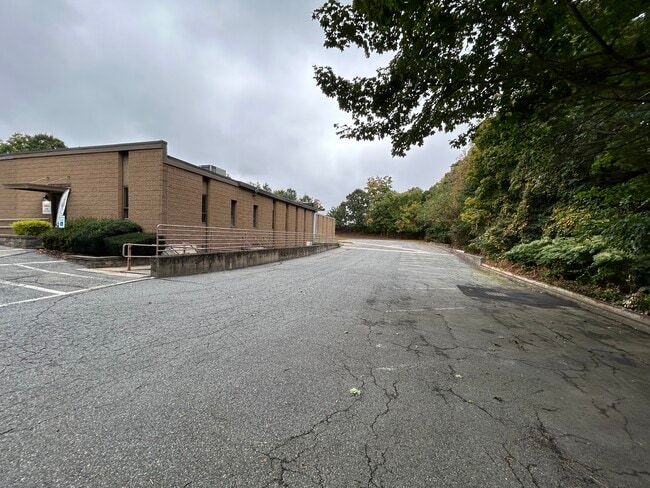
Property Record
112 Main St, Northborough, MA 01532
Current Lease Availabilities
NEARBY LISTINGS FOR SALE OR LEASE
Property Detail
112 Main St
NBOR-000530-000000-000154
Worcester
Medicalbuilding
Massachusetts
X
154
25027C0634F
2.26 AC
2025
The Boroughs
2025
Boston
740200
Worcester, MA-CT
16,672 SF
DEMOGRAPHICS near 112 Main St
1 Mile
3 Mile
5 Mile
2024 Total Population
5,588
23,842
83,925
2029 Population
5,561
23,897
83,691
Pop Growth 2024-2029
(0.48%)
+ 0.23%
(0.28%)
Average Age
42
41
41
2024 Total Households
2,107
8,937
31,510
HH Growth 2024-2029
(0.43%)
+ 0.32%
(0.26%)
Median Household Inc
$146,615
$130,098
$118,080
Avg Household Size
2.60
2.60
2.60
2024 Avg HH Vehicles
2.00
2.00
2.00
Median Home Value
$551,215
$529,345
$538,594
Median Year Built
1975
1981
1978
Nearby Places
- Restaurants
- Banks
- Shops
- Fitness
- Groceries
PUBLIC TRANSPORTATION
COMMUTER RAIL
Westborough (Framingham/Worcester Line - Massachusetts Bay Transportation Authority Commuter Rail (Purple Line))
DRIVE
WALK
Distance
Westborough (Framingham/Worcester Line - Massachusetts Bay Transportation Authority Commuter Rail (Purple Line))
12 min
5.0 mi
Grafton (Framingham/Worcester Line - Massachusetts Bay Transportation Authority Commuter Rail (Purple Line))
DRIVE
WALK
Distance
Grafton (Framingham/Worcester Line - Massachusetts Bay Transportation Authority Commuter Rail (Purple Line))
14 min
7.3 mi
AIRPORT
Worcester Regional
DRIVE
WALK
Distance
Worcester Regional
29 min
16.7 mi
Freight Ports
Port of Boston
DRIVE
WALK
Distance
Port of Boston
55 min
39.3 mi
Nearby Properties
Address
Land Use
TOTAL SIZE
Lot Size
Zoning
Address
Land Use
TOTAL SIZE
Lot Size
Zoning
21.41 AC
LI
Address
Land Use
TOTAL SIZE
Lot Size
Zoning
339,553 SF
42.94 AC
RC
Address
Land Use
TOTAL SIZE
Lot Size
Zoning
18.73 AC
I
Address
Land Use
TOTAL SIZE
Lot Size
Zoning
263,979 SF
0.12 AC
EROD
Address
Land Use
TOTAL SIZE
Lot Size
Zoning
24.39 AC
Address
Land Use
TOTAL SIZE
Lot Size
Zoning
657,045 SF
46.52 AC
LI
Address
Land Use
TOTAL SIZE
Lot Size
Zoning
205,712 SF
3.95 AC
BA
Address
Land Use
TOTAL SIZE
Lot Size
Zoning
554,193 SF
52.56 AC
I
Address
Land Use
TOTAL SIZE
Lot Size
Zoning
300,989 SF
66.90 AC
I
Address
Land Use
TOTAL SIZE
Lot Size
Zoning
24.95 AC
I
Address
Land Use
TOTAL SIZE
Lot Size
Zoning
201,818 SF
5.55 AC
BA
Address
Land Use
TOTAL SIZE
Lot Size
Zoning
205,712 SF
5.76 AC
BA
Address
Land Use
TOTAL SIZE
Lot Size
Zoning
314,677 SF
97.28 AC
Address
Land Use
TOTAL SIZE
Lot Size
Zoning
113.78 AC
I
Address
Land Use
TOTAL SIZE
Lot Size
Zoning
56.73 AC
LI
Address
Land Use
TOTAL SIZE
Lot Size
Zoning
260,605 SF
29 AC
I
Address
Land Use
TOTAL SIZE
Lot Size
Zoning
220,336 SF
24.65 AC
I
Address
Land Use
TOTAL SIZE
Lot Size
Zoning
299,149 SF
28.81 AC
I
Address
Land Use
TOTAL SIZE
Lot Size
Zoning
209,220 SF
19.33 AC
I
Address
Land Use
TOTAL SIZE
Lot Size
Zoning
43.90 AC
M-1
Address
Land Use
TOTAL SIZE
Lot Size
Zoning
204,205 SF
14.59 AC
IP
Address
Land Use
TOTAL SIZE
Lot Size
Zoning
38.24 AC
LI
Address
Land Use
TOTAL SIZE
Lot Size
Zoning
37.84 AC
LI
Address
Land Use
TOTAL SIZE
Lot Size
Zoning
386,463 SF
23.80 AC
I
Address
Land Use
TOTAL SIZE
Lot Size
Zoning
216,218 SF
97.33 AC
Address
Land Use
TOTAL SIZE
Lot Size
Zoning
167,438 SF
23.82 AC
I
Address
Land Use
TOTAL SIZE
Lot Size
Zoning
47,301 SF
8.07 AC
Address
Land Use
TOTAL SIZE
Lot Size
Zoning
199,892 SF
46.51 AC
Address
Land Use
TOTAL SIZE
Lot Size
Zoning
281,079 SF
11.81 AC
Address
Land Use
TOTAL SIZE
Lot Size
Zoning
136,790 SF
11.64 AC
B
The World's #1 Commercial Real Estate Marketplace
Connect with us
© 2025 CoStar Group
The information above has been obtained from sources believed reliable. While we do not doubt its accuracy we have not verified it and make no guarantee, warranty or representation about it. It is your responsibility to independently confirm its accuracy and completeness. Any projections, opinions, assumptions, or estimates used are for example only and do not represent the current or future performance of the property. The value of this transaction to you depends on tax and other factors which should be evaluated by your tax, financial, and legal advisors. You and your advisors should conduct a careful, independent investigation of the property to determine to your satisfaction the suitability of the property for your needs.