Property Record
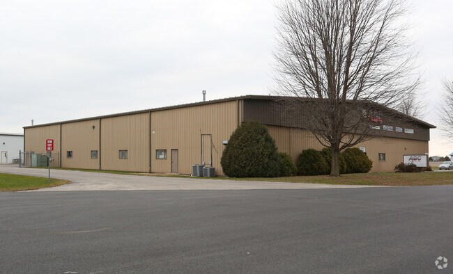
112 Maple Ct, Rochelle, IL 61068


NEARBY LISTINGS FOR SALE OR LEASE
Property Detail
112 Maple Ct
Rochelle, IL
Hllcrest Industrial Park Resub
24-12-177-013
LOTS 8, 9 & 10 RESUB OF LOTS 4,5&6 HILLCREST INDUSTRIAL PARK VIL OF HILLCREST
Commercialnec
Ogle
X
Illinois
17103C0150G
4-10
2024
3.62 AC
2024
I-39 Corridor/Ogle County
961200
Chicago
7,896 SF
DEMOGRAPHICS near 112 Maple Ct
1 mile
3 mile
5 mile
2024 Total Population
1,331
10,574
14,348
2029 Population
1,317
10,533
14,254
Pop Growth 2024-2029
(1.05%)
(0.39%)
(0.66%)
Average Age
38
39
39
2024 Total Households
452
4,213
5,621
HH Growth 2024-2029
(1.11%)
(0.38%)
(0.66%)
Median Household Inc
$77,083
$61,884
$59,735
Avg Household Size
3.00
2.40
2.50
2024 Avg HH Vehicles
2.00
2.00
2.00
Median Home Value
$141,370
$156,939
$157,411
Median Year Built
1978
1971
1971
Nearby Places
Map Layers
Map Styles
 Street
 Aerial
Transit
 Traffic
 Biking
Places
Listings with unknown addresses are not visible on the map
- Restaurants
- Banks
- Shops
- Fitness
- Groceries
PUBLIC TRANSPORTATION
AIRPORT
Chicago/Rockford International
Drive
Walk
Distance
Chicago/Rockford International
29 min
17.6 mi
Nearby Properties
Address
Land Use
TOTAL SIZE
Lot Size
Zoning
Address
Land Use
TOTAL SIZE
Lot Size
Zoning
30,096 SF
44.59 AC
Address
Land Use
TOTAL SIZE
Lot Size
Zoning
Address
Land Use
TOTAL SIZE
Lot Size
Zoning
39,403 SF
13.64 AC
Address
Land Use
TOTAL SIZE
Lot Size
Zoning
Address
Land Use
TOTAL SIZE
Lot Size
Zoning
14.13 AC
Address
Land Use
TOTAL SIZE
Lot Size
Zoning
25.19 AC
Address
Land Use
TOTAL SIZE
Lot Size
Zoning
55.67 AC
Address
Land Use
TOTAL SIZE
Lot Size
Zoning
2.64 AC
Address
Land Use
TOTAL SIZE
Lot Size
Zoning
21,000 SF
4.81 AC
Address
Land Use
TOTAL SIZE
Lot Size
Zoning
55,200 SF
1.74 AC
Address
Land Use
TOTAL SIZE
Lot Size
Zoning
1.27 AC
Address
Land Use
TOTAL SIZE
Lot Size
Zoning
1.15 AC
Address
Land Use
TOTAL SIZE
Lot Size
Zoning
58,473 SF
2.13 AC
Address
Land Use
TOTAL SIZE
Lot Size
Zoning
17,868 SF
4.01 AC
Address
Land Use
TOTAL SIZE
Lot Size
Zoning
1.85 AC
Address
Land Use
TOTAL SIZE
Lot Size
Zoning
95,734 SF
5.90 AC
Address
Land Use
TOTAL SIZE
Lot Size
Zoning
5.85 AC
Address
Land Use
TOTAL SIZE
Lot Size
Zoning
2,000 SF
169.90 AC
Address
Land Use
TOTAL SIZE
Lot Size
Zoning
2.38 AC
Address
Land Use
TOTAL SIZE
Lot Size
Zoning
8.64 AC
Address
Land Use
TOTAL SIZE
Lot Size
Zoning
69,602 SF
2.84 AC
Address
Land Use
TOTAL SIZE
Lot Size
Zoning
47,040 SF
2.26 AC
Address
Land Use
TOTAL SIZE
Lot Size
Zoning
1.15 AC
Address
Land Use
TOTAL SIZE
Lot Size
Zoning
6.85 AC
Address
Land Use
TOTAL SIZE
Lot Size
Zoning
7,839 SF
0.19 AC
Address
Land Use
TOTAL SIZE
Lot Size
Zoning
1.50 AC
Address
Land Use
TOTAL SIZE
Lot Size
Zoning
59,932 SF
4.33 AC
The World's #1 Commercial Real Estate Marketplace
Connect with us
© 2026 CoStar Group
The information above has been obtained from sources believed reliable. While we do not doubt its accuracy we have not verified it and make no guarantee, warranty or representation about it. It is your responsibility to independently confirm its accuracy and completeness. Any projections, opinions, assumptions, or estimates used are for example only and do not represent the current or future performance of the property. The value of this transaction to you depends on tax and other factors which should be evaluated by your tax, financial, and legal advisors. You and your advisors should conduct a careful, independent investigation of the property to determine to your satisfaction the suitability of the property for your needs.