Property Record
112 Mill St, Wethersfield, CT 06109


Property Detail
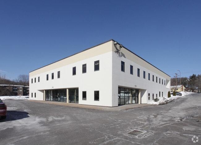
112 Mill St
Officebuilding
HARTFORD
RC
Connecticut
AE The base floodplain where base flood elevations are provided. AE Zones are now used on new format FIRMs instead of A1-A30 Zones.
1.68 AC
2025
Wethersfield
2025
Hartford
492500
Hartford-West Hartford-East Hartford, CT
9,360 SF
WETH-000238-000000-000003
NEARBY LISTINGS FOR SALE OR LEASE
DEMOGRAPHICS near 112 Mill St
1 mile
3 mile
5 mile
2025 Total Population
7,473
50,386
176,244
2030 Population
7,638
51,352
179,161
Pop Growth 2025-2030
+ 2.21%
+ 1.92%
+ 1.66%
Average Age
44
43
41
2025 Total Households
3,304
21,234
70,814
HH Growth 2025-2030
+ 2.48%
+ 2.00%
+ 1.75%
Median Household Inc
$100,511
$106,867
$84,141
Avg Household Size
2.20
2.30
2.40
2025 Avg HH Vehicles
2.00
2.00
2.00
Median Home Value
$322,261
$336,021
$309,843
Median Year Built
1960
1965
1962
Nearby Places
Map Layers
Map Styles
 Street
 Aerial
Transit
 Traffic
 Biking
Places
Listings with unknown addresses are not visible on the map
- Restaurants
- Banks
- Shops
- Fitness
- Groceries
PUBLIC TRANSPORTATION
COMMUTER RAIL
Drive
Walk
Distance
12 min
7.0 mi
Drive
Walk
Distance
12 min
7.0 mi
AIRPORT
Bradley International
Drive
Walk
Distance
Bradley International
34 min
21.0 mi
Tweed/New Haven
Drive
Walk
Distance
Tweed/New Haven
50 min
34.6 mi
Freight Ports
Port of New Haven
Drive
Walk
Distance
Port of New Haven
45 min
33.5 mi
Nearby Properties
Address
Land Use
TOTAL SIZE
Lot Size
Zoning
Address
Land Use
TOTAL SIZE
Lot Size
Zoning
81,507 SF
21.60 AC
R-20
Address
Land Use
TOTAL SIZE
Lot Size
Zoning
33.30 AC
R-20
Address
Land Use
TOTAL SIZE
Lot Size
Zoning
254,786 SF
36 AC
A
Address
Land Use
TOTAL SIZE
Lot Size
Zoning
3,416 SF
19.31 AC
SRD
Address
Land Use
TOTAL SIZE
Lot Size
Zoning
87,037 SF
10.44 AC
R-20
Address
Land Use
TOTAL SIZE
Lot Size
Zoning
116,979 SF
17 AC
B
Address
Land Use
TOTAL SIZE
Lot Size
Zoning
9.09 AC
R-20
Address
Land Use
TOTAL SIZE
Lot Size
Zoning
188,427 SF
8.55 AC
SRD
Address
Land Use
TOTAL SIZE
Lot Size
Zoning
129,065 SF
4.63 AC
MX-2
Address
Land Use
TOTAL SIZE
Lot Size
Zoning
Address
Land Use
TOTAL SIZE
Lot Size
Zoning
11.95 AC
PAD
Address
Land Use
TOTAL SIZE
Lot Size
Zoning
68,967 SF
11.25 AC
O
Address
Land Use
TOTAL SIZE
Lot Size
Zoning
15.12 AC
PAD
Address
Land Use
TOTAL SIZE
Lot Size
Zoning
10.45 AC
R-20
Address
Land Use
TOTAL SIZE
Lot Size
Zoning
83,468 SF
6.65 AC
R-20
Address
Land Use
TOTAL SIZE
Lot Size
Zoning
Address
Land Use
TOTAL SIZE
Lot Size
Zoning
145,956 SF
11.27 AC
OP
Address
Land Use
TOTAL SIZE
Lot Size
Zoning
13.85 AC
R-20
Address
Land Use
TOTAL SIZE
Lot Size
Zoning
53.52 AC
PL
Address
Land Use
TOTAL SIZE
Lot Size
Zoning
13.61 AC
RC
Address
Land Use
TOTAL SIZE
Lot Size
Zoning
8.56 AC
TC
Address
Land Use
TOTAL SIZE
Lot Size
Zoning
186,777 SF
21.25 AC
RC
Address
Land Use
TOTAL SIZE
Lot Size
Zoning
158,692 SF
2.89 AC
PAD
Address
Land Use
TOTAL SIZE
Lot Size
Zoning
172,155 SF
57.35 AC
OP
Address
Land Use
TOTAL SIZE
Lot Size
Zoning
38.84 AC
RC
Address
Land Use
TOTAL SIZE
Lot Size
Zoning
75,478 SF
14.40 AC
A1
Address
Land Use
TOTAL SIZE
Lot Size
Zoning
175,694 SF
9.03 AC
BP
Address
Land Use
TOTAL SIZE
Lot Size
Zoning
97.02 AC
A1
Address
Land Use
TOTAL SIZE
Lot Size
Zoning
57,862 SF
23.20 AC
AA
Address
Land Use
TOTAL SIZE
Lot Size
Zoning
68,601 SF
5.36 AC
SRD
The World's #1 Commercial Real Estate Marketplace
Connect with us
© 2026 CoStar Group
The information above has been obtained from sources believed reliable. While we do not doubt its accuracy we have not verified it and make no guarantee, warranty or representation about it. It is your responsibility to independently confirm its accuracy and completeness. Any projections, opinions, assumptions, or estimates used are for example only and do not represent the current or future performance of the property. The value of this transaction to you depends on tax and other factors which should be evaluated by your tax, financial, and legal advisors. You and your advisors should conduct a careful, independent investigation of the property to determine to your satisfaction the suitability of the property for your needs.