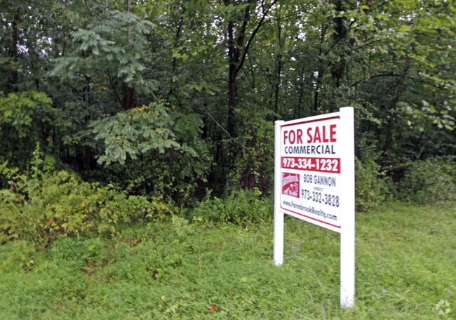
Property Record
112 River Rd, Montville, NJ 07045


NEARBY LISTINGS FOR SALE OR LEASE
Property Detail
112 River Rd
Northern New Jersey
John Wicker Lands
Newark, NJ-PA
FACILITY NAME: PARK
21-00123-0000-00019
Morris
Governmentalpublicusegeneral
New Jersey
0
19
2025
30.41 AC
040804
Parsippany
DEMOGRAPHICS near 112 River Rd
1 Mile
3 Mile
5 Mile
2024 Total Population
9,065
53,832
111,568
2029 Population
8,876
53,756
111,531
Pop Growth 2024-2029
(2.08%)
(0.14%)
(0.03%)
Average Age
42
42
42
2024 Total Households
3,484
20,424
41,021
HH Growth 2024-2029
(2.38%)
(0.05%)
+ 0.01%
Median Household Inc
$97,553
$109,059
$116,046
Avg Household Size
2.50
2.60
2.60
2024 Avg HH Vehicles
2.00
2.00
2.00
Median Home Value
$471,743
$560,359
$564,992
Median Year Built
1972
1969
1968
Nearby Places
Map Layers
Map Styles
 Street
 Aerial
- Restaurants
- Banks
- Shops
- Fitness
- Groceries
PUBLIC TRANSPORTATION
COMMUTER RAIL
Towaco (Montclair-Boonton Line - NJ Transit Commuter Rail (NJ Transit))
DRIVE
WALK
Distance
Towaco (Montclair-Boonton Line - NJ Transit Commuter Rail (NJ Transit))
7 min
3.3 mi
Boonton (Montclair-Boonton Line - NJ Transit Commuter Rail (NJ Transit))
DRIVE
WALK
Distance
Boonton (Montclair-Boonton Line - NJ Transit Commuter Rail (NJ Transit))
8 min
3.4 mi
AIRPORT
Newark Liberty International
DRIVE
WALK
Distance
Newark Liberty International
36 min
23.6 mi
LaGuardia
DRIVE
WALK
Distance
LaGuardia
53 min
38.5 mi
Freight Ports
Maher Terminal
DRIVE
WALK
Distance
Maher Terminal
38 min
23.8 mi
Nearby Properties
Address
Land Use
TOTAL SIZE
Lot Size
Zoning
Address
Land Use
TOTAL SIZE
Lot Size
Zoning
98,228 SF
16.66 AC
I-1
Address
Land Use
TOTAL SIZE
Lot Size
Zoning
11,353 SF
9.29 AC
COD
Address
Land Use
TOTAL SIZE
Lot Size
Zoning
3.86 AC
O-3
Address
Land Use
TOTAL SIZE
Lot Size
Zoning
32.61 AC
R-5
Address
Land Use
TOTAL SIZE
Lot Size
Zoning
201,648 SF
19.35 AC
B-1
Address
Land Use
TOTAL SIZE
Lot Size
Zoning
197,023 SF
22.08 AC
AHMU
Address
Land Use
TOTAL SIZE
Lot Size
Zoning
91,872 SF
31.16 AC
B-1
Address
Land Use
TOTAL SIZE
Lot Size
Zoning
140,560 SF
49.81 AC
R27A
Address
Land Use
TOTAL SIZE
Lot Size
Zoning
4,172 SF
338 AC
R-1
Address
Land Use
TOTAL SIZE
Lot Size
Zoning
132,411 SF
24.87 AC
B-5
Address
Land Use
TOTAL SIZE
Lot Size
Zoning
10.80 AC
R-5
Address
Land Use
TOTAL SIZE
Lot Size
Zoning
4.99 AC
OB
Address
Land Use
TOTAL SIZE
Lot Size
Zoning
4.02 AC
R-3
Address
Land Use
TOTAL SIZE
Lot Size
Zoning
11.52 AC
R-5
Address
Land Use
TOTAL SIZE
Lot Size
Zoning
184,993 SF
8.38 AC
POD
Address
Land Use
TOTAL SIZE
Lot Size
Zoning
266,624 SF
18.13 AC
I1A
Address
Land Use
TOTAL SIZE
Lot Size
Zoning
11.05 AC
R-5
Address
Land Use
TOTAL SIZE
Lot Size
Zoning
12.64 AC
R-5
Address
Land Use
TOTAL SIZE
Lot Size
Zoning
13.70 AC
R-5
Address
Land Use
TOTAL SIZE
Lot Size
Zoning
179,144 SF
40.54 AC
R-3
Address
Land Use
TOTAL SIZE
Lot Size
Zoning
Address
Land Use
TOTAL SIZE
Lot Size
Zoning
7.59 AC
B2
Address
Land Use
TOTAL SIZE
Lot Size
Zoning
214,588 SF
17.38 AC
I1A
Address
Land Use
TOTAL SIZE
Lot Size
Zoning
41.21 AC
R-A
Address
Land Use
TOTAL SIZE
Lot Size
Zoning
11.07 AC
R-5
Address
Land Use
TOTAL SIZE
Lot Size
Zoning
10.46 AC
R-3
Address
Land Use
TOTAL SIZE
Lot Size
Zoning
13.92 AC
Address
Land Use
TOTAL SIZE
Lot Size
Zoning
90,292 SF
14 AC
I2
Address
Land Use
TOTAL SIZE
Lot Size
Zoning
10 AC
RASH
Address
Land Use
TOTAL SIZE
Lot Size
Zoning
50,948 SF
5.60 AC
C-1
The World's #1 Commercial Real Estate Marketplace
Connect with us
© 2026 CoStar Group
The information above has been obtained from sources believed reliable. While we do not doubt its accuracy we have not verified it and make no guarantee, warranty or representation about it. It is your responsibility to independently confirm its accuracy and completeness. Any projections, opinions, assumptions, or estimates used are for example only and do not represent the current or future performance of the property. The value of this transaction to you depends on tax and other factors which should be evaluated by your tax, financial, and legal advisors. You and your advisors should conduct a careful, independent investigation of the property to determine to your satisfaction the suitability of the property for your needs.