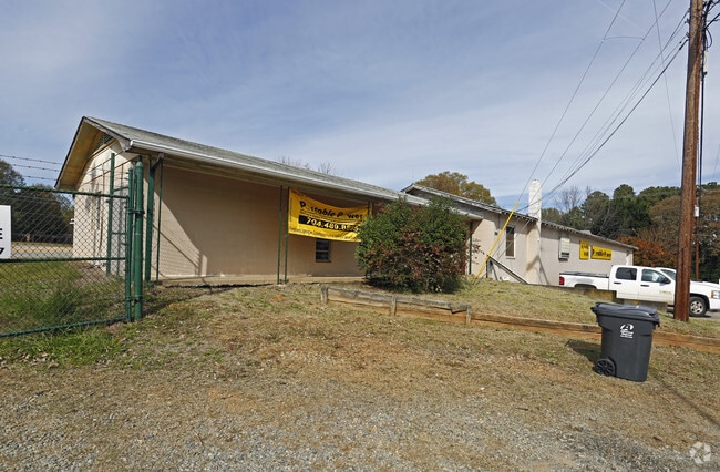
Property Record
112 W Dallas Rd, Stanley, NC 28164


Property Detail
112 W Dallas Rd
134264
PB 029 030 BLK 00 L 1-12 08 009 013 00 000
Storebuilding
GASTON
RET01
North Carolina
B and X Area of moderate flood hazard, usually the area between the limits of the 100-year and 500-year floods.
2.30 AC
2025
Gaston County
2025
Charlotte
033502
Charlotte-Concord-Gastonia, NC-SC
3,200 SF
NEARBY LISTINGS FOR SALE OR LEASE
-
-
View all Stanley listings for sale on LoopNet.com
DEMOGRAPHICS near 112 W Dallas Rd
1 mile
3 mile
5 mile
2025 Total Population
3,563
13,138
39,789
2030 Population
3,774
13,922
42,018
Pop Growth 2025-2030
+ 5.92%
+ 5.97%
+ 5.60%
Average Age
42
42
40
2025 Total Households
1,441
5,252
15,433
HH Growth 2025-2030
+ 6.25%
+ 6.25%
+ 5.85%
Median Household Inc
$73,582
$72,539
$72,573
Avg Household Size
2.40
2.50
2.50
2025 Avg HH Vehicles
2.00
2.00
2.00
Median Home Value
$288,726
$292,996
$280,575
Median Year Built
1980
1984
1987
Nearby Places
Map Layers
Map Styles
 Street
 Aerial
Layers
 Traffic
 Biking
Places
Listings with unknown addresses are not visible on the map
- Restaurants
- Banks
- Shops
- Fitness
- Groceries
PUBLIC TRANSPORTATION
COMMUTER RAIL
Gastonia Amtrak Station (Crescent - Amtrak)
Drive
Walk
Distance
Gastonia Amtrak Station (Crescent - Amtrak)
17 min
8.8 mi
AIRPORT
Charlotte/Douglas International
Drive
Walk
Distance
Charlotte/Douglas International
32 min
16.6 mi
Concord-Padgett Regional
Drive
Walk
Distance
Concord-Padgett Regional
38 min
26.2 mi
Freight Ports
North Charleston Terminal
Drive
Walk
Distance
North Charleston Terminal
243 min
212.5 mi
Nearby Properties
Address
Land Use
TOTAL SIZE
Lot Size
Zoning
Address
Land Use
TOTAL SIZE
Lot Size
Zoning
6,720 SF
60.15 AC
PUB01
Address
Land Use
TOTAL SIZE
Lot Size
Zoning
135,468 SF
35.34 AC
PUB01
Address
Land Use
TOTAL SIZE
Lot Size
Zoning
426,374 SF
17.13 AC
INDS2
Address
Land Use
TOTAL SIZE
Lot Size
Zoning
76,455 SF
36.80 AC
Address
Land Use
TOTAL SIZE
Lot Size
Zoning
278,424 SF
25.32 AC
INDS2
Address
Land Use
TOTAL SIZE
Lot Size
Zoning
138,105 SF
26.16 AC
INDS1
Address
Land Use
TOTAL SIZE
Lot Size
Zoning
7,490 SF
10.10 AC
HCAR4
Address
Land Use
TOTAL SIZE
Lot Size
Zoning
12,000 SF
5.90 AC
SHOP5
Address
Land Use
TOTAL SIZE
Lot Size
Zoning
30,272 SF
9.13 AC
R20
Address
Land Use
TOTAL SIZE
Lot Size
Zoning
76,602 SF
11.48 AC
PUB01
Address
Land Use
TOTAL SIZE
Lot Size
Zoning
59,315 SF
10.31 AC
CHUR2
Address
Land Use
TOTAL SIZE
Lot Size
Zoning
61,359 SF
12.30 AC
PUB01
Address
Land Use
TOTAL SIZE
Lot Size
Zoning
40,937 SF
4.44 AC
MRKT4
Address
Land Use
TOTAL SIZE
Lot Size
Zoning
142,850 SF
18.06 AC
STOR5
Address
Land Use
TOTAL SIZE
Lot Size
Zoning
80,590 SF
9.89 AC
INDS2
Address
Land Use
TOTAL SIZE
Lot Size
Zoning
1,260 SF
3.80 AC
OFF01
Address
Land Use
TOTAL SIZE
Lot Size
Zoning
30,592 SF
4.03 AC
CHUR2
Address
Land Use
TOTAL SIZE
Lot Size
Zoning
8,980 SF
8.02 AC
CHUR2
Address
Land Use
TOTAL SIZE
Lot Size
Zoning
73,956 SF
8.27 AC
INDS1
Address
Land Use
TOTAL SIZE
Lot Size
Zoning
27,609 SF
3.89 AC
HCAR3
Address
Land Use
TOTAL SIZE
Lot Size
Zoning
1,935 SF
2.16 AC
APT02
Address
Land Use
TOTAL SIZE
Lot Size
Zoning
10,125 SF
1.18 AC
RET05
Address
Land Use
TOTAL SIZE
Lot Size
Zoning
8,222 SF
2.08 AC
CHUR5
Address
Land Use
TOTAL SIZE
Lot Size
Zoning
5,400 SF
6.19 AC
STOR4
Address
Land Use
TOTAL SIZE
Lot Size
Zoning
5,472 SF
1.40 AC
GARG1
Address
Land Use
TOTAL SIZE
Lot Size
Zoning
5,908 SF
1.36 AC
GB
Address
Land Use
TOTAL SIZE
Lot Size
Zoning
10,341 SF
5.28 AC
CHUR2
Address
Land Use
TOTAL SIZE
Lot Size
Zoning
12,096 SF
91.24 AC
PUB08
Address
Land Use
TOTAL SIZE
Lot Size
Zoning
60,901 SF
3.90 AC
INDS1
Address
Land Use
TOTAL SIZE
Lot Size
Zoning
1,606 SF
7.88 AC
R1
The World's #1 Commercial Real Estate Marketplace
Connect with us
© 2026 CoStar Group
The information above has been obtained from sources believed reliable. While we do not doubt its accuracy we have not verified it and make no guarantee, warranty or representation about it. It is your responsibility to independently confirm its accuracy and completeness. Any projections, opinions, assumptions, or estimates used are for example only and do not represent the current or future performance of the property. The value of this transaction to you depends on tax and other factors which should be evaluated by your tax, financial, and legal advisors. You and your advisors should conduct a careful, independent investigation of the property to determine to your satisfaction the suitability of the property for your needs.