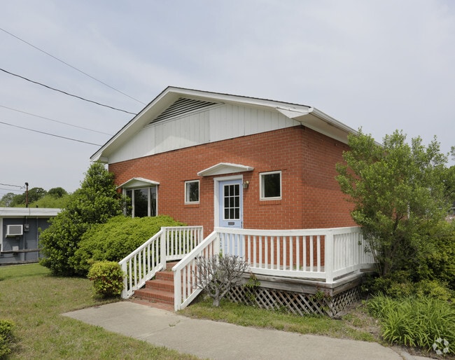
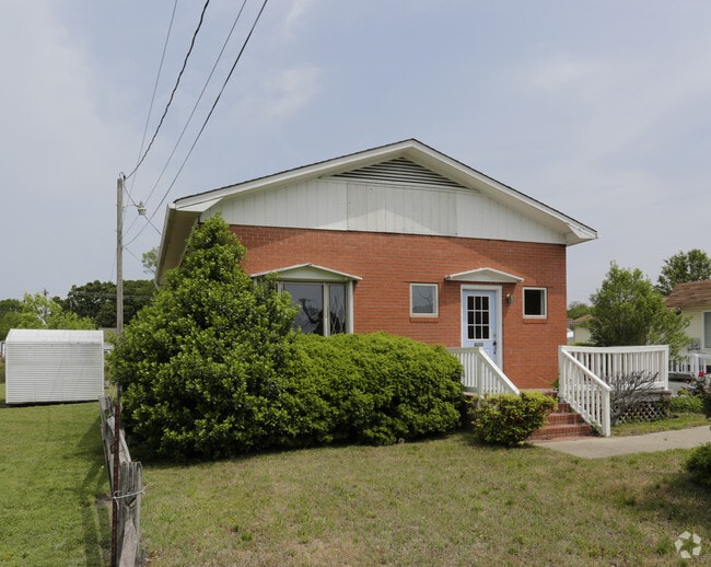
Property Record
112 W Main St, Marshville, NC 28103

Current Lease Availabilities
NEARBY LISTINGS FOR SALE OR LEASE
Property Detail
112 W Main St
02-310-072
A Minor Subdivision For Hrb Investments
Officebuilding
TRACT 1 HRB INVESTMENTS OPCJ060
X
Union
3710548500J
North Carolina
2025
0.17 AC
2025
Union County
020800
Charlotte
891 SF
Charlotte-Concord-Gastonia, NC-SC
DEMOGRAPHICS near 112 W Main St
1 Mile
3 Mile
5 Mile
2024 Total Population
2,731
4,237
12,299
2029 Population
3,066
4,748
13,531
Pop Growth 2024-2029
+ 12.27%
+ 12.06%
+ 10.02%
Average Age
40
40
38
2024 Total Households
985
1,528
3,887
HH Growth 2024-2029
+ 12.49%
+ 12.37%
+ 11.01%
Median Household Inc
$52,701
$54,389
$59,042
Avg Household Size
2.60
2.60
2.60
2024 Avg HH Vehicles
2.00
2.00
2.00
Median Home Value
$158,964
$170,460
$205,852
Median Year Built
1974
1975
1982
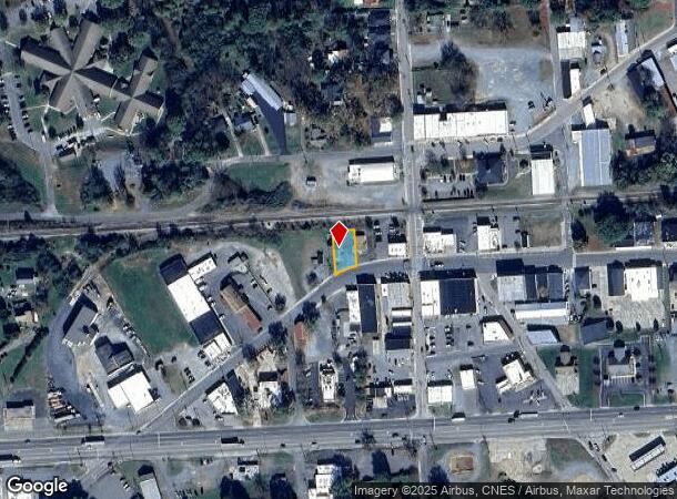
Nearby Places
Map Layers
Map Styles
 Street
 Aerial
- Restaurants
- Banks
- Shops
- Fitness
- Groceries
PUBLIC TRANSPORTATION
AIRPORT
Concord-Padgett Regional
DRIVE
WALK
Distance
Concord-Padgett Regional
58 min
42.6 mi
Charlotte/Douglas International
DRIVE
WALK
Distance
Charlotte/Douglas International
63 min
42.7 mi
Nearby Properties
Address
Land Use
TOTAL SIZE
Lot Size
Zoning
Address
Land Use
TOTAL SIZE
Lot Size
Zoning
138,165 SF
135.17 AC
HC UNION C
Address
Land Use
TOTAL SIZE
Lot Size
Zoning
88,806 SF
15.72 AC
IND MARSHV
Address
Land Use
TOTAL SIZE
Lot Size
Zoning
69,549 SF
13 AC
IND MARSHV
Address
Land Use
TOTAL SIZE
Lot Size
Zoning
74,070 SF
15.61 AC
CIV MARSHV
Address
Land Use
TOTAL SIZE
Lot Size
Zoning
49,000 SF
12.47 AC
IND MARSHV
Address
Land Use
TOTAL SIZE
Lot Size
Zoning
24.89 AC
Address
Land Use
TOTAL SIZE
Lot Size
Zoning
4,575 SF
5.10 AC
TMU MARSHV
Address
Land Use
TOTAL SIZE
Lot Size
Zoning
32,121 SF
180.03 AC
RA-40 UNIO
Address
Land Use
TOTAL SIZE
Lot Size
Zoning
13,656 SF
36.15 AC
CIV MARSHV
Address
Land Use
TOTAL SIZE
Lot Size
Zoning
28 AC
IND MARSHV
Address
Land Use
TOTAL SIZE
Lot Size
Zoning
73,033 SF
15.12 AC
CIV MARSHV
Address
Land Use
TOTAL SIZE
Lot Size
Zoning
47,416 SF
10.41 AC
TMU MARSHV
Address
Land Use
TOTAL SIZE
Lot Size
Zoning
15,928 SF
3.87 AC
CIV MARSHV
Address
Land Use
TOTAL SIZE
Lot Size
Zoning
25,430 SF
8.59 AC
CIV MARSHV
Address
Land Use
TOTAL SIZE
Lot Size
Zoning
32,536 SF
4.91 AC
C-74 MARSH
Address
Land Use
TOTAL SIZE
Lot Size
Zoning
115.01 AC
AG MARSHVI
Address
Land Use
TOTAL SIZE
Lot Size
Zoning
13,200 SF
35.28 AC
AG MARSHVI
Address
Land Use
TOTAL SIZE
Lot Size
Zoning
12,017 SF
1.60 AC
MS MARSHVI
Address
Land Use
TOTAL SIZE
Lot Size
Zoning
8,375 SF
1.25 AC
CIV MARSHV
Address
Land Use
TOTAL SIZE
Lot Size
Zoning
16,000 SF
7.95 AC
IND MARSHV
Address
Land Use
TOTAL SIZE
Lot Size
Zoning
6,470 SF
3 AC
R/MST MARS
Address
Land Use
TOTAL SIZE
Lot Size
Zoning
8,704 SF
249.53 AC
HC UNION C
Address
Land Use
TOTAL SIZE
Lot Size
Zoning
94,066 SF
13.72 AC
LI UNION C
Address
Land Use
TOTAL SIZE
Lot Size
Zoning
15,377 SF
23.17 AC
RA-40 UNIO
Address
Land Use
TOTAL SIZE
Lot Size
Zoning
6,272 SF
2.68 AC
C-74 MARSH
Address
Land Use
TOTAL SIZE
Lot Size
Zoning
5,307 SF
16.18 AC
Address
Land Use
TOTAL SIZE
Lot Size
Zoning
14,917 SF
3.39 AC
C-74 MARSH
Address
Land Use
TOTAL SIZE
Lot Size
Zoning
7,200 SF
8.49 AC
IND MARSHV
Address
Land Use
TOTAL SIZE
Lot Size
Zoning
9,900 SF
5.41 AC
C-74 MARSH
Address
Land Use
TOTAL SIZE
Lot Size
Zoning
10,337 SF
0.98 AC
C-74 MARSH
The World's #1 Commercial Real Estate Marketplace
Connect with us
© 2025 CoStar Group
The information above has been obtained from sources believed reliable. While we do not doubt its accuracy we have not verified it and make no guarantee, warranty or representation about it. It is your responsibility to independently confirm its accuracy and completeness. Any projections, opinions, assumptions, or estimates used are for example only and do not represent the current or future performance of the property. The value of this transaction to you depends on tax and other factors which should be evaluated by your tax, financial, and legal advisors. You and your advisors should conduct a careful, independent investigation of the property to determine to your satisfaction the suitability of the property for your needs.