Property Record
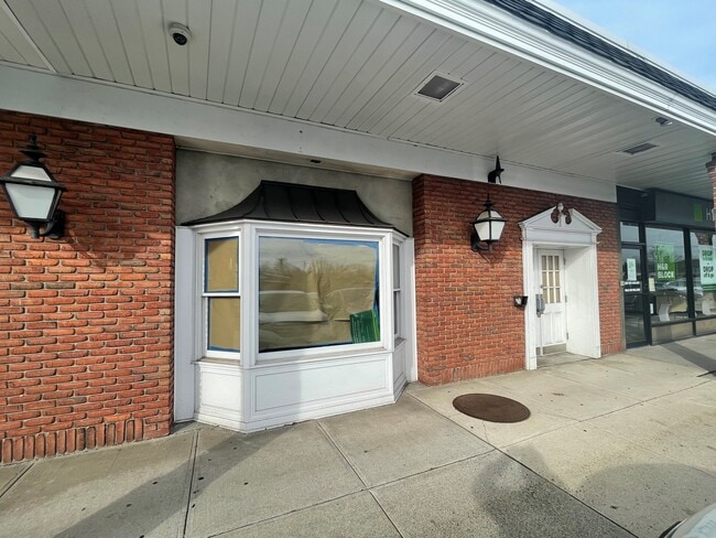
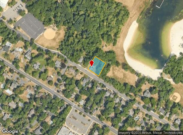
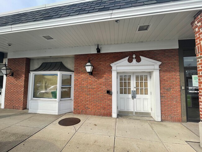
112 W Maple Ave, Allendale, NJ 07401
NEARBY LISTINGS FOR SALE OR LEASE
Property Detail
112 W Maple Ave
New York-Jersey City-White Plains, NY-NJ
Bergen
01-01003-0000-00008
New Jersey
Sfr
0.44 AC
X
North Central Bergen
34003C0067H
Northern New Jersey
2,252 SF
DEMOGRAPHICS near 112 W Maple Ave
1 Mile
3 Mile
5 Mile
2024 Total Population
16,922
105,835
314,188
2029 Population
16,911
104,811
309,576
Pop Growth 2024-2029
(0.07%)
(0.97%)
(1.47%)
Average Age
40
41
41
2024 Total Households
5,711
36,677
106,721
HH Growth 2024-2029
(0.05%)
(1.17%)
(1.57%)
Median Household Inc
$176,804
$148,362
$117,035
Avg Household Size
2.90
2.80
2.90
2024 Avg HH Vehicles
2.00
2.00
2.00
Median Home Value
$798,804
$707,005
$649,131
Median Year Built
1949
1955
1956
Nearby Places
Map Layers
Map Styles
 Street
 Aerial
- Restaurants
- Banks
- Shops
- Fitness
- Groceries
PUBLIC TRANSPORTATION
COMMUTER RAIL
Allendale (Bergen County/Port Jervis Line - NJ Transit Commuter Rail (NJ Transit), Main/Port Jervis Line - NJ Transit Commuter Rail (NJ Transit))
DRIVE
WALK
Distance
Allendale (Bergen County/Port Jervis Line - NJ Transit Commuter Rail (NJ Transit), Main/Port Jervis Line - NJ Transit Commuter Rail (NJ Transit))
2 min
10 min
0.6 mi
Ramsey (Bergen County/Port Jervis Line - NJ Transit Commuter Rail (NJ Transit), Main/Port Jervis Line - NJ Transit Commuter Rail (NJ Transit))
DRIVE
WALK
Distance
Ramsey (Bergen County/Port Jervis Line - NJ Transit Commuter Rail (NJ Transit), Main/Port Jervis Line - NJ Transit Commuter Rail (NJ Transit))
6 min
2.3 mi
AIRPORT
Newark Liberty International
DRIVE
WALK
Distance
Newark Liberty International
39 min
29.0 mi
LaGuardia
DRIVE
WALK
Distance
LaGuardia
46 min
30.0 mi
Westchester County
DRIVE
WALK
Distance
Westchester County
52 min
38.1 mi
Freight Ports
Port Newark Container Terminal
DRIVE
WALK
Distance
Port Newark Container Terminal
45 min
29.4 mi
SALE & LEASE HISTORY
LISTING DATE
SALE/LEASE

Dec 16, 2021
For Lease
Nearby Properties
Address
Land Use
TOTAL SIZE
Lot Size
Zoning
Address
Land Use
TOTAL SIZE
Lot Size
Zoning
28.44 AC
Address
Land Use
TOTAL SIZE
Lot Size
Zoning
88.72 AC
ORL
Address
Land Use
TOTAL SIZE
Lot Size
Zoning
2,252 SF
19.04 AC
Address
Land Use
TOTAL SIZE
Lot Size
Zoning
39.50 AC
Address
Land Use
TOTAL SIZE
Lot Size
Zoning
40.40 AC
PU
Address
Land Use
TOTAL SIZE
Lot Size
Zoning
17.71 AC
B3
Address
Land Use
TOTAL SIZE
Lot Size
Zoning
7.11 AC
Address
Land Use
TOTAL SIZE
Lot Size
Zoning
80.80 AC
Address
Land Use
TOTAL SIZE
Lot Size
Zoning
23.19 AC
R1
Address
Land Use
TOTAL SIZE
Lot Size
Zoning
16.02 AC
R3
Address
Land Use
TOTAL SIZE
Lot Size
Zoning
20.30 AC
Address
Land Use
TOTAL SIZE
Lot Size
Zoning
3,165 SF
2.07 AC
VC2
Address
Land Use
TOTAL SIZE
Lot Size
Zoning
38.65 AC
Address
Land Use
TOTAL SIZE
Lot Size
Zoning
10.38 AC
Address
Land Use
TOTAL SIZE
Lot Size
Zoning
10.64 AC
AAA
Address
Land Use
TOTAL SIZE
Lot Size
Zoning
6.52 AC
Address
Land Use
TOTAL SIZE
Lot Size
Zoning
17.90 AC
IP
Address
Land Use
TOTAL SIZE
Lot Size
Zoning
2.33 AC
B3
Address
Land Use
TOTAL SIZE
Lot Size
Zoning
170,941 SF
10.04 AC
IP
Address
Land Use
TOTAL SIZE
Lot Size
Zoning
124,528 SF
8.87 AC
EM
Address
Land Use
TOTAL SIZE
Lot Size
Zoning
3.63 AC
Address
Land Use
TOTAL SIZE
Lot Size
Zoning
106,836 SF
8.85 AC
LO
Address
Land Use
TOTAL SIZE
Lot Size
Zoning
6.29 AC
B3
Address
Land Use
TOTAL SIZE
Lot Size
Zoning
99,832 SF
10.39 AC
E
Address
Land Use
TOTAL SIZE
Lot Size
Zoning
74,278 SF
6.91 AC
C2
Address
Land Use
TOTAL SIZE
Lot Size
Zoning
107,584 SF
9.19 AC
EM
Address
Land Use
TOTAL SIZE
Lot Size
Zoning
15.30 AC
R1
Address
Land Use
TOTAL SIZE
Lot Size
Zoning
133,140 SF
8.10 AC
B3
Address
Land Use
TOTAL SIZE
Lot Size
Zoning
12.45 AC
A225
Address
Land Use
TOTAL SIZE
Lot Size
Zoning
146,442 SF
7.97 AC
LO
The World's #1 Commercial Real Estate Marketplace
Connect with us
© 2025 CoStar Group
The information above has been obtained from sources believed reliable. While we do not doubt its accuracy we have not verified it and make no guarantee, warranty or representation about it. It is your responsibility to independently confirm its accuracy and completeness. Any projections, opinions, assumptions, or estimates used are for example only and do not represent the current or future performance of the property. The value of this transaction to you depends on tax and other factors which should be evaluated by your tax, financial, and legal advisors. You and your advisors should conduct a careful, independent investigation of the property to determine to your satisfaction the suitability of the property for your needs.