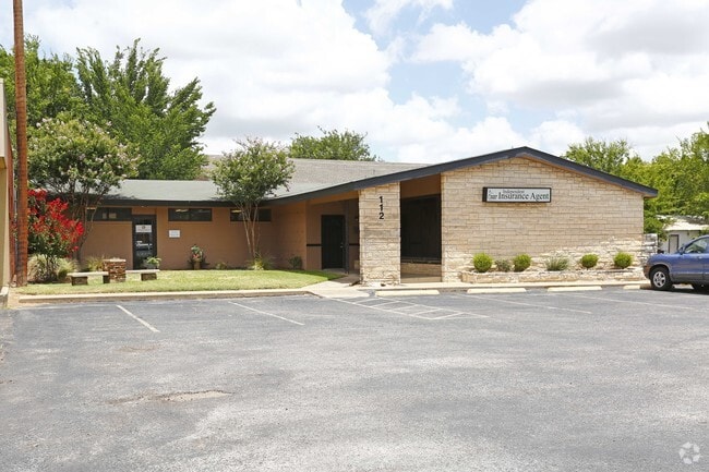
Property Record
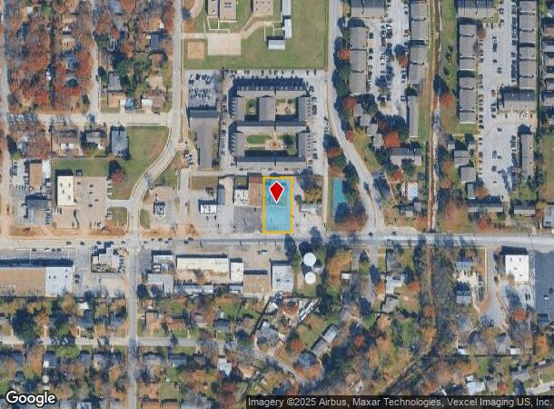
112 W Pipeline Rd, Hurst, TX 76053

NEARBY LISTINGS FOR SALE OR LEASE
Property Detail
112 W Pipeline Rd
04241371
Wallace, William W Survey
Commercialnec
WALLACE, WILLIAM W SURVEY ABSTRACT 1607 TRACT 23B04D
X
Tarrant
48439C0210K
Texas
2024
0.42 AC
2025
HEB/Mid-Cities
113404
Dallas/Ft Worth
4,362 SF
Dallas-Fort Worth-Arlington, TX
DEMOGRAPHICS near 112 W Pipeline Rd
1 Mile
3 Mile
5 Mile
2024 Total Population
19,287
104,597
253,751
2029 Population
20,327
110,254
267,833
Pop Growth 2024-2029
+ 5.39%
+ 5.41%
+ 5.55%
Average Age
36
39
39
2024 Total Households
7,006
42,027
100,407
HH Growth 2024-2029
+ 5.42%
+ 5.47%
+ 5.61%
Median Household Inc
$55,289
$66,878
$75,712
Avg Household Size
2.60
2.40
2.50
2024 Avg HH Vehicles
2.00
2.00
2.00
Median Home Value
$222,667
$268,502
$285,208
Median Year Built
1964
1979
1983
Nearby Places
Map Layers
Map Styles
 Street
 Aerial
- Restaurants
- Banks
- Shops
- Fitness
- Groceries
PUBLIC TRANSPORTATION
COMMUTER RAIL
Hurst/Bell (Trinity Railway Express - Dallas Area Rapid Transit (DART))
DRIVE
WALK
Distance
Hurst/Bell (Trinity Railway Express - Dallas Area Rapid Transit (DART))
6 min
2.2 mi
DRIVE
WALK
Distance
9 min
3.6 mi
AIRPORT
Dallas-Fort Worth International
DRIVE
WALK
Distance
Dallas-Fort Worth International
21 min
13.3 mi
Dallas Love Field
DRIVE
WALK
Distance
Dallas Love Field
32 min
22.0 mi
SALE & LEASE HISTORY
LISTING DATE
SALE/LEASE

Sep 26, 2016
For Lease
Nov 27, 2020
For Sale
Mar 21, 2017
For Lease
Jul 02, 2020
For Lease
Aug 09, 2018
For Lease
Nearby Properties
Address
Land Use
TOTAL SIZE
Lot Size
Zoning
Address
Land Use
TOTAL SIZE
Lot Size
Zoning
1,300,314 SF
40.15 AC
Address
Land Use
TOTAL SIZE
Lot Size
Zoning
415,563 SF
25.40 AC
Address
Land Use
TOTAL SIZE
Lot Size
Zoning
285,754 SF
69.41 AC
Address
Land Use
TOTAL SIZE
Lot Size
Zoning
290,680 SF
26.31 AC
Address
Land Use
TOTAL SIZE
Lot Size
Zoning
356,000 SF
39.44 AC
Address
Land Use
TOTAL SIZE
Lot Size
Zoning
521,150 SF
92.05 AC
Address
Land Use
TOTAL SIZE
Lot Size
Zoning
1,544,748 SF
76.25 AC
Address
Land Use
TOTAL SIZE
Lot Size
Zoning
282,665 SF
14.29 AC
Address
Land Use
TOTAL SIZE
Lot Size
Zoning
174,596 SF
11.91 AC
Address
Land Use
TOTAL SIZE
Lot Size
Zoning
260,590 SF
15.30 AC
Address
Land Use
TOTAL SIZE
Lot Size
Zoning
172,000 SF
6.34 AC
Address
Land Use
TOTAL SIZE
Lot Size
Zoning
318,602 SF
9.90 AC
Address
Land Use
TOTAL SIZE
Lot Size
Zoning
223,131 SF
12.50 AC
Address
Land Use
TOTAL SIZE
Lot Size
Zoning
348,941 SF
22.25 AC
Address
Land Use
TOTAL SIZE
Lot Size
Zoning
240,154 SF
6.92 AC
Address
Land Use
TOTAL SIZE
Lot Size
Zoning
79,244 SF
54.50 AC
Address
Land Use
TOTAL SIZE
Lot Size
Zoning
236,701 SF
15.96 AC
Address
Land Use
TOTAL SIZE
Lot Size
Zoning
211,449 SF
11.30 AC
Address
Land Use
TOTAL SIZE
Lot Size
Zoning
237,551 SF
4.39 AC
Address
Land Use
TOTAL SIZE
Lot Size
Zoning
208,238 SF
12.55 AC
Address
Land Use
TOTAL SIZE
Lot Size
Zoning
173,068 SF
15.55 AC
Address
Land Use
TOTAL SIZE
Lot Size
Zoning
232,295 SF
21.49 AC
Address
Land Use
TOTAL SIZE
Lot Size
Zoning
197,964 SF
4.57 AC
Address
Land Use
TOTAL SIZE
Lot Size
Zoning
235,530 SF
13.21 AC
Address
Land Use
TOTAL SIZE
Lot Size
Zoning
194,625 SF
15.07 AC
Address
Land Use
TOTAL SIZE
Lot Size
Zoning
221,591 SF
14.50 AC
Address
Land Use
TOTAL SIZE
Lot Size
Zoning
220,650 SF
3.03 AC
Address
Land Use
TOTAL SIZE
Lot Size
Zoning
161,332 SF
8.56 AC
Address
Land Use
TOTAL SIZE
Lot Size
Zoning
201,121 SF
8.96 AC
Address
Land Use
TOTAL SIZE
Lot Size
Zoning
151,023 SF
5.18 AC
The World's #1 Commercial Real Estate Marketplace
Connect with us
© 2026 CoStar Group
The information above has been obtained from sources believed reliable. While we do not doubt its accuracy we have not verified it and make no guarantee, warranty or representation about it. It is your responsibility to independently confirm its accuracy and completeness. Any projections, opinions, assumptions, or estimates used are for example only and do not represent the current or future performance of the property. The value of this transaction to you depends on tax and other factors which should be evaluated by your tax, financial, and legal advisors. You and your advisors should conduct a careful, independent investigation of the property to determine to your satisfaction the suitability of the property for your needs.