Property Record
1120 Epps Farm Rd, Fort Mill, SC 29715

Property Detail
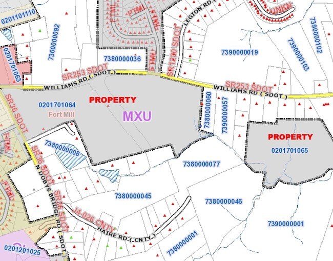
1120 Epps Farm Rd
0201701064
24.78 AC / OFF WILLIAMS RD
Residentialacreage
York
RDII
South Carolina
B and X Area of moderate flood hazard, usually the area between the limits of the 100-year and 500-year floods.
55.63 AC
2025
York County
2025
Charlotte
061101
Charlotte-Concord-Gastonia, NC-SC
1,044 SF
NEARBY LISTINGS FOR SALE OR LEASE
DEMOGRAPHICS near 1120 Epps Farm Rd
1 mile
3 mile
5 mile
2025 Total Population
5,204
31,141
101,890
2030 Population
5,515
33,332
110,056
Pop Growth 2025-2030
+ 5.98%
+ 7.04%
+ 8.01%
Average Age
38
38
38
2025 Total Households
1,760
11,104
38,293
HH Growth 2025-2030
+ 5.91%
+ 6.98%
+ 8.01%
Median Household Inc
$130,141
$120,321
$108,254
Avg Household Size
3.00
2.80
2.60
2025 Avg HH Vehicles
2.00
2.00
2.00
Median Home Value
$467,142
$479,051
$481,415
Median Year Built
2005
2005
2007
Nearby Places
Map Layers
Map Styles
 Street
 Aerial
Layers
 Traffic
 Biking
Places
Listings with unknown addresses are not visible on the map
- Restaurants
- Banks
- Shops
- Fitness
- Groceries
PUBLIC TRANSPORTATION
AIRPORT
Charlotte/Douglas International
Drive
Walk
Distance
Charlotte/Douglas International
34 min
18.6 mi
Concord-Padgett Regional
Drive
Walk
Distance
Concord-Padgett Regional
52 min
35.6 mi
Freight Ports
North Charleston Terminal
Drive
Walk
Distance
North Charleston Terminal
209 min
184.7 mi
Nearby Properties
Address
Land Use
TOTAL SIZE
Lot Size
Zoning
Address
Land Use
TOTAL SIZE
Lot Size
Zoning
532,223 SF
29.11 AC
LI
Address
Land Use
TOTAL SIZE
Lot Size
Zoning
234,931 SF
133.39 AC
PDD
Address
Land Use
TOTAL SIZE
Lot Size
Zoning
64,338 SF
0.83 AC
Address
Land Use
TOTAL SIZE
Lot Size
Zoning
178,585 SF
17.44 AC
Address
Land Use
TOTAL SIZE
Lot Size
Zoning
167.49 AC
MULTIPLEZ
Address
Land Use
TOTAL SIZE
Lot Size
Zoning
162.78 AC
RCI
Address
Land Use
TOTAL SIZE
Lot Size
Zoning
64,113 SF
6.69 AC
Address
Land Use
TOTAL SIZE
Lot Size
Zoning
79,600 SF
9.58 AC
Address
Land Use
TOTAL SIZE
Lot Size
Zoning
7,772 SF
4.75 AC
Address
Land Use
TOTAL SIZE
Lot Size
Zoning
598,425 SF
102 AC
ID
Address
Land Use
TOTAL SIZE
Lot Size
Zoning
28,569 SF
0.39 AC
Address
Land Use
TOTAL SIZE
Lot Size
Zoning
Address
Land Use
TOTAL SIZE
Lot Size
Zoning
18,990 SF
0.23 AC
Address
Land Use
TOTAL SIZE
Lot Size
Zoning
131,716 SF
13.89 AC
Address
Land Use
TOTAL SIZE
Lot Size
Zoning
14,000 SF
3.32 AC
Address
Land Use
TOTAL SIZE
Lot Size
Zoning
21,761 SF
30.22 AC
AGC
Address
Land Use
TOTAL SIZE
Lot Size
Zoning
4,398 SF
15.25 AC
Address
Land Use
TOTAL SIZE
Lot Size
Zoning
16.05 AC
Address
Land Use
TOTAL SIZE
Lot Size
Zoning
8,320 SF
1.89 AC
PDD
Address
Land Use
TOTAL SIZE
Lot Size
Zoning
5,392 SF
1.46 AC
Address
Land Use
TOTAL SIZE
Lot Size
Zoning
4,953 SF
2.20 AC
Address
Land Use
TOTAL SIZE
Lot Size
Zoning
4,698 SF
3.30 AC
Address
Land Use
TOTAL SIZE
Lot Size
Zoning
5,289 SF
1.20 AC
PD
Address
Land Use
TOTAL SIZE
Lot Size
Zoning
5,800 SF
2.41 AC
RCI
Address
Land Use
TOTAL SIZE
Lot Size
Zoning
4,358 SF
0.23 AC
Address
Land Use
TOTAL SIZE
Lot Size
Zoning
3,763 SF
2 AC
Address
Land Use
TOTAL SIZE
Lot Size
Zoning
3,831 SF
0.23 AC
Address
Land Use
TOTAL SIZE
Lot Size
Zoning
4,731 SF
1.01 AC
RCI
Address
Land Use
TOTAL SIZE
Lot Size
Zoning
259.17 AC
The World's #1 Commercial Real Estate Marketplace
Connect with us
© 2026 CoStar Group
The information above has been obtained from sources believed reliable. While we do not doubt its accuracy we have not verified it and make no guarantee, warranty or representation about it. It is your responsibility to independently confirm its accuracy and completeness. Any projections, opinions, assumptions, or estimates used are for example only and do not represent the current or future performance of the property. The value of this transaction to you depends on tax and other factors which should be evaluated by your tax, financial, and legal advisors. You and your advisors should conduct a careful, independent investigation of the property to determine to your satisfaction the suitability of the property for your needs.