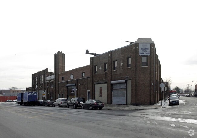
Property Record
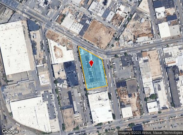
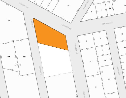
1120 Leggett Ave, Bronx, NY 10474
NEARBY LISTINGS FOR SALE OR LEASE
Property Detail
1120 Leggett Ave
02606-0230
Bronx
Lightindustrial
New York
X
230
3604970092F
1.63 AC
2024
Bronx
2025
Westchester/So Connecticut
009302
New York-Jersey City-White Plains, NY-NJ
62,999 SF
DEMOGRAPHICS near 1120 Leggett Ave
1 Mile
3 Mile
5 Mile
2024 Total Population
73,406
932,518
2,657,370
2029 Population
68,391
863,749
2,467,810
Pop Growth 2024-2029
(6.83%)
(7.37%)
(7.13%)
Average Age
36
38
40
2024 Total Households
24,682
339,589
1,024,223
HH Growth 2024-2029
(7.69%)
(7.99%)
(7.52%)
Median Household Inc
$33,341
$39,221
$56,745
Avg Household Size
2.80
2.60
2.50
2024 Avg HH Vehicles
.00
.00
.00
Median Home Value
$416,216
$590,946
$730,381
Median Year Built
1965
1956
1951
Nearby Places
- Restaurants
- Banks
- Shops
- Fitness
- Groceries
PUBLIC TRANSPORTATION
COMMUTER RAIL
Melrose Station (Harlem Line - Metro-North Commuter Railroad Company (Metro-North))
DRIVE
WALK
Distance
Melrose Station (Harlem Line - Metro-North Commuter Railroad Company (Metro-North))
8 min
2.6 mi
Harlem-125th Street Station (Harlem Line - Metro-North Commuter Railroad Company (Metro-North), Hudson Line - Metro-North Commuter Railroad Company (Metro-North), New Haven Line - Metro-North Commuter Railroad Company (Metro-North))
DRIVE
WALK
Distance
Harlem-125th Street Station (Harlem Line - Metro-North Commuter Railroad Company (Metro-North), Hudson Line - Metro-North Commuter Railroad Company (Metro-North), New Haven Line - Metro-North Commuter Railroad Company (Metro-North))
8 min
3.4 mi
AIRPORT
LaGuardia
DRIVE
WALK
Distance
LaGuardia
15 min
7.2 mi
John F Kennedy International
DRIVE
WALK
Distance
John F Kennedy International
30 min
18.4 mi
Newark Liberty International
DRIVE
WALK
Distance
Newark Liberty International
33 min
26.1 mi
Freight Ports
NY - Red Hook Container Terminal
DRIVE
WALK
Distance
NY - Red Hook Container Terminal
29 min
15.4 mi
SALE & LEASE HISTORY
LISTING DATE
SALE/LEASE

Sep 23, 2021
For Lease
Nearby Properties
Address
Land Use
TOTAL SIZE
Lot Size
Zoning
Address
Land Use
TOTAL SIZE
Lot Size
Zoning
5,519,372 SF
409.21 AC
C8-2
Address
Land Use
TOTAL SIZE
Lot Size
Zoning
400,160 SF
10.96 AC
R7-2
Address
Land Use
TOTAL SIZE
Lot Size
Zoning
2,278,432 SF
5.99 AC
R7-2
Address
Land Use
TOTAL SIZE
Lot Size
Zoning
1,311,800 SF
9.89 AC
C4-4
Address
Land Use
TOTAL SIZE
Lot Size
Zoning
207.09 AC
PARK
Address
Land Use
TOTAL SIZE
Lot Size
Zoning
1,012,000 SF
7.79 AC
R6
Address
Land Use
TOTAL SIZE
Lot Size
Zoning
507,265 SF
4.04 AC
C4-4
Address
Land Use
TOTAL SIZE
Lot Size
Zoning
892,550 SF
2.93 AC
M13R8
Address
Land Use
TOTAL SIZE
Lot Size
Zoning
948 SF
282.37 AC
PARK
Address
Land Use
TOTAL SIZE
Lot Size
Zoning
2,531,670 SF
17.15 AC
R7-2
Address
Land Use
TOTAL SIZE
Lot Size
Zoning
390,750 SF
265 AC
PARK
Address
Land Use
TOTAL SIZE
Lot Size
Zoning
620,000 SF
3.31 AC
R7-2
Address
Land Use
TOTAL SIZE
Lot Size
Zoning
480,769 SF
1.21 AC
R8
Address
Land Use
TOTAL SIZE
Lot Size
Zoning
276,285 SF
1.26 AC
R7-2
Address
Land Use
TOTAL SIZE
Lot Size
Zoning
293,848 SF
2.98 AC
C8-3
Address
Land Use
TOTAL SIZE
Lot Size
Zoning
426,172 SF
14.30 AC
M3-1
Address
Land Use
TOTAL SIZE
Lot Size
Zoning
491,007 SF
11.85 AC
M3-1
Address
Land Use
TOTAL SIZE
Lot Size
Zoning
566,233 SF
13.25 AC
M3-1
Address
Land Use
TOTAL SIZE
Lot Size
Zoning
291,885 SF
8.86 AC
R8
Address
Land Use
TOTAL SIZE
Lot Size
Zoning
139,333 SF
1.17 AC
C6-3
Address
Land Use
TOTAL SIZE
Lot Size
Zoning
14,681 SF
97 AC
PARK
Address
Land Use
TOTAL SIZE
Lot Size
Zoning
127,000 SF
16.53 AC
M3-1
Address
Land Use
TOTAL SIZE
Lot Size
Zoning
447,145 SF
8.05 AC
M3-1
Address
Land Use
TOTAL SIZE
Lot Size
Zoning
245,002 SF
9.12 AC
C8-3
Address
Land Use
TOTAL SIZE
Lot Size
Zoning
238,500 SF
1.13 AC
C4-4
Address
Land Use
TOTAL SIZE
Lot Size
Zoning
809,377 SF
7.64 AC
R7-2
Address
Land Use
TOTAL SIZE
Lot Size
Zoning
340,364 SF
4.10 AC
C4-6
Address
Land Use
TOTAL SIZE
Lot Size
Zoning
429,149 SF
4.79 AC
C4-4
Address
Land Use
TOTAL SIZE
Lot Size
Zoning
1,172,005 SF
128.83 AC
M1-1
Address
Land Use
TOTAL SIZE
Lot Size
Zoning
594,976 SF
1.62 AC
C4-6
The World's #1 Commercial Real Estate Marketplace
Connect with us
© 2025 CoStar Group
The information above has been obtained from sources believed reliable. While we do not doubt its accuracy we have not verified it and make no guarantee, warranty or representation about it. It is your responsibility to independently confirm its accuracy and completeness. Any projections, opinions, assumptions, or estimates used are for example only and do not represent the current or future performance of the property. The value of this transaction to you depends on tax and other factors which should be evaluated by your tax, financial, and legal advisors. You and your advisors should conduct a careful, independent investigation of the property to determine to your satisfaction the suitability of the property for your needs.