Property Record
1551 Highway 113 Sw, Cartersville, GA 30120
This Property Is For Sale
NEARBY LISTINGS FOR SALE OR LEASE
Property Detail
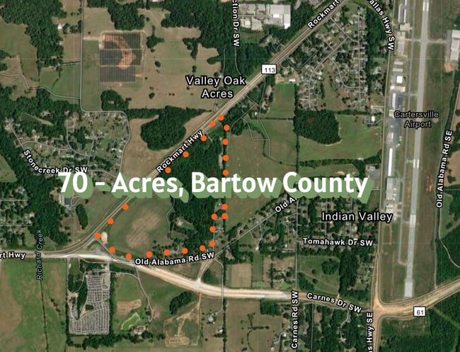
1551 Highway 113 Sw
0055-0929-001
LL929-930 LD4
Agriculturalland
Bartow
X
Georgia
13015C0355H
20.04 AC
2024
Bartow County
2024
Atlanta
960902
Atlanta-Sandy Springs-Roswell, GA
945 SF
DEMOGRAPHICS near 1551 Highway 113 Sw
1 Mile
3 Mile
5 Mile
2024 Total Population
1,468
6,351
28,492
2029 Population
1,718
7,411
33,422
Pop Growth 2024-2029
+ 17.03%
+ 16.69%
+ 17.30%
Average Age
39
40
40
2024 Total Households
537
2,267
10,384
HH Growth 2024-2029
+ 17.32%
+ 16.85%
+ 17.32%
Median Household Inc
$104,500
$99,499
$90,235
Avg Household Size
2.60
2.70
2.70
2024 Avg HH Vehicles
2.00
2.00
2.00
Median Home Value
$287,856
$344,152
$340,610
Median Year Built
1993
1994
1993
Nearby Places
- Restaurants
- Banks
- Shops
- Fitness
- Groceries
Nearby Properties
Address
Land Use
TOTAL SIZE
Lot Size
Zoning
Address
Land Use
TOTAL SIZE
Lot Size
Zoning
226,108 SF
33.73 AC
Address
Land Use
TOTAL SIZE
Lot Size
Zoning
196,710 SF
149.63 AC
Address
Land Use
TOTAL SIZE
Lot Size
Zoning
149,158 SF
46.23 AC
IN
Address
Land Use
TOTAL SIZE
Lot Size
Zoning
1,800 SF
102.03 AC
A1
Address
Land Use
TOTAL SIZE
Lot Size
Zoning
57,164 SF
4.88 AC
Address
Land Use
TOTAL SIZE
Lot Size
Zoning
Address
Land Use
TOTAL SIZE
Lot Size
Zoning
128.74 AC
A1
Address
Land Use
TOTAL SIZE
Lot Size
Zoning
61,132 SF
5.39 AC
Address
Land Use
TOTAL SIZE
Lot Size
Zoning
70,122 SF
6.10 AC
Address
Land Use
TOTAL SIZE
Lot Size
Zoning
211,879 SF
23.57 AC
IN
Address
Land Use
TOTAL SIZE
Lot Size
Zoning
40,000 SF
18.15 AC
Address
Land Use
TOTAL SIZE
Lot Size
Zoning
242,214 SF
14.71 AC
IN
Address
Land Use
TOTAL SIZE
Lot Size
Zoning
2,632 SF
52.90 AC
IN
Address
Land Use
TOTAL SIZE
Lot Size
Zoning
147,500 SF
14.60 AC
IN
Address
Land Use
TOTAL SIZE
Lot Size
Zoning
98,691 SF
12.08 AC
Address
Land Use
TOTAL SIZE
Lot Size
Zoning
85 AC
INDUSTRIAL
Address
Land Use
TOTAL SIZE
Lot Size
Zoning
58,074 SF
20.28 AC
I1
Address
Land Use
TOTAL SIZE
Lot Size
Zoning
30,000 SF
53.17 AC
IN
Address
Land Use
TOTAL SIZE
Lot Size
Zoning
6,980 SF
202.44 AC
IN
Address
Land Use
TOTAL SIZE
Lot Size
Zoning
110,924 SF
18.72 AC
IN
Address
Land Use
TOTAL SIZE
Lot Size
Zoning
90.17 AC
IN
Address
Land Use
TOTAL SIZE
Lot Size
Zoning
29,686 SF
14.15 AC
IN
Address
Land Use
TOTAL SIZE
Lot Size
Zoning
91,612 SF
5.44 AC
IN
Address
Land Use
TOTAL SIZE
Lot Size
Zoning
57.89 AC
IN
Address
Land Use
TOTAL SIZE
Lot Size
Zoning
161.62 AC
Address
Land Use
TOTAL SIZE
Lot Size
Zoning
36,205 SF
10 AC
IN
Address
Land Use
TOTAL SIZE
Lot Size
Zoning
1,400 SF
37.84 AC
Address
Land Use
TOTAL SIZE
Lot Size
Zoning
76,500 SF
Address
Land Use
TOTAL SIZE
Lot Size
Zoning
14,925 SF
4.28 AC
Address
Land Use
TOTAL SIZE
Lot Size
Zoning
13,500 SF
55.40 AC
I2
The World's #1 Commercial Real Estate Marketplace
Connect with us
© 2025 CoStar Group
The information above has been obtained from sources believed reliable. While we do not doubt its accuracy we have not verified it and make no guarantee, warranty or representation about it. It is your responsibility to independently confirm its accuracy and completeness. Any projections, opinions, assumptions, or estimates used are for example only and do not represent the current or future performance of the property. The value of this transaction to you depends on tax and other factors which should be evaluated by your tax, financial, and legal advisors. You and your advisors should conduct a careful, independent investigation of the property to determine to your satisfaction the suitability of the property for your needs.