Property Record
1120 Stevenson Mill Rd, Coraopolis, PA 15108


Property Detail
1120 Stevenson Mill Rd
Pittsburgh, PA
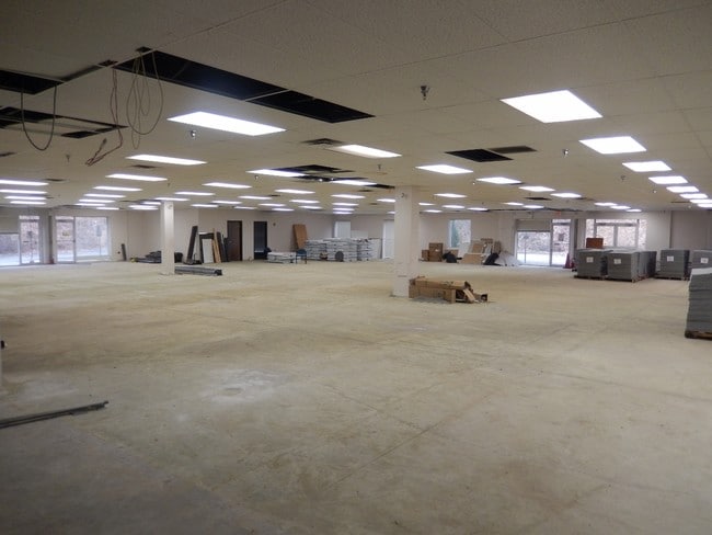
6 A LD STEVENSON MILL RD 1 STY CB WHSE & OFFICE BLDG (FLEX BLDG) #1120
0806-H-00390-0000-00
Allegheny
Warehouse
Pennsylvania
B and X Area of moderate flood hazard, usually the area between the limits of the 100-year and 500-year floods.
390
2024
6 AC
2025
West Pittsburgh
451105
Pittsburgh
NEARBY LISTINGS FOR SALE OR LEASE
DEMOGRAPHICS near 1120 Stevenson Mill Rd
1 mile
3 mile
5 mile
2025 Total Population
3,006
22,102
64,679
2030 Population
3,005
21,983
64,173
Pop Growth 2025-2030
(0.03%)
(0.54%)
(0.78%)
Average Age
36
40
42
2025 Total Households
1,164
8,414
26,750
HH Growth 2025-2030
(0.43%)
(0.75%)
(0.87%)
Median Household Inc
$93,455
$115,196
$95,319
Avg Household Size
2.10
2.30
2.30
2025 Avg HH Vehicles
2.00
2.00
2.00
Median Home Value
$281,944
$298,740
$276,436
Median Year Built
1976
1975
1972
Nearby Places
Map Layers
Map Styles
 Street
 Aerial
Layers
 Traffic
 Biking
Places
Listings with unknown addresses are not visible on the map
- Restaurants
- Banks
- Shops
- Fitness
- Groceries
PUBLIC TRANSPORTATION
AIRPORT
Pittsburgh International
Drive
Walk
Distance
Pittsburgh International
9 min
3.4 mi
Freight Ports
Port of Toledo
Drive
Walk
Distance
Port of Toledo
249 min
220.3 mi
SALE & LEASE HISTORY
LISTING DATE
SALE/LEASE

May 10, 2024
For Lease
Mar 30, 2017
For Lease
Dec 04, 2018
For Lease
Aug 17, 2017
For Lease
Nearby Properties
Address
Land Use
TOTAL SIZE
Lot Size
Zoning
Address
Land Use
TOTAL SIZE
Lot Size
Zoning
7,144.15 AC
Address
Land Use
TOTAL SIZE
Lot Size
Zoning
3,320 SF
180.98 AC
Address
Land Use
TOTAL SIZE
Lot Size
Zoning
8.81 AC
Address
Land Use
TOTAL SIZE
Lot Size
Zoning
23.15 AC
Address
Land Use
TOTAL SIZE
Lot Size
Zoning
115.98 AC
Address
Land Use
TOTAL SIZE
Lot Size
Zoning
Address
Land Use
TOTAL SIZE
Lot Size
Zoning
25.97 AC
Address
Land Use
TOTAL SIZE
Lot Size
Zoning
14.70 AC
Address
Land Use
TOTAL SIZE
Lot Size
Zoning
11.42 AC
Address
Land Use
TOTAL SIZE
Lot Size
Zoning
15,134 SF
19.73 AC
Address
Land Use
TOTAL SIZE
Lot Size
Zoning
2.86 AC
Address
Land Use
TOTAL SIZE
Lot Size
Zoning
Address
Land Use
TOTAL SIZE
Lot Size
Zoning
39.36 AC
Address
Land Use
TOTAL SIZE
Lot Size
Zoning
19.63 AC
Address
Land Use
TOTAL SIZE
Lot Size
Zoning
Address
Land Use
TOTAL SIZE
Lot Size
Zoning
20.73 AC
Address
Land Use
TOTAL SIZE
Lot Size
Zoning
16.26 AC
Address
Land Use
TOTAL SIZE
Lot Size
Zoning
Address
Land Use
TOTAL SIZE
Lot Size
Zoning
Address
Land Use
TOTAL SIZE
Lot Size
Zoning
Address
Land Use
TOTAL SIZE
Lot Size
Zoning
16.40 AC
Address
Land Use
TOTAL SIZE
Lot Size
Zoning
Address
Land Use
TOTAL SIZE
Lot Size
Zoning
29.76 AC
Address
Land Use
TOTAL SIZE
Lot Size
Zoning
Address
Land Use
TOTAL SIZE
Lot Size
Zoning
8.33 AC
Address
Land Use
TOTAL SIZE
Lot Size
Zoning
Address
Land Use
TOTAL SIZE
Lot Size
Zoning
17.61 AC
Address
Land Use
TOTAL SIZE
Lot Size
Zoning
Address
Land Use
TOTAL SIZE
Lot Size
Zoning
Address
Land Use
TOTAL SIZE
Lot Size
Zoning
The World's #1 Commercial Real Estate Marketplace
Connect with us
© 2026 CoStar Group
The information above has been obtained from sources believed reliable. While we do not doubt its accuracy we have not verified it and make no guarantee, warranty or representation about it. It is your responsibility to independently confirm its accuracy and completeness. Any projections, opinions, assumptions, or estimates used are for example only and do not represent the current or future performance of the property. The value of this transaction to you depends on tax and other factors which should be evaluated by your tax, financial, and legal advisors. You and your advisors should conduct a careful, independent investigation of the property to determine to your satisfaction the suitability of the property for your needs.