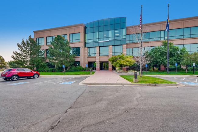
Property Record
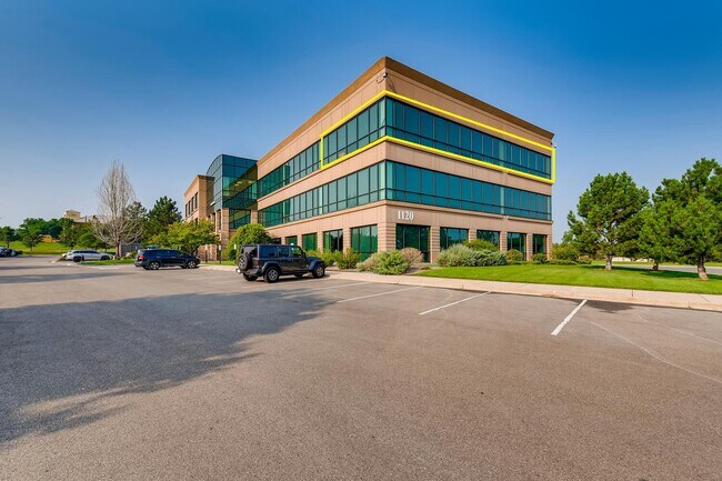
1120 W 122Nd Ave, Denver, CO 80234
Current Lease Availabilities
Property Detail
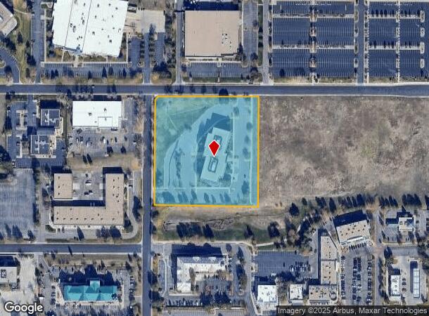
1120 W 122Nd Ave
Denver-Aurora-Centennial, CO
First Replat The Park Centre Filing No 3
1573-33-4-01-001
SUB:FIRST REPLAT THE PARK CENTRE FILING NO 3 LOT:8C
Officebuilding
Adams
ARE
Colorado
0850730092H
8c
2024
5.58 AC
2025
North Denver
060200
Denver
59,784 SF
NEARBY LISTINGS FOR SALE OR LEASE
DEMOGRAPHICS near 1120 W 122Nd Ave
1 mile
3 mile
5 mile
2024 Total Population
9,395
119,610
317,666
2029 Population
9,729
124,630
331,014
Pop Growth 2024-2029
+ 3.56%
+ 4.20%
+ 4.20%
Average Age
36
38
38
2024 Total Households
4,271
45,384
115,775
HH Growth 2024-2029
+ 3.42%
+ 4.20%
+ 4.28%
Median Household Inc
$65,713
$88,029
$88,161
Avg Household Size
2.10
2.60
2.70
2024 Avg HH Vehicles
2.00
2.00
2.00
Median Home Value
$389,760
$463,631
$445,362
Median Year Built
1996
1992
1992
Nearby Places
Map Layers
Map Styles
 Street
 Aerial
Transit
 Traffic
 Biking
Places
Listings with unknown addresses are not visible on the map
- Restaurants
- Banks
- Shops
- Fitness
- Groceries
PUBLIC TRANSPORTATION
COMMUTER RAIL
Drive
Walk
Distance
7 min
3.2 mi
Drive
Walk
Distance
9 min
3.8 mi
AIRPORT
Denver International
Drive
Walk
Distance
Denver International
36 min
29.8 mi
Nearby Properties
Address
Land Use
TOTAL SIZE
Lot Size
Zoning
Address
Land Use
TOTAL SIZE
Lot Size
Zoning
385,623 SF
32.77 AC
Address
Land Use
TOTAL SIZE
Lot Size
Zoning
332,908 SF
10.49 AC
Address
Land Use
TOTAL SIZE
Lot Size
Zoning
1,031,000 SF
31.98 AC
Address
Land Use
TOTAL SIZE
Lot Size
Zoning
154,914 SF
11.39 AC
Address
Land Use
TOTAL SIZE
Lot Size
Zoning
424,498 SF
42.85 AC
Address
Land Use
TOTAL SIZE
Lot Size
Zoning
271,772 SF
21.57 AC
Address
Land Use
TOTAL SIZE
Lot Size
Zoning
539,891 SF
30.35 AC
Address
Land Use
TOTAL SIZE
Lot Size
Zoning
506,255 SF
19.10 AC
Address
Land Use
TOTAL SIZE
Lot Size
Zoning
99,497 SF
11.02 AC
Address
Land Use
TOTAL SIZE
Lot Size
Zoning
406,811 SF
50.96 AC
Address
Land Use
TOTAL SIZE
Lot Size
Zoning
244,459 SF
50.30 AC
Address
Land Use
TOTAL SIZE
Lot Size
Zoning
251,374 SF
20.95 AC
B-1
Address
Land Use
TOTAL SIZE
Lot Size
Zoning
1,440 SF
41.30 AC
Address
Land Use
TOTAL SIZE
Lot Size
Zoning
512,780 SF
25.11 AC
Address
Land Use
TOTAL SIZE
Lot Size
Zoning
1 SF
13.55 AC
Address
Land Use
TOTAL SIZE
Lot Size
Zoning
616,346 SF
30.04 AC
Address
Land Use
TOTAL SIZE
Lot Size
Zoning
317,619 SF
32.28 AC
Address
Land Use
TOTAL SIZE
Lot Size
Zoning
428,341 SF
22.35 AC
Address
Land Use
TOTAL SIZE
Lot Size
Zoning
547,908 SF
12.24 AC
Address
Land Use
TOTAL SIZE
Lot Size
Zoning
149,769 SF
20.71 AC
Address
Land Use
TOTAL SIZE
Lot Size
Zoning
74,610 SF
1.56 AC
Address
Land Use
TOTAL SIZE
Lot Size
Zoning
411,708 SF
22.39 AC
Address
Land Use
TOTAL SIZE
Lot Size
Zoning
406,720 SF
17.59 AC
Address
Land Use
TOTAL SIZE
Lot Size
Zoning
325,764 SF
18.76 AC
Address
Land Use
TOTAL SIZE
Lot Size
Zoning
345,461 SF
15.99 AC
Address
Land Use
TOTAL SIZE
Lot Size
Zoning
172,200 SF
10.94 AC
Address
Land Use
TOTAL SIZE
Lot Size
Zoning
273,415 SF
35.24 AC
Address
Land Use
TOTAL SIZE
Lot Size
Zoning
311,274 SF
18.75 AC
Address
Land Use
TOTAL SIZE
Lot Size
Zoning
162,240 SF
14.41 AC
Address
Land Use
TOTAL SIZE
Lot Size
Zoning
297,172 SF
24.11 AC
The World's #1 Commercial Real Estate Marketplace
Connect with us
© 2026 CoStar Group
The information above has been obtained from sources believed reliable. While we do not doubt its accuracy we have not verified it and make no guarantee, warranty or representation about it. It is your responsibility to independently confirm its accuracy and completeness. Any projections, opinions, assumptions, or estimates used are for example only and do not represent the current or future performance of the property. The value of this transaction to you depends on tax and other factors which should be evaluated by your tax, financial, and legal advisors. You and your advisors should conduct a careful, independent investigation of the property to determine to your satisfaction the suitability of the property for your needs.