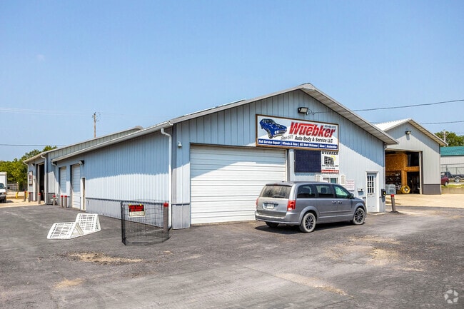
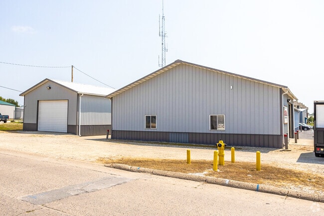
Property Record
1120 W 3Rd St, Perry, IA 50220
NEARBY LISTINGS FOR SALE OR LEASE
-
-
View all Perry listings for lease on LoopNet.com
Property Detail
1120 W 3Rd St
Des Moines-West Des Moines, IA
City/Perry
02-09-435-011
PARCEL 23-112 PT OF BLK 35
Warehouse
Dallas
X
Iowa
19015C0425D
7,8
2023
0.20 AC
2024
Outlying Dallas County
050400
Des Moines
9,360 SF
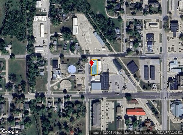
DEMOGRAPHICS near 1120 W 3Rd St
1 Mile
3 Mile
5 Mile
2024 Total Population
5,841
9,038
9,624
2029 Population
7,036
10,836
11,487
Pop Growth 2024-2029
+ 20.46%
+ 19.89%
+ 19.36%
Average Age
37
38
38
2024 Total Households
2,171
3,377
3,597
HH Growth 2024-2029
+ 21.37%
+ 20.82%
+ 20.32%
Median Household Inc
$43,958
$44,851
$47,422
Avg Household Size
2.60
2.60
2.60
2024 Avg HH Vehicles
2.00
2.00
2.00
Median Home Value
$114,688
$129,068
$134,702
Median Year Built
1948
1954
1954
Nearby Places
Map Layers
Map Styles
 Street
 Aerial
- Restaurants
- Banks
- Shops
- Fitness
- Groceries
SALE & LEASE HISTORY
LISTING DATE
SALE/LEASE

Nov 02, 2016
For Sale
Mar 10, 2017
For Sale
Jun 28, 2022
For Lease
Jul 02, 2018
For Sale
Jan 17, 2018
For Sale
Apr 15, 2022
For Sale
Apr 06, 2021
For Sale
Nearby Properties
Address
Land Use
TOTAL SIZE
Lot Size
Zoning
Address
Land Use
TOTAL SIZE
Lot Size
Zoning
16 AC
Address
Land Use
TOTAL SIZE
Lot Size
Zoning
27,096 SF
4.31 AC
Address
Land Use
TOTAL SIZE
Lot Size
Zoning
24,240 SF
11.75 AC
Address
Land Use
TOTAL SIZE
Lot Size
Zoning
15,111 SF
6.54 AC
Address
Land Use
TOTAL SIZE
Lot Size
Zoning
30,672 SF
4.01 AC
Address
Land Use
TOTAL SIZE
Lot Size
Zoning
8,560 SF
1.07 AC
Address
Land Use
TOTAL SIZE
Lot Size
Zoning
43,710 SF
24.96 AC
Address
Land Use
TOTAL SIZE
Lot Size
Zoning
2,400 SF
5.55 AC
Address
Land Use
TOTAL SIZE
Lot Size
Zoning
9,512 SF
5.64 AC
Address
Land Use
TOTAL SIZE
Lot Size
Zoning
33,666 SF
7.69 AC
Address
Land Use
TOTAL SIZE
Lot Size
Zoning
12,188 SF
0.50 AC
Address
Land Use
TOTAL SIZE
Lot Size
Zoning
144,400 SF
38.52 AC
Address
Land Use
TOTAL SIZE
Lot Size
Zoning
13,746 SF
0.58 AC
Address
Land Use
TOTAL SIZE
Lot Size
Zoning
42,600 SF
5.20 AC
Address
Land Use
TOTAL SIZE
Lot Size
Zoning
10,877 SF
4.25 AC
Address
Land Use
TOTAL SIZE
Lot Size
Zoning
1,600 SF
5 AC
Address
Land Use
TOTAL SIZE
Lot Size
Zoning
12,982 SF
4.37 AC
Address
Land Use
TOTAL SIZE
Lot Size
Zoning
31,065 SF
5.50 AC
Address
Land Use
TOTAL SIZE
Lot Size
Zoning
21,037 SF
3.61 AC
Address
Land Use
TOTAL SIZE
Lot Size
Zoning
42,364 SF
4.74 AC
Address
Land Use
TOTAL SIZE
Lot Size
Zoning
67,761 SF
1.70 AC
Address
Land Use
TOTAL SIZE
Lot Size
Zoning
5,544 SF
0.19 AC
Address
Land Use
TOTAL SIZE
Lot Size
Zoning
34,924 SF
3.87 AC
Address
Land Use
TOTAL SIZE
Lot Size
Zoning
1,890 SF
2.07 AC
Address
Land Use
TOTAL SIZE
Lot Size
Zoning
1,155 SF
4.95 AC
Address
Land Use
TOTAL SIZE
Lot Size
Zoning
3,480 SF
2.16 AC
Address
Land Use
TOTAL SIZE
Lot Size
Zoning
1,534 SF
3.75 AC
Address
Land Use
TOTAL SIZE
Lot Size
Zoning
2,000 SF
17.54 AC
Address
Land Use
TOTAL SIZE
Lot Size
Zoning
5,933 SF
2.71 AC
The World's #1 Commercial Real Estate Marketplace
Connect with us
© 2025 CoStar Group
The information above has been obtained from sources believed reliable. While we do not doubt its accuracy we have not verified it and make no guarantee, warranty or representation about it. It is your responsibility to independently confirm its accuracy and completeness. Any projections, opinions, assumptions, or estimates used are for example only and do not represent the current or future performance of the property. The value of this transaction to you depends on tax and other factors which should be evaluated by your tax, financial, and legal advisors. You and your advisors should conduct a careful, independent investigation of the property to determine to your satisfaction the suitability of the property for your needs.