Property Record
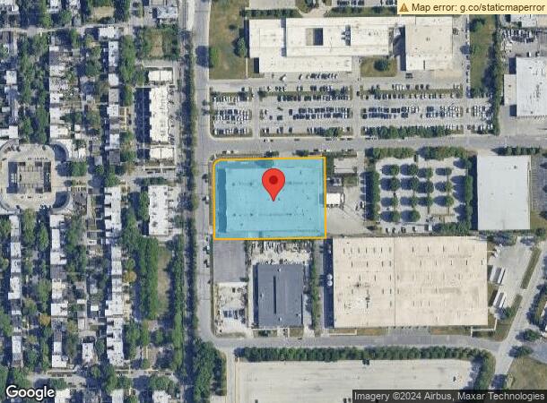
11200 S Ellis Ave, Chicago, IL 60628


NEARBY LISTINGS FOR SALE OR LEASE
Property Detail
11200 S Ellis Ave
25-22-231-004-0000
Pullman Indust Park
Commercialbuilding
Cook
X
Illinois
17031C0655J
20
2023
2.12 AC
2024
South Chicago
491000
Chicago
61,004 SF
Chicago-Naperville-Elgin, IL-IN-WI
DEMOGRAPHICS near 11200 S Ellis Ave
1 Mile
3 Mile
5 Mile
2024 Total Population
11,034
119,286
404,156
2029 Population
10,670
115,888
391,452
Pop Growth 2024-2029
(3.30%)
(2.85%)
(3.14%)
Average Age
41
41
41
2024 Total Households
4,742
45,327
156,951
HH Growth 2024-2029
(3.61%)
(3.23%)
(3.52%)
Median Household Inc
$37,305
$46,073
$48,210
Avg Household Size
2.20
2.50
2.50
2024 Avg HH Vehicles
1.00
1.00
1.00
Median Home Value
$142,786
$141,994
$163,486
Median Year Built
1948
1950
1949
Nearby Places
Map Layers
Map Styles
 Street
 Aerial
- Restaurants
- Banks
- Shops
- Fitness
- Groceries
PUBLIC TRANSPORTATION
TRANSIT/SUBWAY
Pullman/111th Street Station (Metra Electric Line - Northeast Illinois Regional Commuter Railroad (Metra))
DRIVE
WALK
Distance
Pullman/111th Street Station (Metra Electric Line - Northeast Illinois Regional Commuter Railroad (Metra))
2 min
10 min
0.5 mi
Kensington Street Station (South Shore Line - Northern Indiana Commuter Transportation District (South Shore Line))
DRIVE
WALK
Distance
Kensington Street Station (South Shore Line - Northern Indiana Commuter Transportation District (South Shore Line))
4 min
17 min
0.9 mi
107th Street Station (Metra Electric Line) (Metra Electric Line - Northeast Illinois Regional Commuter Railroad (Metra))
DRIVE
WALK
Distance
107th Street Station (Metra Electric Line) (Metra Electric Line - Northeast Illinois Regional Commuter Railroad (Metra))
3 min
17 min
0.9 mi
COMMUTER RAIL
Pullman/111th Street Station (Metra Electric Line - Northeast Illinois Regional Commuter Railroad (Metra))
DRIVE
WALK
Distance
Pullman/111th Street Station (Metra Electric Line - Northeast Illinois Regional Commuter Railroad (Metra))
2 min
10 min
0.5 mi
Kensington Street Station (South Shore Line - Northern Indiana Commuter Transportation District (South Shore Line))
DRIVE
WALK
Distance
Kensington Street Station (South Shore Line - Northern Indiana Commuter Transportation District (South Shore Line))
4 min
17 min
0.9 mi
AIRPORT
Chicago Midway International
DRIVE
WALK
Distance
Chicago Midway International
27 min
14.7 mi
Chicago O'Hare International
DRIVE
WALK
Distance
Chicago O'Hare International
49 min
31.5 mi
SALE & LEASE HISTORY
LISTING DATE
SALE/LEASE

Oct 08, 2024
For Lease
Nearby Properties
Address
Land Use
TOTAL SIZE
Lot Size
Zoning
Address
Land Use
TOTAL SIZE
Lot Size
Zoning
8 AC
PD 1168
Address
Land Use
TOTAL SIZE
Lot Size
Zoning
0.51 AC
PD 1168
Address
Land Use
TOTAL SIZE
Lot Size
Zoning
1.08 AC
PD 1168
Address
Land Use
TOTAL SIZE
Lot Size
Zoning
41,400 SF
13.35 AC
PD 1254
Address
Land Use
TOTAL SIZE
Lot Size
Zoning
11 AC
PD 1168
Address
Land Use
TOTAL SIZE
Lot Size
Zoning
8,400 SF
65.94 AC
PMD 6
Address
Land Use
TOTAL SIZE
Lot Size
Zoning
162,000 SF
20.94 AC
PD 1167
Address
Land Use
TOTAL SIZE
Lot Size
Zoning
148,700 SF
Address
Land Use
TOTAL SIZE
Lot Size
Zoning
400,737 SF
PD 1167
Address
Land Use
TOTAL SIZE
Lot Size
Zoning
622,934 SF
34.41 AC
M2-3
Address
Land Use
TOTAL SIZE
Lot Size
Zoning
12,334 SF
53.37 AC
PD 1160
Address
Land Use
TOTAL SIZE
Lot Size
Zoning
1 AC
RS-3
Address
Land Use
TOTAL SIZE
Lot Size
Zoning
73,947 SF
17.40 AC
PD 1167
Address
Land Use
TOTAL SIZE
Lot Size
Zoning
542,852 SF
PMD 6,M2-1
Address
Land Use
TOTAL SIZE
Lot Size
Zoning
5,300 SF
36.84 AC
PMD 6
Address
Land Use
TOTAL SIZE
Lot Size
Zoning
155,765 SF
8.75 AC
PD 1167
Address
Land Use
TOTAL SIZE
Lot Size
Zoning
76,867 SF
3.44 AC
M1-1
Address
Land Use
TOTAL SIZE
Lot Size
Zoning
207,100 SF
9.84 AC
M2-2
Address
Land Use
TOTAL SIZE
Lot Size
Zoning
9.55 AC
M2-2
Address
Land Use
TOTAL SIZE
Lot Size
Zoning
72,219 SF
4.30 AC
M1-2
Address
Land Use
TOTAL SIZE
Lot Size
Zoning
84,400 SF
15.18 AC
M2-2,M1-1
Address
Land Use
TOTAL SIZE
Lot Size
Zoning
12.42 AC
PD 485
Address
Land Use
TOTAL SIZE
Lot Size
Zoning
71,700 SF
6.24 AC
PD 485
Address
Land Use
TOTAL SIZE
Lot Size
Zoning
1.71 AC
PD 1168
Address
Land Use
TOTAL SIZE
Lot Size
Zoning
58,275 SF
6.25 AC
M1-2,C1-2
Address
Land Use
TOTAL SIZE
Lot Size
Zoning
43.34 AC
M3-3
Address
Land Use
TOTAL SIZE
Lot Size
Zoning
63,700 SF
0.74 AC
C1-1
Address
Land Use
TOTAL SIZE
Lot Size
Zoning
37.23 AC
PMD 6
Address
Land Use
TOTAL SIZE
Lot Size
Zoning
Address
Land Use
TOTAL SIZE
Lot Size
Zoning
67,348 SF
6.33 AC
PD 131
The World's #1 Commercial Real Estate Marketplace
Connect with us
© 2025 CoStar Group
The information above has been obtained from sources believed reliable. While we do not doubt its accuracy we have not verified it and make no guarantee, warranty or representation about it. It is your responsibility to independently confirm its accuracy and completeness. Any projections, opinions, assumptions, or estimates used are for example only and do not represent the current or future performance of the property. The value of this transaction to you depends on tax and other factors which should be evaluated by your tax, financial, and legal advisors. You and your advisors should conduct a careful, independent investigation of the property to determine to your satisfaction the suitability of the property for your needs.