Property Record
11205 E Dishman Mica Rd, Spokane Valley, WA 99206


NEARBY LISTINGS FOR SALE OR LEASE
Property Detail
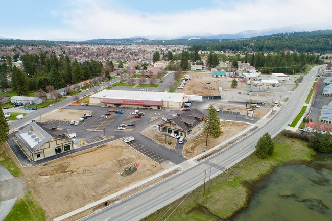
11205 E Dishman Mica Rd
Spokane-Spokane Valley, WA
33-25-44 PTN OF NE1/4 DAF; BEG AT CENTER 1/4 COR OF SEC TH W ALG N LN OF SD SW1/4 1030.35 TH S30 A PT ON 40TH AVE & TRUE POB TH S38DEG 20MIN 21SDS W169.34 TH S38DEG 44MIN 07SDS E 239.83 TH S0DEG 40MIN 22SDS W86.63 TO NELY R/W LN OF DISHMA N MICA RD C
45333.9205
Spokane
Storebuilding
Washington
2025
4.60 AC
2025
Valley
012402
Spokane
45,218 SF
DEMOGRAPHICS near 11205 E Dishman Mica Rd
1 Mile
3 Mile
5 Mile
2024 Total Population
7,570
45,043
120,398
2029 Population
8,039
47,785
128,438
Pop Growth 2024-2029
+ 6.20%
+ 6.09%
+ 6.68%
Average Age
42
41
40
2024 Total Households
2,820
17,194
47,812
HH Growth 2024-2029
+ 6.38%
+ 6.25%
+ 6.84%
Median Household Inc
$96,632
$73,252
$68,442
Avg Household Size
2.70
2.50
2.40
2024 Avg HH Vehicles
2.00
2.00
2.00
Median Home Value
$391,274
$354,028
$352,435
Median Year Built
1977
1976
1980
Nearby Places
Map Layers
Map Styles
 Street
 Aerial
- Restaurants
- Banks
- Shops
- Fitness
- Groceries
PUBLIC TRANSPORTATION
COMMUTER RAIL
DRIVE
WALK
Distance
19 min
9.7 mi
AIRPORT
Spokane International
DRIVE
WALK
Distance
Spokane International
26 min
15.6 mi
SALE & LEASE HISTORY
LISTING DATE
SALE/LEASE

Mar 15, 2021
For Lease
Nearby Properties
Address
Land Use
TOTAL SIZE
Lot Size
Zoning
Address
Land Use
TOTAL SIZE
Lot Size
Zoning
473,651 SF
76.70 AC
R-2
Address
Land Use
TOTAL SIZE
Lot Size
Zoning
260,345 SF
23.70 AC
MDR
Address
Land Use
TOTAL SIZE
Lot Size
Zoning
240,663 SF
8.90 AC
MF-2
Address
Land Use
TOTAL SIZE
Lot Size
Zoning
100,060 SF
14.94 AC
R-3
Address
Land Use
TOTAL SIZE
Lot Size
Zoning
69,202 SF
9.99 AC
R-2
Address
Land Use
TOTAL SIZE
Lot Size
Zoning
72,443 SF
8.90 AC
R-3
Address
Land Use
TOTAL SIZE
Lot Size
Zoning
126,906 SF
20.25 AC
LDR
Address
Land Use
TOTAL SIZE
Lot Size
Zoning
70,265 SF
9.64 AC
R-2
Address
Land Use
TOTAL SIZE
Lot Size
Zoning
47,612 SF
3.38 AC
CMU
Address
Land Use
TOTAL SIZE
Lot Size
Zoning
105,659 SF
4.40 AC
MF-1
Address
Land Use
TOTAL SIZE
Lot Size
Zoning
68,600 SF
5.25 AC
MF-2
Address
Land Use
TOTAL SIZE
Lot Size
Zoning
109,016 SF
8.01 AC
MF-2
Address
Land Use
TOTAL SIZE
Lot Size
Zoning
100,035 SF
5.74 AC
CMU
Address
Land Use
TOTAL SIZE
Lot Size
Zoning
37,759 SF
17.57 AC
LDR
Address
Land Use
TOTAL SIZE
Lot Size
Zoning
26,561 SF
2.73 AC
CMU
Address
Land Use
TOTAL SIZE
Lot Size
Zoning
102,875 SF
7.44 AC
RC
Address
Land Use
TOTAL SIZE
Lot Size
Zoning
49,598 SF
8.19 AC
R-2
Address
Land Use
TOTAL SIZE
Lot Size
Zoning
106,877 SF
6.92 AC
MF-2
Address
Land Use
TOTAL SIZE
Lot Size
Zoning
61,200 SF
0.83 AC
MF-2
Address
Land Use
TOTAL SIZE
Lot Size
Zoning
58,647 SF
5.19 AC
MF-2
Address
Land Use
TOTAL SIZE
Lot Size
Zoning
46,893 SF
2.43 AC
MF-1
Address
Land Use
TOTAL SIZE
Lot Size
Zoning
83,618 SF
0.50 AC
CMU
Address
Land Use
TOTAL SIZE
Lot Size
Zoning
46,693 SF
9.13 AC
R-2
Address
Land Use
TOTAL SIZE
Lot Size
Zoning
40,010 SF
3.35 AC
MF-2
Address
Land Use
TOTAL SIZE
Lot Size
Zoning
182,486 SF
23.66 AC
R-3
Address
Land Use
TOTAL SIZE
Lot Size
Zoning
61,369 SF
5 AC
CMU
Address
Land Use
TOTAL SIZE
Lot Size
Zoning
80,696 SF
12.93 AC
R-3
Address
Land Use
TOTAL SIZE
Lot Size
Zoning
359.36 AC
RCV
Address
Land Use
TOTAL SIZE
Lot Size
Zoning
62,669 SF
2.52 AC
CMU
Address
Land Use
TOTAL SIZE
Lot Size
Zoning
111,053 SF
6.55 AC
MF-2
The World's #1 Commercial Real Estate Marketplace
Connect with us
© 2025 CoStar Group
The information above has been obtained from sources believed reliable. While we do not doubt its accuracy we have not verified it and make no guarantee, warranty or representation about it. It is your responsibility to independently confirm its accuracy and completeness. Any projections, opinions, assumptions, or estimates used are for example only and do not represent the current or future performance of the property. The value of this transaction to you depends on tax and other factors which should be evaluated by your tax, financial, and legal advisors. You and your advisors should conduct a careful, independent investigation of the property to determine to your satisfaction the suitability of the property for your needs.