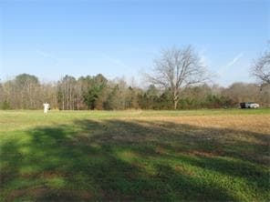
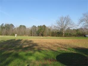
Property Record
1121 Jim Daws Rd, Monroe, GA 30656

Property Detail
1121 Jim Daws Rd
C163000000105000
33.22AC
Agriculturalland
WALTON
A2
Georgia
A Areas with a 1% annual chance of flooding and a 26% chance of flooding over the life of a 30-year mortgage.
33.22 AC
2025
Walton County
2025
Atlanta
110102
Atlanta-Sandy Springs-Roswell, GA
2,322 SF
NEARBY LISTINGS FOR SALE OR LEASE
-
-
View all Monroe listings for sale on LoopNet.com
DEMOGRAPHICS near 1121 Jim Daws Rd
1 mile
3 mile
5 mile
2025 Total Population
750
7,676
30,873
2030 Population
840
8,590
34,567
Pop Growth 2025-2030
+ 12.00%
+ 11.91%
+ 11.97%
Average Age
43
41
40
2025 Total Households
296
2,842
11,495
HH Growth 2025-2030
+ 12.16%
+ 11.96%
+ 12.04%
Median Household Inc
$69,230
$62,282
$52,976
Avg Household Size
2.50
2.60
2.60
2025 Avg HH Vehicles
3.00
2.00
2.00
Median Home Value
$284,328
$307,019
$314,271
Median Year Built
1990
1994
1990
Nearby Places
Map Layers
Map Styles
 Street
 Aerial
Layers
 Traffic
 Biking
Places
Listings with unknown addresses are not visible on the map
- Restaurants
- Banks
- Shops
- Fitness
- Groceries
SALE & LEASE HISTORY
LISTING DATE
SALE/LEASE

Sep 05, 2017
For Sale
Nearby Properties
Address
Land Use
TOTAL SIZE
Lot Size
Zoning
Address
Land Use
TOTAL SIZE
Lot Size
Zoning
63,172 SF
226.40 AC
R1 P
Address
Land Use
TOTAL SIZE
Lot Size
Zoning
210,000 SF
36 AC
M1
Address
Land Use
TOTAL SIZE
Lot Size
Zoning
375,544 SF
128.40 AC
M1
Address
Land Use
TOTAL SIZE
Lot Size
Zoning
185,112 SF
26.38 AC
PCD
Address
Land Use
TOTAL SIZE
Lot Size
Zoning
16,880 SF
55.23 AC
M1
Address
Land Use
TOTAL SIZE
Lot Size
Zoning
268,431 SF
14.74 AC
M1
Address
Land Use
TOTAL SIZE
Lot Size
Zoning
140,800 SF
12.05 AC
I1
Address
Land Use
TOTAL SIZE
Lot Size
Zoning
70,400 SF
17 AC
M1
Address
Land Use
TOTAL SIZE
Lot Size
Zoning
159,604 SF
17.50 AC
M1
Address
Land Use
TOTAL SIZE
Lot Size
Zoning
140.98 AC
M1
Address
Land Use
TOTAL SIZE
Lot Size
Zoning
10,000 SF
80.08 AC
M1
Address
Land Use
TOTAL SIZE
Lot Size
Zoning
3,040 SF
19.94 AC
M1
Address
Land Use
TOTAL SIZE
Lot Size
Zoning
23.89 AC
MHP
Address
Land Use
TOTAL SIZE
Lot Size
Zoning
5,600 SF
66.05 AC
M1
Address
Land Use
TOTAL SIZE
Lot Size
Zoning
7,000 SF
3.83 AC
M1
Address
Land Use
TOTAL SIZE
Lot Size
Zoning
4,762 SF
6.62 AC
R1
Address
Land Use
TOTAL SIZE
Lot Size
Zoning
147.55 AC
A1
Address
Land Use
TOTAL SIZE
Lot Size
Zoning
172.12 AC
A2
Address
Land Use
TOTAL SIZE
Lot Size
Zoning
165.33 AC
A1
Address
Land Use
TOTAL SIZE
Lot Size
Zoning
61.31 AC
M1
Address
Land Use
TOTAL SIZE
Lot Size
Zoning
10,400 SF
10 AC
M1
Address
Land Use
TOTAL SIZE
Lot Size
Zoning
12,800 SF
4.68 AC
M1
Address
Land Use
TOTAL SIZE
Lot Size
Zoning
88.52 AC
R1OSC
Address
Land Use
TOTAL SIZE
Lot Size
Zoning
120,000 SF
14.06 AC
M1
Address
Land Use
TOTAL SIZE
Lot Size
Zoning
4,378 SF
14.97 AC
B2
Address
Land Use
TOTAL SIZE
Lot Size
Zoning
1,654 SF
8.14 AC
R2
Address
Land Use
TOTAL SIZE
Lot Size
Zoning
120.95 AC
A1
Address
Land Use
TOTAL SIZE
Lot Size
Zoning
1,232 SF
98.01 AC
A2
Address
Land Use
TOTAL SIZE
Lot Size
Zoning
25,525 SF
16.32 AC
A1
Address
Land Use
TOTAL SIZE
Lot Size
Zoning
14,696 SF
4.12 AC
M1
The World's #1 Commercial Real Estate Marketplace
Connect with us
© 2026 CoStar Group
The information above has been obtained from sources believed reliable. While we do not doubt its accuracy we have not verified it and make no guarantee, warranty or representation about it. It is your responsibility to independently confirm its accuracy and completeness. Any projections, opinions, assumptions, or estimates used are for example only and do not represent the current or future performance of the property. The value of this transaction to you depends on tax and other factors which should be evaluated by your tax, financial, and legal advisors. You and your advisors should conduct a careful, independent investigation of the property to determine to your satisfaction the suitability of the property for your needs.