Property Record
1121 Wilkins Cir, Casper, WY 82601
NEARBY LISTINGS FOR SALE OR LEASE
Property Detail
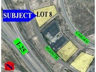
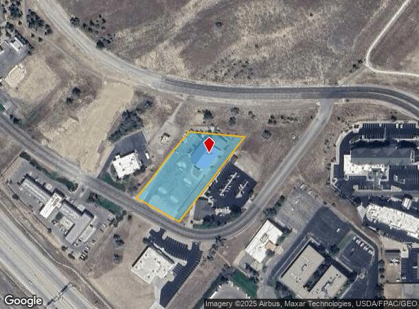
1121 Wilkins Cir
Casper, WY
North Platte Ind Pk
33-79-05-1-0-100100
NORTH PLATTE IND PK LOT 16 COMMERCIAL
Bartavern
Natrona
X
Wyoming
56025C2002E
16
2024
1.85 AC
2025
I-25 Corridor/Casper
001401
Other Market Areas
15,834 SF
DEMOGRAPHICS near 1121 Wilkins Cir
1 Mile
3 Mile
5 Mile
2024 Total Population
2,080
31,880
66,994
2029 Population
2,152
32,499
68,018
Pop Growth 2024-2029
+ 3.46%
+ 1.94%
+ 1.53%
Average Age
41
40
40
2024 Total Households
1,029
14,190
27,770
HH Growth 2024-2029
+ 3.30%
+ 1.95%
+ 1.57%
Median Household Inc
$34,456
$53,598
$62,659
Avg Household Size
1.90
2.20
2.30
2024 Avg HH Vehicles
1.00
2.00
2.00
Median Home Value
$145,971
$180,016
$228,354
Median Year Built
1964
1958
1974
Nearby Places
Map Layers
Map Styles
 Street
 Aerial
- Restaurants
- Banks
- Shops
- Fitness
- Groceries
PUBLIC TRANSPORTATION
AIRPORT
Casper/Natrona County International
DRIVE
WALK
Distance
Casper/Natrona County International
27 min
14.2 mi
Freight Ports
Tulsa Port Of Catoosa
DRIVE
WALK
Distance
Tulsa Port Of Catoosa
993 min
978.8 mi
Nearby Properties
Address
Land Use
TOTAL SIZE
Lot Size
Zoning
Address
Land Use
TOTAL SIZE
Lot Size
Zoning
156,457 SF
5.74 AC
Address
Land Use
TOTAL SIZE
Lot Size
Zoning
53,685 SF
4.28 AC
Address
Land Use
TOTAL SIZE
Lot Size
Zoning
16,924 SF
9.54 AC
Address
Land Use
TOTAL SIZE
Lot Size
Zoning
95,290 SF
0.57 AC
Address
Land Use
TOTAL SIZE
Lot Size
Zoning
99,524 SF
4.67 AC
Address
Land Use
TOTAL SIZE
Lot Size
Zoning
81,240 SF
5.86 AC
Address
Land Use
TOTAL SIZE
Lot Size
Zoning
166,099 SF
7.65 AC
Address
Land Use
TOTAL SIZE
Lot Size
Zoning
89,892 SF
2.75 AC
Address
Land Use
TOTAL SIZE
Lot Size
Zoning
88,739 SF
13.39 AC
Address
Land Use
TOTAL SIZE
Lot Size
Zoning
54,112 SF
3.52 AC
Address
Land Use
TOTAL SIZE
Lot Size
Zoning
40,414 SF
0.03 AC
Address
Land Use
TOTAL SIZE
Lot Size
Zoning
70,772 SF
11.68 AC
Address
Land Use
TOTAL SIZE
Lot Size
Zoning
92,078 SF
5.52 AC
Address
Land Use
TOTAL SIZE
Lot Size
Zoning
21,120 SF
16.73 AC
Address
Land Use
TOTAL SIZE
Lot Size
Zoning
76,420 SF
6.67 AC
Address
Land Use
TOTAL SIZE
Lot Size
Zoning
24,240 SF
16.47 AC
Address
Land Use
TOTAL SIZE
Lot Size
Zoning
82,800 SF
5.94 AC
Address
Land Use
TOTAL SIZE
Lot Size
Zoning
56,433 SF
3 AC
Address
Land Use
TOTAL SIZE
Lot Size
Zoning
45,297 SF
1.29 AC
Address
Land Use
TOTAL SIZE
Lot Size
Zoning
65,427 SF
2.16 AC
Address
Land Use
TOTAL SIZE
Lot Size
Zoning
46,926 SF
9.56 AC
Address
Land Use
TOTAL SIZE
Lot Size
Zoning
95,322 SF
2.01 AC
Address
Land Use
TOTAL SIZE
Lot Size
Zoning
63,950 SF
8.02 AC
Address
Land Use
TOTAL SIZE
Lot Size
Zoning
58,661 SF
2.49 AC
Address
Land Use
TOTAL SIZE
Lot Size
Zoning
55,953 SF
1.94 AC
Address
Land Use
TOTAL SIZE
Lot Size
Zoning
22,150 SF
5.49 AC
Address
Land Use
TOTAL SIZE
Lot Size
Zoning
37,542 SF
3 AC
Address
Land Use
TOTAL SIZE
Lot Size
Zoning
19,695 SF
2.40 AC
Address
Land Use
TOTAL SIZE
Lot Size
Zoning
17,181 SF
0.38 AC
Address
Land Use
TOTAL SIZE
Lot Size
Zoning
84,524 SF
3.46 AC
The World's #1 Commercial Real Estate Marketplace
Connect with us
© 2025 CoStar Group
The information above has been obtained from sources believed reliable. While we do not doubt its accuracy we have not verified it and make no guarantee, warranty or representation about it. It is your responsibility to independently confirm its accuracy and completeness. Any projections, opinions, assumptions, or estimates used are for example only and do not represent the current or future performance of the property. The value of this transaction to you depends on tax and other factors which should be evaluated by your tax, financial, and legal advisors. You and your advisors should conduct a careful, independent investigation of the property to determine to your satisfaction the suitability of the property for your needs.