Property Record
11210 S Post Oak Rd, Houston, TX 77035
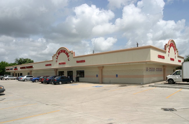


Property Detail
11210 S Post Oak Rd
Houston-Pasadena-The Woodlands, TX
LT 32 WILLOW CREEK ESTATES
0691220000032
HARRIS
Storebuilding
Texas
B and X Area of moderate flood hazard, usually the area between the limits of the 100-year and 500-year floods.
32
2025
2.50 AC
2025
Southwest
420500
Houston
14,880 SF
NEARBY LISTINGS FOR SALE OR LEASE
DEMOGRAPHICS near 11210 S Post Oak Rd
1 mile
3 mile
5 mile
2025 Total Population
12,775
148,701
447,203
2030 Population
13,614
158,695
480,365
Pop Growth 2025-2030
+ 6.57%
+ 6.72%
+ 7.42%
Average Age
39
38
37
2025 Total Households
4,869
55,404
167,069
HH Growth 2025-2030
+ 6.61%
+ 6.95%
+ 7.60%
Median Household Inc
$85,252
$69,738
$62,484
Avg Household Size
2.50
2.60
2.60
2025 Avg HH Vehicles
2.00
2.00
2.00
Median Home Value
$357,719
$337,547
$289,863
Median Year Built
1962
1975
1980
Nearby Places
Map Layers
Map Styles
 Street
 Aerial
Layers
 Traffic
 Biking
Places
Listings with unknown addresses are not visible on the map
- Restaurants
- Banks
- Shops
- Fitness
- Groceries
PUBLIC TRANSPORTATION
AIRPORT
William P Hobby
Drive
Walk
Distance
William P Hobby
30 min
16.8 mi
George Bush Intcntl/Houston
Drive
Walk
Distance
George Bush Intcntl/Houston
41 min
31.9 mi
Freight Ports
Port of Houston
Drive
Walk
Distance
Port of Houston
27 min
17.1 mi
Nearby Properties
Address
Land Use
TOTAL SIZE
Lot Size
Zoning
Address
Land Use
TOTAL SIZE
Lot Size
Zoning
777,791 SF
47.90 AC
Address
Land Use
TOTAL SIZE
Lot Size
Zoning
1,202,191 SF
39.08 AC
Address
Land Use
TOTAL SIZE
Lot Size
Zoning
15.46 AC
Address
Land Use
TOTAL SIZE
Lot Size
Zoning
305,512 SF
13.74 AC
Address
Land Use
TOTAL SIZE
Lot Size
Zoning
544,698 SF
15.66 AC
Address
Land Use
TOTAL SIZE
Lot Size
Zoning
640,860 SF
5.31 AC
Address
Land Use
TOTAL SIZE
Lot Size
Zoning
398,772 SF
2.97 AC
Address
Land Use
TOTAL SIZE
Lot Size
Zoning
297,620 SF
11.01 AC
Address
Land Use
TOTAL SIZE
Lot Size
Zoning
292,644 SF
15.47 AC
Address
Land Use
TOTAL SIZE
Lot Size
Zoning
534,800 SF
33.43 AC
Address
Land Use
TOTAL SIZE
Lot Size
Zoning
426,919 SF
12.62 AC
Address
Land Use
TOTAL SIZE
Lot Size
Zoning
290,624 SF
3.17 AC
Address
Land Use
TOTAL SIZE
Lot Size
Zoning
255,680 SF
13.42 AC
Address
Land Use
TOTAL SIZE
Lot Size
Zoning
301,360 SF
11.97 AC
Address
Land Use
TOTAL SIZE
Lot Size
Zoning
242,982 SF
11.56 AC
Address
Land Use
TOTAL SIZE
Lot Size
Zoning
456,076 SF
19.09 AC
Address
Land Use
TOTAL SIZE
Lot Size
Zoning
363,134 SF
18.52 AC
Address
Land Use
TOTAL SIZE
Lot Size
Zoning
414,014 SF
7.77 AC
Address
Land Use
TOTAL SIZE
Lot Size
Zoning
253,163 SF
8.66 AC
Address
Land Use
TOTAL SIZE
Lot Size
Zoning
371,335 SF
31.65 AC
Address
Land Use
TOTAL SIZE
Lot Size
Zoning
391,473 SF
17.11 AC
Address
Land Use
TOTAL SIZE
Lot Size
Zoning
186,759 SF
42.60 AC
Address
Land Use
TOTAL SIZE
Lot Size
Zoning
434,744 SF
16.74 AC
Address
Land Use
TOTAL SIZE
Lot Size
Zoning
191,931 SF
8.25 AC
Address
Land Use
TOTAL SIZE
Lot Size
Zoning
411,605 SF
19.51 AC
Address
Land Use
TOTAL SIZE
Lot Size
Zoning
186,423 SF
7.07 AC
Address
Land Use
TOTAL SIZE
Lot Size
Zoning
Address
Land Use
TOTAL SIZE
Lot Size
Zoning
237,204 SF
7.65 AC
Address
Land Use
TOTAL SIZE
Lot Size
Zoning
298,857 SF
11.34 AC
Address
Land Use
TOTAL SIZE
Lot Size
Zoning
154,220 SF
2.03 AC
The World's #1 Commercial Real Estate Marketplace
Connect with us
© 2026 CoStar Group
The information above has been obtained from sources believed reliable. While we do not doubt its accuracy we have not verified it and make no guarantee, warranty or representation about it. It is your responsibility to independently confirm its accuracy and completeness. Any projections, opinions, assumptions, or estimates used are for example only and do not represent the current or future performance of the property. The value of this transaction to you depends on tax and other factors which should be evaluated by your tax, financial, and legal advisors. You and your advisors should conduct a careful, independent investigation of the property to determine to your satisfaction the suitability of the property for your needs.