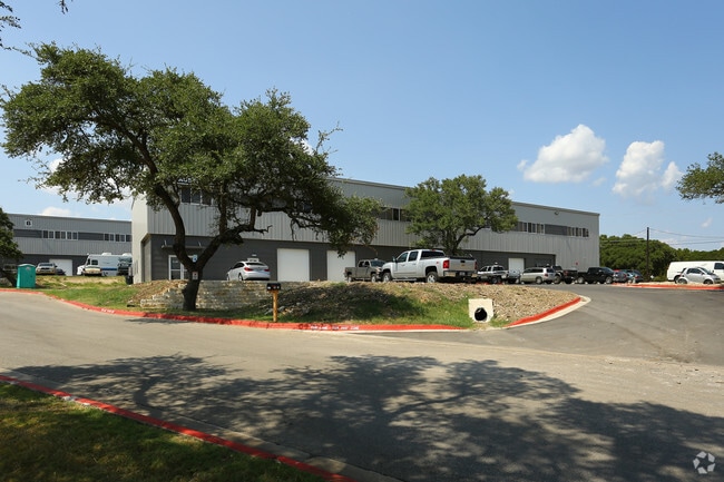
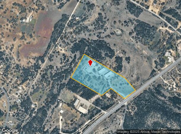
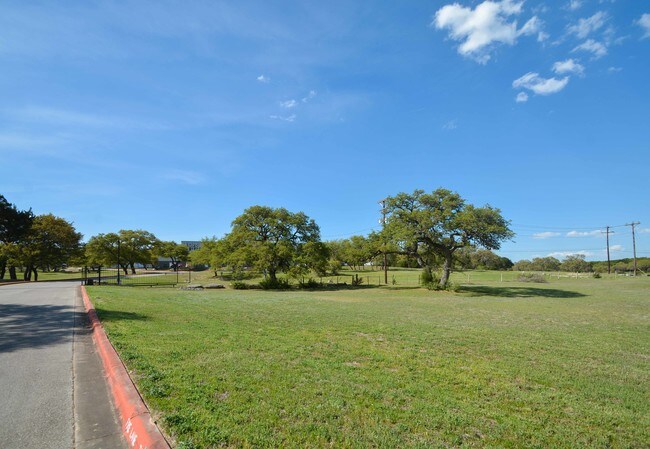
Property Record
11210 W Highway 290, Austin, TX 78737
NEARBY LISTINGS FOR SALE OR LEASE
Property Detail
11210 W Highway 290
Austin-Round Rock, TX
Collings Subd
446861
LOT 1 BLK A COLLINGS SUBD & LOTS 3-5 SUMMIT SUBD
Industrialgeneral
Travis
AE
Texas
48453C0555J
1,3-5
2024
16.08 AC
2025
Southwest
036600
Austin
47,530 SF
DEMOGRAPHICS near 11210 W Highway 290
1 Mile
3 Mile
5 Mile
2024 Total Population
612
15,169
58,060
2029 Population
686
18,855
68,181
Pop Growth 2024-2029
+ 12.09%
+ 24.30%
+ 17.43%
Average Age
45
41
39
2024 Total Households
230
5,373
20,528
HH Growth 2024-2029
+ 12.61%
+ 24.96%
+ 18.08%
Median Household Inc
$127,500
$135,600
$138,172
Avg Household Size
2.60
2.80
2.80
2024 Avg HH Vehicles
2.00
2.00
2.00
Median Home Value
$726,000
$617,067
$617,716
Median Year Built
1996
2005
2005
Nearby Places
Map Layers
Map Styles
 Street
 Aerial
- Restaurants
- Banks
- Shops
- Fitness
- Groceries
PUBLIC TRANSPORTATION
AIRPORT
Austin-Bergstrom International
DRIVE
WALK
Distance
Austin-Bergstrom International
36 min
21.4 mi
Freight Ports
Calhoun Port
DRIVE
WALK
Distance
Calhoun Port
201 min
164.9 mi
SALE & LEASE HISTORY
LISTING DATE
SALE/LEASE

May 20, 2019
For Lease
Jan 15, 2020
For Lease
Nearby Properties
Address
Land Use
TOTAL SIZE
Lot Size
Zoning
Address
Land Use
TOTAL SIZE
Lot Size
Zoning
339,456 SF
32.70 AC
Address
Land Use
TOTAL SIZE
Lot Size
Zoning
399,662 SF
16.72 AC
Address
Land Use
TOTAL SIZE
Lot Size
Zoning
324,987 SF
8.29 AC
Address
Land Use
TOTAL SIZE
Lot Size
Zoning
191,928 SF
4.79 AC
Address
Land Use
TOTAL SIZE
Lot Size
Zoning
219,299 SF
4.89 AC
Address
Land Use
TOTAL SIZE
Lot Size
Zoning
275,753 SF
15.68 AC
Address
Land Use
TOTAL SIZE
Lot Size
Zoning
64,670 SF
13.53 AC
Address
Land Use
TOTAL SIZE
Lot Size
Zoning
231,472 SF
9.53 AC
Address
Land Use
TOTAL SIZE
Lot Size
Zoning
103,045 SF
59.39 AC
Address
Land Use
TOTAL SIZE
Lot Size
Zoning
121,400 SF
28.99 AC
Address
Land Use
TOTAL SIZE
Lot Size
Zoning
59,133 SF
13.33 AC
Address
Land Use
TOTAL SIZE
Lot Size
Zoning
37,380 SF
4.35 AC
Address
Land Use
TOTAL SIZE
Lot Size
Zoning
84,970 SF
7.19 AC
Address
Land Use
TOTAL SIZE
Lot Size
Zoning
214.72 AC
Address
Land Use
TOTAL SIZE
Lot Size
Zoning
101,453 SF
14.29 AC
Address
Land Use
TOTAL SIZE
Lot Size
Zoning
33,145 SF
2.70 AC
Address
Land Use
TOTAL SIZE
Lot Size
Zoning
70,194 SF
2.71 AC
Address
Land Use
TOTAL SIZE
Lot Size
Zoning
18.29 AC
Address
Land Use
TOTAL SIZE
Lot Size
Zoning
69.12 AC
Address
Land Use
TOTAL SIZE
Lot Size
Zoning
43,215 SF
3.85 AC
Address
Land Use
TOTAL SIZE
Lot Size
Zoning
15,750 SF
1.94 AC
Address
Land Use
TOTAL SIZE
Lot Size
Zoning
54,606 SF
12.27 AC
Address
Land Use
TOTAL SIZE
Lot Size
Zoning
17,987 SF
12.07 AC
Address
Land Use
TOTAL SIZE
Lot Size
Zoning
27,900 SF
5.01 AC
Address
Land Use
TOTAL SIZE
Lot Size
Zoning
15,000 SF
8.73 AC
Address
Land Use
TOTAL SIZE
Lot Size
Zoning
39,650 SF
9.17 AC
Address
Land Use
TOTAL SIZE
Lot Size
Zoning
15,639 SF
2.10 AC
Address
Land Use
TOTAL SIZE
Lot Size
Zoning
14,880 SF
1.96 AC
Address
Land Use
TOTAL SIZE
Lot Size
Zoning
15,825 SF
10.99 AC
The World's #1 Commercial Real Estate Marketplace
Connect with us
© 2025 CoStar Group
The information above has been obtained from sources believed reliable. While we do not doubt its accuracy we have not verified it and make no guarantee, warranty or representation about it. It is your responsibility to independently confirm its accuracy and completeness. Any projections, opinions, assumptions, or estimates used are for example only and do not represent the current or future performance of the property. The value of this transaction to you depends on tax and other factors which should be evaluated by your tax, financial, and legal advisors. You and your advisors should conduct a careful, independent investigation of the property to determine to your satisfaction the suitability of the property for your needs.