Property Record
11211 Us Highway 290 E, Manor, TX 78653


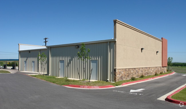
Property Detail
11211 Us Highway 290 E
Austin-Round Rock-San Marcos, TX
LOT 2 COTTONWOOD COMMERCIAL SOUTH SEC 1
377649
Travis
Stripcommercialcenter
Texas
B and X Area of moderate flood hazard, usually the area between the limits of the 100-year and 500-year floods.
2
2025
0.63 AC
2025
East
002217
Austin
5,395 SF
NEARBY LISTINGS FOR SALE OR LEASE
DEMOGRAPHICS near 11211 Us Highway 290 E
1 mile
3 mile
5 mile
2025 Total Population
5,563
30,890
51,774
2030 Population
5,978
33,165
55,570
Pop Growth 2025-2030
+ 7.46%
+ 7.36%
+ 7.33%
Average Age
37
35
35
2025 Total Households
1,828
9,854
16,518
HH Growth 2025-2030
+ 8.04%
+ 8.07%
+ 7.99%
Median Household Inc
$88,429
$95,521
$98,886
Avg Household Size
3.00
3.10
3.10
2025 Avg HH Vehicles
2.00
2.00
2.00
Median Home Value
$388,240
$358,778
$362,103
Median Year Built
2010
2010
2010
Nearby Places
Map Layers
Map Styles
 Street
 Aerial
Transit
 Traffic
 Biking
Places
Listings with unknown addresses are not visible on the map
- Restaurants
- Banks
- Shops
- Fitness
- Groceries
PUBLIC TRANSPORTATION
AIRPORT
Austin-Bergstrom International
Drive
Walk
Distance
Austin-Bergstrom International
29 min
18.0 mi
SALE & LEASE HISTORY
LISTING DATE
SALE/LEASE

Sep 16, 2019
For Lease
Mar 01, 2018
For Lease
Jun 15, 2017
For Sale
Jan 24, 2019
For Lease
Feb 13, 2018
For Lease
Nearby Properties
Address
Land Use
TOTAL SIZE
Lot Size
Zoning
Address
Land Use
TOTAL SIZE
Lot Size
Zoning
411,429 SF
61.03 AC
Address
Land Use
TOTAL SIZE
Lot Size
Zoning
292,050 SF
15.65 AC
Address
Land Use
TOTAL SIZE
Lot Size
Zoning
358,683 SF
17.54 AC
Address
Land Use
TOTAL SIZE
Lot Size
Zoning
483,840 SF
47.88 AC
Address
Land Use
TOTAL SIZE
Lot Size
Zoning
469,500 SF
24.44 AC
Address
Land Use
TOTAL SIZE
Lot Size
Zoning
255,750 SF
13.38 AC
Address
Land Use
TOTAL SIZE
Lot Size
Zoning
264,000 SF
14.22 AC
Address
Land Use
TOTAL SIZE
Lot Size
Zoning
300,492 SF
13.20 AC
Address
Land Use
TOTAL SIZE
Lot Size
Zoning
266,564 SF
27.40 AC
Address
Land Use
TOTAL SIZE
Lot Size
Zoning
204,356 SF
12.18 AC
Address
Land Use
TOTAL SIZE
Lot Size
Zoning
423,360 SF
32.31 AC
Address
Land Use
TOTAL SIZE
Lot Size
Zoning
223,575 SF
12.47 AC
Address
Land Use
TOTAL SIZE
Lot Size
Zoning
149,640 SF
10.39 AC
Address
Land Use
TOTAL SIZE
Lot Size
Zoning
178,200 SF
31.29 AC
Address
Land Use
TOTAL SIZE
Lot Size
Zoning
191,300 SF
30.73 AC
Address
Land Use
TOTAL SIZE
Lot Size
Zoning
158,000 SF
23.60 AC
Address
Land Use
TOTAL SIZE
Lot Size
Zoning
351,000 SF
23.22 AC
Address
Land Use
TOTAL SIZE
Lot Size
Zoning
150,000 SF
10.04 AC
Address
Land Use
TOTAL SIZE
Lot Size
Zoning
75,000 SF
97.48 AC
Address
Land Use
TOTAL SIZE
Lot Size
Zoning
248,325 SF
14.73 AC
Address
Land Use
TOTAL SIZE
Lot Size
Zoning
111,966 SF
11.61 AC
Address
Land Use
TOTAL SIZE
Lot Size
Zoning
138,000 SF
9.69 AC
Address
Land Use
TOTAL SIZE
Lot Size
Zoning
109,184 SF
13.45 AC
Address
Land Use
TOTAL SIZE
Lot Size
Zoning
322,420 SF
24.16 AC
Address
Land Use
TOTAL SIZE
Lot Size
Zoning
132,500 SF
15.56 AC
Address
Land Use
TOTAL SIZE
Lot Size
Zoning
147,908 SF
15.54 AC
Address
Land Use
TOTAL SIZE
Lot Size
Zoning
243,000 SF
20.52 AC
Address
Land Use
TOTAL SIZE
Lot Size
Zoning
200.38 AC
Address
Land Use
TOTAL SIZE
Lot Size
Zoning
51,910 SF
13.19 AC
Address
Land Use
TOTAL SIZE
Lot Size
Zoning
3,460 SF
150.67 AC
The World's #1 Commercial Real Estate Marketplace
Connect with us
© 2026 CoStar Group
The information above has been obtained from sources believed reliable. While we do not doubt its accuracy we have not verified it and make no guarantee, warranty or representation about it. It is your responsibility to independently confirm its accuracy and completeness. Any projections, opinions, assumptions, or estimates used are for example only and do not represent the current or future performance of the property. The value of this transaction to you depends on tax and other factors which should be evaluated by your tax, financial, and legal advisors. You and your advisors should conduct a careful, independent investigation of the property to determine to your satisfaction the suitability of the property for your needs.