Property Record
11212 Maple Ridge Rd, Medina, NY 14103
NEARBY LISTINGS FOR SALE OR LEASE
-
-
View all Medina listings for sale on LoopNet.com
Property Detail
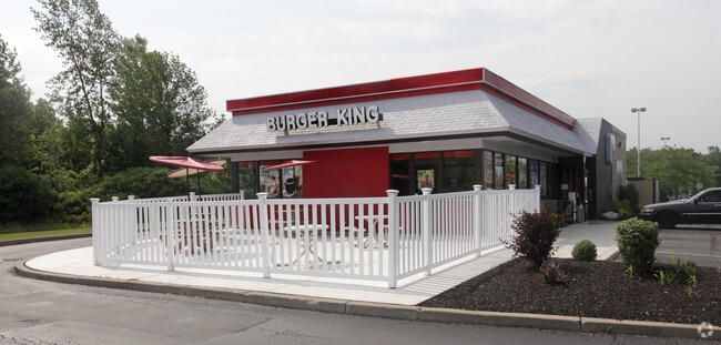
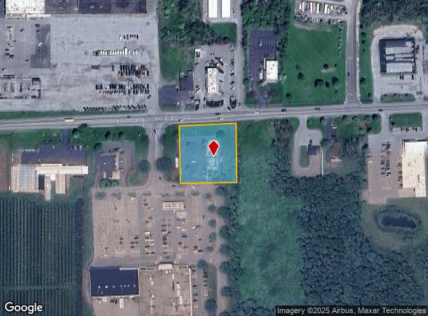
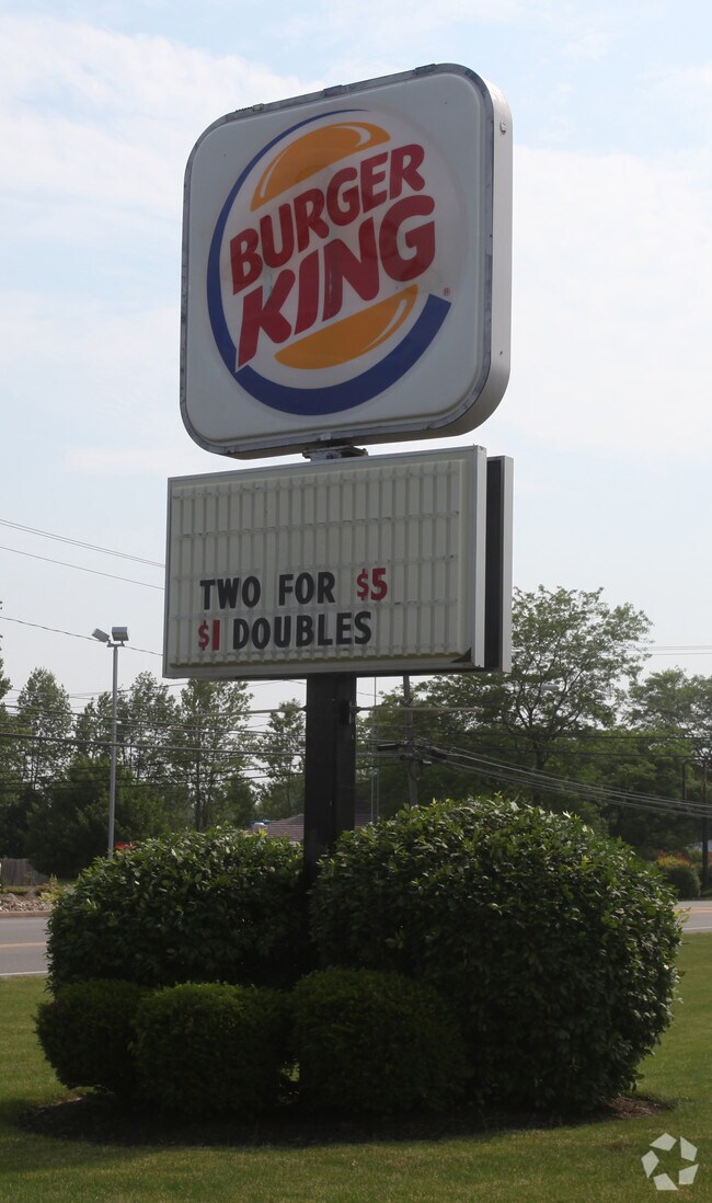
11212 Maple Ridge Rd
343601-079-019-0003-001-012
PT LOT8 T14 R4 HLC BURGER KING
Restaurantdrivein
Orleans
X
New York
36073C0259D
1.012
2025
1.33 AC
2024
Orleans County
040300
Rochester
2,736 SF
Rochester, NY
DEMOGRAPHICS near 11212 Maple Ridge Rd
1 Mile
3 Mile
5 Mile
2024 Total Population
2,730
7,682
11,979
2029 Population
2,668
7,509
11,707
Pop Growth 2024-2029
(2.27%)
(2.25%)
(2.27%)
Average Age
43
42
42
2024 Total Households
1,187
3,261
5,016
HH Growth 2024-2029
(2.11%)
(2.24%)
(2.29%)
Median Household Inc
$42,261
$51,926
$56,588
Avg Household Size
2.20
2.30
2.30
2024 Avg HH Vehicles
1.00
2.00
2.00
Median Home Value
$80,043
$90,110
$107,681
Median Year Built
1947
1947
1948
Nearby Places
- Restaurants
- Banks
- Shops
- Fitness
- Groceries
PUBLIC TRANSPORTATION
AIRPORT
Niagara Falls International
DRIVE
WALK
Distance
Niagara Falls International
46 min
31.5 mi
Buffalo Niagara International
DRIVE
WALK
Distance
Buffalo Niagara International
47 min
32.8 mi
Nearby Properties
Address
Land Use
TOTAL SIZE
Lot Size
Zoning
Address
Land Use
TOTAL SIZE
Lot Size
Zoning
20,925 SF
71.25 AC
Address
Land Use
TOTAL SIZE
Lot Size
Zoning
128,450 SF
58.10 AC
Address
Land Use
TOTAL SIZE
Lot Size
Zoning
114,038 SF
65.10 AC
01 - NOT Z
Address
Land Use
TOTAL SIZE
Lot Size
Zoning
Address
Land Use
TOTAL SIZE
Lot Size
Zoning
80,480 SF
3.60 AC
R
Address
Land Use
TOTAL SIZE
Lot Size
Zoning
29 AC
Address
Land Use
TOTAL SIZE
Lot Size
Zoning
66,080 SF
0.01 AC
05 - COMME
Address
Land Use
TOTAL SIZE
Lot Size
Zoning
330,360 SF
19 AC
Address
Land Use
TOTAL SIZE
Lot Size
Zoning
2,800 SF
37.95 AC
05
Address
Land Use
TOTAL SIZE
Lot Size
Zoning
11.05 AC
Address
Land Use
TOTAL SIZE
Lot Size
Zoning
59.90 AC
Address
Land Use
TOTAL SIZE
Lot Size
Zoning
24.60 AC
Address
Land Use
TOTAL SIZE
Lot Size
Zoning
3.10 AC
05 - COMME
Address
Land Use
TOTAL SIZE
Lot Size
Zoning
2,470 SF
12.80 AC
Address
Land Use
TOTAL SIZE
Lot Size
Zoning
68,000 SF
13 AC
Address
Land Use
TOTAL SIZE
Lot Size
Zoning
33,735 SF
4.50 AC
Address
Land Use
TOTAL SIZE
Lot Size
Zoning
Address
Land Use
TOTAL SIZE
Lot Size
Zoning
42.60 AC
Address
Land Use
TOTAL SIZE
Lot Size
Zoning
17 AC
Address
Land Use
TOTAL SIZE
Lot Size
Zoning
Address
Land Use
TOTAL SIZE
Lot Size
Zoning
82,300 SF
4.30 AC
06 - INDUS
Address
Land Use
TOTAL SIZE
Lot Size
Zoning
1,440 SF
15.40 AC
07 - MIXED
Address
Land Use
TOTAL SIZE
Lot Size
Zoning
28.20 AC
05 - COMME
Address
Land Use
TOTAL SIZE
Lot Size
Zoning
66.61 AC
Address
Land Use
TOTAL SIZE
Lot Size
Zoning
79.70 AC
Address
Land Use
TOTAL SIZE
Lot Size
Zoning
63,569 SF
16.90 AC
R
Address
Land Use
TOTAL SIZE
Lot Size
Zoning
37,536 SF
23.90 AC
05 - COMME
Address
Land Use
TOTAL SIZE
Lot Size
Zoning
19,545 SF
0.01 AC
Address
Land Use
TOTAL SIZE
Lot Size
Zoning
14,149 SF
2.40 AC
R
Address
Land Use
TOTAL SIZE
Lot Size
Zoning
32,000 SF
5.80 AC
The World's #1 Commercial Real Estate Marketplace
Connect with us
© 2025 CoStar Group
The information above has been obtained from sources believed reliable. While we do not doubt its accuracy we have not verified it and make no guarantee, warranty or representation about it. It is your responsibility to independently confirm its accuracy and completeness. Any projections, opinions, assumptions, or estimates used are for example only and do not represent the current or future performance of the property. The value of this transaction to you depends on tax and other factors which should be evaluated by your tax, financial, and legal advisors. You and your advisors should conduct a careful, independent investigation of the property to determine to your satisfaction the suitability of the property for your needs.