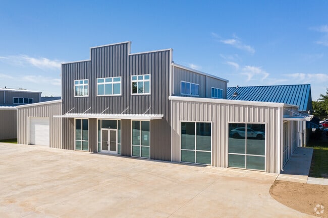
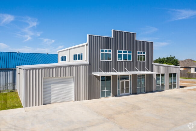
Property Record
11215 Conroy Ln, Manchaca, TX 78652

Property Detail
11215 Conroy Ln
Austin-Round Rock-San Marcos, TX
UNT 2 11215 CONROY LANE CONDOMINIUMS AMD PLUS 25.0 % INT IN COM AREA
925506
TRAVIS
Commercialcondominium
Texas
B and X Area of moderate flood hazard, usually the area between the limits of the 100-year and 500-year floods.
2
2025
0.27 AC
2025
South
002407
Austin
6,288 SF
NEARBY LISTINGS FOR SALE OR LEASE
DEMOGRAPHICS near 11215 Conroy Ln
1 mile
3 mile
5 mile
2024 Total Population
10,482
73,602
196,036
2029 Population
11,508
80,167
218,595
Pop Growth 2024-2029
+ 9.79%
+ 8.92%
+ 11.51%
Average Age
38
37
37
2024 Total Households
4,978
30,387
78,454
HH Growth 2024-2029
+ 10.33%
+ 9.60%
+ 12.06%
Median Household Inc
$76,773
$86,588
$83,756
Avg Household Size
2.00
2.30
2.40
2024 Avg HH Vehicles
2.00
2.00
2.00
Median Home Value
$397,037
$358,699
$362,895
Median Year Built
2010
2008
2003
Nearby Places
Map Layers
Map Styles
 Street
 Aerial
Transit
 Traffic
 Biking
Places
Listings with unknown addresses are not visible on the map
- Restaurants
- Banks
- Shops
- Fitness
- Groceries
PUBLIC TRANSPORTATION
AIRPORT
Austin-Bergstrom International
Drive
Walk
Distance
Austin-Bergstrom International
28 min
14.9 mi
SALE & LEASE HISTORY
LISTING DATE
SALE/LEASE

Jun 25, 2024
For Sale
Jun 10, 2020
For Lease
Jul 11, 2022
For Sale
Aug 14, 2024
For Lease
Nearby Properties
Address
Land Use
TOTAL SIZE
Lot Size
Zoning
Address
Land Use
TOTAL SIZE
Lot Size
Zoning
450,836 SF
29.58 AC
Address
Land Use
TOTAL SIZE
Lot Size
Zoning
380,191 SF
37.33 AC
Address
Land Use
TOTAL SIZE
Lot Size
Zoning
408,828 SF
43.52 AC
Address
Land Use
TOTAL SIZE
Lot Size
Zoning
331,650 SF
19.33 AC
Address
Land Use
TOTAL SIZE
Lot Size
Zoning
314,325 SF
29.53 AC
Address
Land Use
TOTAL SIZE
Lot Size
Zoning
374,720 SF
26.96 AC
Address
Land Use
TOTAL SIZE
Lot Size
Zoning
330,491 SF
19.37 AC
Address
Land Use
TOTAL SIZE
Lot Size
Zoning
307,584 SF
16.31 AC
Address
Land Use
TOTAL SIZE
Lot Size
Zoning
287,267 SF
13.28 AC
Address
Land Use
TOTAL SIZE
Lot Size
Zoning
414,030 SF
55.96 AC
Address
Land Use
TOTAL SIZE
Lot Size
Zoning
320,000 SF
7.44 AC
Address
Land Use
TOTAL SIZE
Lot Size
Zoning
434,872 SF
12.57 AC
Address
Land Use
TOTAL SIZE
Lot Size
Zoning
287,100 SF
13.20 AC
Address
Land Use
TOTAL SIZE
Lot Size
Zoning
384,254 SF
24.13 AC
Address
Land Use
TOTAL SIZE
Lot Size
Zoning
286,614 SF
15.81 AC
Address
Land Use
TOTAL SIZE
Lot Size
Zoning
328,606 SF
42.16 AC
Address
Land Use
TOTAL SIZE
Lot Size
Zoning
333,746 SF
53.90 AC
Address
Land Use
TOTAL SIZE
Lot Size
Zoning
281,107 SF
15.91 AC
Address
Land Use
TOTAL SIZE
Lot Size
Zoning
249,600 SF
14.48 AC
Address
Land Use
TOTAL SIZE
Lot Size
Zoning
316,572 SF
22.67 AC
Address
Land Use
TOTAL SIZE
Lot Size
Zoning
318,962 SF
31.88 AC
Address
Land Use
TOTAL SIZE
Lot Size
Zoning
312,800 SF
32.06 AC
Address
Land Use
TOTAL SIZE
Lot Size
Zoning
244,746 SF
12.24 AC
Address
Land Use
TOTAL SIZE
Lot Size
Zoning
244,365 SF
11.87 AC
Address
Land Use
TOTAL SIZE
Lot Size
Zoning
245,086 SF
11.94 AC
Address
Land Use
TOTAL SIZE
Lot Size
Zoning
278,070 SF
23.97 AC
Address
Land Use
TOTAL SIZE
Lot Size
Zoning
226,301 SF
13.26 AC
Address
Land Use
TOTAL SIZE
Lot Size
Zoning
288,750 SF
14.86 AC
Address
Land Use
TOTAL SIZE
Lot Size
Zoning
292,257 SF
33.21 AC
Address
Land Use
TOTAL SIZE
Lot Size
Zoning
263,100 SF
15.97 AC
The World's #1 Commercial Real Estate Marketplace
Connect with us
© 2026 CoStar Group
The information above has been obtained from sources believed reliable. While we do not doubt its accuracy we have not verified it and make no guarantee, warranty or representation about it. It is your responsibility to independently confirm its accuracy and completeness. Any projections, opinions, assumptions, or estimates used are for example only and do not represent the current or future performance of the property. The value of this transaction to you depends on tax and other factors which should be evaluated by your tax, financial, and legal advisors. You and your advisors should conduct a careful, independent investigation of the property to determine to your satisfaction the suitability of the property for your needs.