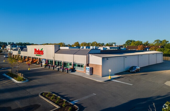
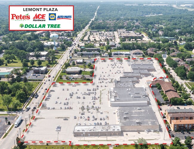
Property Record
1122 State St, Lemont, IL 60439
NEARBY LISTINGS FOR SALE OR LEASE
-
-
View all Lemont listings for sale on LoopNet.com
Property Detail
1122 State St
22-29-309-039-0000
Lemont Plaza Partners
Commercialnec
Cook
X
Illinois
17043C0267J
0.53 AC
2023
Joliet/Central Will
2024
Chicago
824005
Chicago-Naperville-Elgin, IL-IN-WI
DEMOGRAPHICS near 1122 State St
1 Mile
3 Mile
5 Mile
2024 Total Population
9,489
25,472
97,709
2029 Population
9,178
24,849
96,366
Pop Growth 2024-2029
(3.28%)
(2.45%)
(1.37%)
Average Age
43
43
41
2024 Total Households
3,511
9,319
34,412
HH Growth 2024-2029
(3.62%)
(2.67%)
(1.43%)
Median Household Inc
$115,133
$112,500
$94,138
Avg Household Size
2.70
2.70
2.80
2024 Avg HH Vehicles
2.00
2.00
2.00
Median Home Value
$374,682
$397,389
$312,978
Median Year Built
1987
1989
1981
Nearby Places
Map Layers
Map Styles
 Street
 Aerial
- Restaurants
- Banks
- Shops
- Fitness
- Groceries
PUBLIC TRANSPORTATION
COMMUTER RAIL
Lemont Station (Heritage Corridor Line - Northeast Illinois Regional Commuter Railroad (Metra))
DRIVE
WALK
Distance
Lemont Station (Heritage Corridor Line - Northeast Illinois Regional Commuter Railroad (Metra))
3 min
1.1 mi
Romeoville (Heritage Corridor - Metra)
DRIVE
WALK
Distance
Romeoville (Heritage Corridor - Metra)
9 min
4.4 mi
AIRPORT
Chicago Midway International
DRIVE
WALK
Distance
Chicago Midway International
28 min
19.0 mi
Chicago O'Hare International
DRIVE
WALK
Distance
Chicago O'Hare International
45 min
30.5 mi
Freight Ports
Port Milwaukee
DRIVE
WALK
Distance
Port Milwaukee
126 min
102.2 mi
SALE & LEASE HISTORY
LISTING DATE
SALE/LEASE

Sep 25, 2016
For Lease
Jan 31, 2024
For Sale
Jan 17, 2020
For Lease
Nearby Properties
Address
Land Use
TOTAL SIZE
Lot Size
Zoning
Address
Land Use
TOTAL SIZE
Lot Size
Zoning
122.95 AC
Address
Land Use
TOTAL SIZE
Lot Size
Zoning
32.82 AC
Address
Land Use
TOTAL SIZE
Lot Size
Zoning
115.36 AC
Address
Land Use
TOTAL SIZE
Lot Size
Zoning
759,709 SF
41.75 AC
Address
Land Use
TOTAL SIZE
Lot Size
Zoning
48.48 AC
Address
Land Use
TOTAL SIZE
Lot Size
Zoning
49.91 AC
Address
Land Use
TOTAL SIZE
Lot Size
Zoning
264,310 SF
12.21 AC
I
Address
Land Use
TOTAL SIZE
Lot Size
Zoning
18.82 AC
Address
Land Use
TOTAL SIZE
Lot Size
Zoning
28.15 AC
Address
Land Use
TOTAL SIZE
Lot Size
Zoning
165.89 AC
Address
Land Use
TOTAL SIZE
Lot Size
Zoning
506,726 SF
28.54 AC
Address
Land Use
TOTAL SIZE
Lot Size
Zoning
490,436 SF
22.22 AC
Address
Land Use
TOTAL SIZE
Lot Size
Zoning
500,160 SF
25.07 AC
Address
Land Use
TOTAL SIZE
Lot Size
Zoning
30.56 AC
Address
Land Use
TOTAL SIZE
Lot Size
Zoning
19.21 AC
Address
Land Use
TOTAL SIZE
Lot Size
Zoning
17.18 AC
Address
Land Use
TOTAL SIZE
Lot Size
Zoning
351,257 SF
16.39 AC
I
Address
Land Use
TOTAL SIZE
Lot Size
Zoning
396,546 SF
20.33 AC
I
Address
Land Use
TOTAL SIZE
Lot Size
Zoning
25.79 AC
Address
Land Use
TOTAL SIZE
Lot Size
Zoning
Address
Land Use
TOTAL SIZE
Lot Size
Zoning
18.96 AC
Address
Land Use
TOTAL SIZE
Lot Size
Zoning
263,010 SF
13.56 AC
I
Address
Land Use
TOTAL SIZE
Lot Size
Zoning
356,521 SF
16.32 AC
Address
Land Use
TOTAL SIZE
Lot Size
Zoning
17.18 AC
Address
Land Use
TOTAL SIZE
Lot Size
Zoning
19.01 AC
Address
Land Use
TOTAL SIZE
Lot Size
Zoning
121.17 AC
Address
Land Use
TOTAL SIZE
Lot Size
Zoning
119,270 SF
7 AC
I
Address
Land Use
TOTAL SIZE
Lot Size
Zoning
24.85 AC
Address
Land Use
TOTAL SIZE
Lot Size
Zoning
268,744 SF
12.23 AC
Address
Land Use
TOTAL SIZE
Lot Size
Zoning
274,325 SF
16.32 AC
The World's #1 Commercial Real Estate Marketplace
Connect with us
© 2025 CoStar Group
The information above has been obtained from sources believed reliable. While we do not doubt its accuracy we have not verified it and make no guarantee, warranty or representation about it. It is your responsibility to independently confirm its accuracy and completeness. Any projections, opinions, assumptions, or estimates used are for example only and do not represent the current or future performance of the property. The value of this transaction to you depends on tax and other factors which should be evaluated by your tax, financial, and legal advisors. You and your advisors should conduct a careful, independent investigation of the property to determine to your satisfaction the suitability of the property for your needs.