Property Record
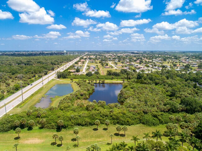
11220 Burnt Store Rd, Punta Gorda, FL 33955


NEARBY LISTINGS FOR SALE OR LEASE
-
-
-
-
-
No Photo
-
-
-
View all Punta Gorda listings for sale on LoopNet.com
Property Detail
11220 Burnt Store Rd
Punta Gorda, FL
Acreage
412333159001
Charlotte
Sfr
Florida
AE
19.52 AC
12015C0407G
Charlotte County
3,490 SF
Southwest Florida
DEMOGRAPHICS near 11220 Burnt Store Rd
1 Mile
3 Mile
5 Mile
2024 Total Population
2,617
13,344
33,416
2029 Population
3,151
15,969
40,314
Pop Growth 2024-2029
+ 20.41%
+ 19.67%
+ 20.64%
Average Age
58
58
58
2024 Total Households
1,306
6,339
16,374
HH Growth 2024-2029
+ 20.75%
+ 19.99%
+ 20.91%
Median Household Inc
$66,076
$66,111
$63,344
Avg Household Size
2.00
2.00
2.00
2024 Avg HH Vehicles
2.00
2.00
2.00
Median Home Value
$279,154
$281,011
$339,275
Median Year Built
1997
1997
1995
Nearby Places
Map Layers
Map Styles
 Street
 Aerial
- Restaurants
- Banks
- Shops
- Fitness
- Groceries
PUBLIC TRANSPORTATION
AIRPORT
Punta Gorda
DRIVE
WALK
Distance
Punta Gorda
11 min
5.2 mi
Southwest Florida International
DRIVE
WALK
Distance
Southwest Florida International
45 min
33.6 mi
Freight Ports
Port Manatee
DRIVE
WALK
Distance
Port Manatee
91 min
76.8 mi
SALE & LEASE HISTORY
LISTING DATE
SALE/LEASE

Jul 02, 2020
For Sale
Aug 17, 2023
For Sale
Nearby Properties
Address
Land Use
TOTAL SIZE
Lot Size
Zoning
Address
Land Use
TOTAL SIZE
Lot Size
Zoning
265,949 SF
22.80 AC
PD-CC
Address
Land Use
TOTAL SIZE
Lot Size
Zoning
253,440 SF
30.47 AC
ECAP
Address
Land Use
TOTAL SIZE
Lot Size
Zoning
378,000 SF
29.24 AC
ECAP
Address
Land Use
TOTAL SIZE
Lot Size
Zoning
198,916 SF
25.79 AC
HC
Address
Land Use
TOTAL SIZE
Lot Size
Zoning
142,812 SF
7.89 AC
HC
Address
Land Use
TOTAL SIZE
Lot Size
Zoning
96,845 SF
17.62 AC
HC
Address
Land Use
TOTAL SIZE
Lot Size
Zoning
8,406 SF
31.48 AC
ECAP
Address
Land Use
TOTAL SIZE
Lot Size
Zoning
16,364 SF
333.14 AC
PD
Address
Land Use
TOTAL SIZE
Lot Size
Zoning
104,398 SF
12.97 AC
HC
Address
Land Use
TOTAL SIZE
Lot Size
Zoning
13,260 SF
2.27 AC
CG
Address
Land Use
TOTAL SIZE
Lot Size
Zoning
65,396 SF
5.13 AC
HC
Address
Land Use
TOTAL SIZE
Lot Size
Zoning
65,141 SF
9.56 AC
HC
Address
Land Use
TOTAL SIZE
Lot Size
Zoning
15,134 SF
2.03 AC
CG
Address
Land Use
TOTAL SIZE
Lot Size
Zoning
18.93 AC
HC
Address
Land Use
TOTAL SIZE
Lot Size
Zoning
68,773 SF
8.05 AC
ECAP
Address
Land Use
TOTAL SIZE
Lot Size
Zoning
43,500 SF
9.84 AC
CG
Address
Land Use
TOTAL SIZE
Lot Size
Zoning
17.81 AC
HC
Address
Land Use
TOTAL SIZE
Lot Size
Zoning
Address
Land Use
TOTAL SIZE
Lot Size
Zoning
12,408 SF
1.92 AC
CG
Address
Land Use
TOTAL SIZE
Lot Size
Zoning
21,936 SF
175.75 AC
GS-3.5
Address
Land Use
TOTAL SIZE
Lot Size
Zoning
22,597 SF
3.43 AC
HC
Address
Land Use
TOTAL SIZE
Lot Size
Zoning
73,204 SF
9.16 AC
PD-SP
Address
Land Use
TOTAL SIZE
Lot Size
Zoning
20,271 SF
6.26 AC
CG
Address
Land Use
TOTAL SIZE
Lot Size
Zoning
28,730 SF
11.64 AC
NC
Address
Land Use
TOTAL SIZE
Lot Size
Zoning
0.86 AC
RE1
Address
Land Use
TOTAL SIZE
Lot Size
Zoning
Address
Land Use
TOTAL SIZE
Lot Size
Zoning
24,672 SF
4.47 AC
CG
Address
Land Use
TOTAL SIZE
Lot Size
Zoning
98.41 AC
PD
Address
Land Use
TOTAL SIZE
Lot Size
Zoning
29,003 SF
11.77 AC
PD
Address
Land Use
TOTAL SIZE
Lot Size
Zoning
44,506 SF
8.44 AC
IG
The World's #1 Commercial Real Estate Marketplace
Connect with us
© 2025 CoStar Group
The information above has been obtained from sources believed reliable. While we do not doubt its accuracy we have not verified it and make no guarantee, warranty or representation about it. It is your responsibility to independently confirm its accuracy and completeness. Any projections, opinions, assumptions, or estimates used are for example only and do not represent the current or future performance of the property. The value of this transaction to you depends on tax and other factors which should be evaluated by your tax, financial, and legal advisors. You and your advisors should conduct a careful, independent investigation of the property to determine to your satisfaction the suitability of the property for your needs.