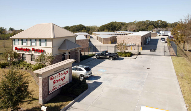
Property Record
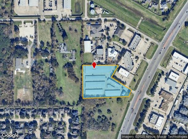
11220 S Highway 6, Sugar Land, TX 77498

Current Lease Availabilities
NEARBY LISTINGS FOR SALE OR LEASE
-
-
View all Sugar Land listings for lease on LoopNet.com
Property Detail
11220 S Highway 6
0032-00-000-3922-907
A Hodge
Commercialnec
0032 A HODGE, ACRES 3.3976, PT RESTRICTED RESERVE A, BLOCK 1, WOODBRIDGE CENTER AT MCKASKLE RD
X
Fort Bend
48157C0145L
Texas
2024
3.40 AC
2025
E Fort Bend Co/Sugar Land
672703
Houston
1,092 SF
Houston-The Woodlands-Sugar Land, TX
DEMOGRAPHICS near 11220 S Highway 6
1 Mile
3 Mile
5 Mile
2024 Total Population
15,338
114,923
340,578
2029 Population
18,294
134,566
384,946
Pop Growth 2024-2029
+ 19.27%
+ 17.09%
+ 13.03%
Average Age
37
38
38
2024 Total Households
4,664
35,276
108,631
HH Growth 2024-2029
+ 19.88%
+ 17.61%
+ 13.55%
Median Household Inc
$77,319
$78,524
$69,949
Avg Household Size
3.30
3.20
3.10
2024 Avg HH Vehicles
2.00
2.00
2.00
Median Home Value
$257,281
$253,580
$253,196
Median Year Built
2001
1997
1992
Nearby Places
- Restaurants
- Banks
- Shops
- Fitness
- Groceries
PUBLIC TRANSPORTATION
AIRPORT
William P Hobby
DRIVE
WALK
Distance
William P Hobby
45 min
27.4 mi
George Bush Intcntl/Houston
DRIVE
WALK
Distance
George Bush Intcntl/Houston
54 min
41.2 mi
Freight Ports
Port of Houston
DRIVE
WALK
Distance
Port of Houston
47 min
29.5 mi
Nearby Properties
Address
Land Use
TOTAL SIZE
Lot Size
Zoning
Address
Land Use
TOTAL SIZE
Lot Size
Zoning
94,547 SF
13.59 AC
Address
Land Use
TOTAL SIZE
Lot Size
Zoning
14.01 AC
Address
Land Use
TOTAL SIZE
Lot Size
Zoning
287,350 SF
59.38 AC
Address
Land Use
TOTAL SIZE
Lot Size
Zoning
77,850 SF
8.53 AC
YQZ
Address
Land Use
TOTAL SIZE
Lot Size
Zoning
104,287 SF
13.56 AC
M
Address
Land Use
TOTAL SIZE
Lot Size
Zoning
88,705 SF
17.04 AC
SY
Address
Land Use
TOTAL SIZE
Lot Size
Zoning
126,308 SF
16.95 AC
Address
Land Use
TOTAL SIZE
Lot Size
Zoning
260,269 SF
8.53 AC
Address
Land Use
TOTAL SIZE
Lot Size
Zoning
12.38 AC
Address
Land Use
TOTAL SIZE
Lot Size
Zoning
Address
Land Use
TOTAL SIZE
Lot Size
Zoning
343,438 SF
54.92 AC
S
Address
Land Use
TOTAL SIZE
Lot Size
Zoning
61,006 SF
13.16 AC
X
Address
Land Use
TOTAL SIZE
Lot Size
Zoning
291,196 SF
30.06 AC
SXY
Address
Land Use
TOTAL SIZE
Lot Size
Zoning
194,211 SF
26.22 AC
Y
Address
Land Use
TOTAL SIZE
Lot Size
Zoning
156,259 SF
9.28 AC
IT
Address
Land Use
TOTAL SIZE
Lot Size
Zoning
226,700 SF
19.14 AC
M
Address
Land Use
TOTAL SIZE
Lot Size
Zoning
719,540 SF
33.47 AC
YQX
Address
Land Use
TOTAL SIZE
Lot Size
Zoning
459,199 SF
15.74 AC
Address
Land Use
TOTAL SIZE
Lot Size
Zoning
314,657 SF
17.77 AC
S
Address
Land Use
TOTAL SIZE
Lot Size
Zoning
263,303 SF
11.47 AC
YT
Address
Land Use
TOTAL SIZE
Lot Size
Zoning
45,216 SF
11.92 AC
SY
Address
Land Use
TOTAL SIZE
Lot Size
Zoning
25,220 SF
30.79 AC
SYM
Address
Land Use
TOTAL SIZE
Lot Size
Zoning
299,622 SF
17.66 AC
MSY
Address
Land Use
TOTAL SIZE
Lot Size
Zoning
8.89 AC
Address
Land Use
TOTAL SIZE
Lot Size
Zoning
158,975 SF
46.38 AC
YQ
Address
Land Use
TOTAL SIZE
Lot Size
Zoning
223,099 SF
8.68 AC
Address
Land Use
TOTAL SIZE
Lot Size
Zoning
206,121 SF
23.28 AC
Address
Land Use
TOTAL SIZE
Lot Size
Zoning
153,222 SF
15 AC
M
Address
Land Use
TOTAL SIZE
Lot Size
Zoning
328,483 SF
15.53 AC
XY
Address
Land Use
TOTAL SIZE
Lot Size
Zoning
240.65 AC
SQ
The World's #1 Commercial Real Estate Marketplace
Connect with us
© 2025 CoStar Group
The information above has been obtained from sources believed reliable. While we do not doubt its accuracy we have not verified it and make no guarantee, warranty or representation about it. It is your responsibility to independently confirm its accuracy and completeness. Any projections, opinions, assumptions, or estimates used are for example only and do not represent the current or future performance of the property. The value of this transaction to you depends on tax and other factors which should be evaluated by your tax, financial, and legal advisors. You and your advisors should conduct a careful, independent investigation of the property to determine to your satisfaction the suitability of the property for your needs.