Property Record
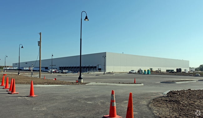
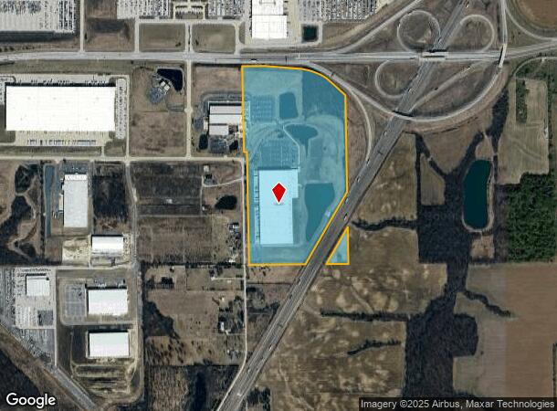
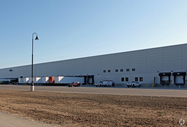
11222 Stonebridge Rd, Roanoke, IN 46783
NEARBY LISTINGS FOR SALE OR LEASE
-
-
View all Roanoke listings for sale on LoopNet.com
Property Detail
11222 Stonebridge Rd
02-16-21-100-001.000-048
W 1/2 NW 1/4 SEC 21 EX I-69 & EX R/W
Warehouse
Allen
X
Indiana
18069C0200D
687.40 AC
2024
Outlying Allen County
2025
Fort Wayne
011701
Fort Wayne, IN
427,200 SF
DEMOGRAPHICS near 11222 Stonebridge Rd
1 Mile
3 Mile
5 Mile
2024 Total Population
144
3,754
12,741
2029 Population
150
3,872
13,014
Pop Growth 2024-2029
+ 4.17%
+ 3.14%
+ 2.14%
Average Age
42
40
41
2024 Total Households
52
1,356
4,773
HH Growth 2024-2029
+ 3.85%
+ 3.10%
+ 2.12%
Median Household Inc
$95,312
$100,855
$91,666
Avg Household Size
2.70
2.80
2.60
2024 Avg HH Vehicles
3.00
3.00
2.00
Median Home Value
$240,000
$262,635
$257,954
Median Year Built
1977
1991
1988
Nearby Places
Map Layers
Map Styles
 Street
 Aerial
- Restaurants
- Banks
- Shops
- Fitness
- Groceries
PUBLIC TRANSPORTATION
AIRPORT
Fort Wayne International
DRIVE
WALK
Distance
Fort Wayne International
15 min
7.5 mi
Freight Ports
Port of Toledo
DRIVE
WALK
Distance
Port of Toledo
149 min
118.5 mi
Nearby Properties
Address
Land Use
TOTAL SIZE
Lot Size
Zoning
Address
Land Use
TOTAL SIZE
Lot Size
Zoning
5,843,317 SF
7,044.71 AC
Address
Land Use
TOTAL SIZE
Lot Size
Zoning
806,403 SF
614.20 AC
Address
Land Use
TOTAL SIZE
Lot Size
Zoning
154,882 SF
156.45 AC
Address
Land Use
TOTAL SIZE
Lot Size
Zoning
52,892 SF
1,370 AC
Address
Land Use
TOTAL SIZE
Lot Size
Zoning
181,852 SF
163.81 AC
Address
Land Use
TOTAL SIZE
Lot Size
Zoning
150,600 SF
301.55 AC
Address
Land Use
TOTAL SIZE
Lot Size
Zoning
99,688 SF
87.88 AC
Address
Land Use
TOTAL SIZE
Lot Size
Zoning
201,000 SF
161.38 AC
Address
Land Use
TOTAL SIZE
Lot Size
Zoning
72,865 SF
262 AC
Address
Land Use
TOTAL SIZE
Lot Size
Zoning
94,605 SF
111.48 AC
Address
Land Use
TOTAL SIZE
Lot Size
Zoning
114,304 SF
283.30 AC
Address
Land Use
TOTAL SIZE
Lot Size
Zoning
17,991 SF
100 AC
Address
Land Use
TOTAL SIZE
Lot Size
Zoning
12,736 SF
148.50 AC
Address
Land Use
TOTAL SIZE
Lot Size
Zoning
9,252 SF
120 AC
Address
Land Use
TOTAL SIZE
Lot Size
Zoning
76,960 SF
152.71 AC
Address
Land Use
TOTAL SIZE
Lot Size
Zoning
175.79 AC
Address
Land Use
TOTAL SIZE
Lot Size
Zoning
12,228 SF
462.60 AC
Address
Land Use
TOTAL SIZE
Lot Size
Zoning
33,420 SF
577.70 AC
Address
Land Use
TOTAL SIZE
Lot Size
Zoning
11,039 SF
253.91 AC
Address
Land Use
TOTAL SIZE
Lot Size
Zoning
3,712 SF
1,178.70 AC
Address
Land Use
TOTAL SIZE
Lot Size
Zoning
13,355 SF
127.93 AC
Address
Land Use
TOTAL SIZE
Lot Size
Zoning
12,695 SF
212.68 AC
Address
Land Use
TOTAL SIZE
Lot Size
Zoning
51,590 SF
124.20 AC
Address
Land Use
TOTAL SIZE
Lot Size
Zoning
11,695 SF
886.05 AC
Address
Land Use
TOTAL SIZE
Lot Size
Zoning
8,659 SF
203.10 AC
Address
Land Use
TOTAL SIZE
Lot Size
Zoning
8,962 SF
598.80 AC
Address
Land Use
TOTAL SIZE
Lot Size
Zoning
7,264 SF
255.40 AC
Address
Land Use
TOTAL SIZE
Lot Size
Zoning
9,275 SF
214 AC
Address
Land Use
TOTAL SIZE
Lot Size
Zoning
11,945 SF
12.18 AC
The World's #1 Commercial Real Estate Marketplace
Connect with us
© 2025 CoStar Group
The information above has been obtained from sources believed reliable. While we do not doubt its accuracy we have not verified it and make no guarantee, warranty or representation about it. It is your responsibility to independently confirm its accuracy and completeness. Any projections, opinions, assumptions, or estimates used are for example only and do not represent the current or future performance of the property. The value of this transaction to you depends on tax and other factors which should be evaluated by your tax, financial, and legal advisors. You and your advisors should conduct a careful, independent investigation of the property to determine to your satisfaction the suitability of the property for your needs.