Property Record
62 Japura Ct, Saint Johns, FL 32259
This Property Is For Sale
NEARBY LISTINGS FOR SALE OR LEASE
Property Detail
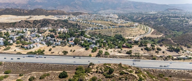
62 Japura Ct
Los Angeles-Long Beach-Glendale, CA
Santa Susan Hills 02
2818-034-023
FOR DESC SEE ASSESSORS MAPS POR OF LOTS 1 AND 2 IN SEC 7 T2N R16W
Residentialacreage
Los Angeles
D
California
06037C1635F
1,2
2024
5.21 AC
2025
Western SFV
113323
Los Angeles
DEMOGRAPHICS near 62 Japura Ct
1 Mile
3 Mile
5 Mile
2024 Total Population
8,480
65,205
245,458
2029 Population
8,434
65,363
245,499
Pop Growth 2024-2029
(0.54%)
+ 0.24%
+ 0.02%
Average Age
43
44
41
2024 Total Households
2,918
23,021
82,044
HH Growth 2024-2029
(0.72%)
+ 0.05%
(0.19%)
Median Household Inc
$144,897
$130,639
$103,458
Avg Household Size
2.80
2.80
2.90
2024 Avg HH Vehicles
2.00
2.00
2.00
Median Home Value
$1,015,574
$919,978
$838,390
Median Year Built
1987
1978
1974
Nearby Places
Map Layers
Map Styles
 Street
 Aerial
- Restaurants
- Banks
- Shops
- Fitness
- Groceries
PUBLIC TRANSPORTATION
COMMUTER RAIL
Chatsworth (Ventura County Line - Southern California Regional Rail Authority (Metrolink))
DRIVE
WALK
Distance
Chatsworth (Ventura County Line - Southern California Regional Rail Authority (Metrolink))
5 min
1.7 mi
Northridge (Pacific Surfliner - Amtrak)
DRIVE
WALK
Distance
Northridge (Pacific Surfliner - Amtrak)
14 min
6.5 mi
AIRPORT
Bob Hope
DRIVE
WALK
Distance
Bob Hope
25 min
17.9 mi
Los Angeles International
DRIVE
WALK
Distance
Los Angeles International
45 min
33.8 mi
Freight Ports
The Port of Hueneme
DRIVE
WALK
Distance
The Port of Hueneme
59 min
40.8 mi
Nearby Properties
Address
Land Use
TOTAL SIZE
Lot Size
Zoning
Address
Land Use
TOTAL SIZE
Lot Size
Zoning
158,172 SF
13.23 AC
LAC4
Address
Land Use
TOTAL SIZE
Lot Size
Zoning
298,782 SF
8.63 AC
LAR3
Address
Land Use
TOTAL SIZE
Lot Size
Zoning
304,209 SF
11.31 AC
LAMR2
Address
Land Use
TOTAL SIZE
Lot Size
Zoning
143,044 SF
23.17 AC
LAC4
Address
Land Use
TOTAL SIZE
Lot Size
Zoning
274,013 SF
15.24 AC
LAA1
Address
Land Use
TOTAL SIZE
Lot Size
Zoning
411,979 SF
15.22 AC
LAC4
Address
Land Use
TOTAL SIZE
Lot Size
Zoning
339,133 SF
13.09 AC
LAC4
Address
Land Use
TOTAL SIZE
Lot Size
Zoning
93,466 SF
11.07 AC
LAC2
Address
Land Use
TOTAL SIZE
Lot Size
Zoning
272,065 SF
7.83 AC
LAMR2
Address
Land Use
TOTAL SIZE
Lot Size
Zoning
210,386 SF
8.33 AC
LAMR2
Address
Land Use
TOTAL SIZE
Lot Size
Zoning
145,243 SF
6.68 AC
LAMR2
Address
Land Use
TOTAL SIZE
Lot Size
Zoning
1.86 AC
LACR
Address
Land Use
TOTAL SIZE
Lot Size
Zoning
318,450 SF
11.87 AC
LAMR2
Address
Land Use
TOTAL SIZE
Lot Size
Zoning
173,080 SF
5.60 AC
LAMR2
Address
Land Use
TOTAL SIZE
Lot Size
Zoning
98,073 SF
7.05 AC
LCA21*
Address
Land Use
TOTAL SIZE
Lot Size
Zoning
269,140 SF
LAMR2
Address
Land Use
TOTAL SIZE
Lot Size
Zoning
268,451 SF
6 AC
LAMR2
Address
Land Use
TOTAL SIZE
Lot Size
Zoning
111,405 SF
3.23 AC
LAMR2
Address
Land Use
TOTAL SIZE
Lot Size
Zoning
126,497 SF
3.87 AC
LAMR2
Address
Land Use
TOTAL SIZE
Lot Size
Zoning
158,000 SF
3.86 AC
LAC4
Address
Land Use
TOTAL SIZE
Lot Size
Zoning
40,314 SF
20.21 AC
LAMR1
Address
Land Use
TOTAL SIZE
Lot Size
Zoning
59,028 SF
5.29 AC
LCA21*
Address
Land Use
TOTAL SIZE
Lot Size
Zoning
54,780 SF
1.90 AC
LARE11
Address
Land Use
TOTAL SIZE
Lot Size
Zoning
109,726 SF
4.05 AC
LARD5
Address
Land Use
TOTAL SIZE
Lot Size
Zoning
189,773 SF
4.14 AC
LAP
Address
Land Use
TOTAL SIZE
Lot Size
Zoning
Address
Land Use
TOTAL SIZE
Lot Size
Zoning
59,434 SF
2.69 AC
LAMR2
Address
Land Use
TOTAL SIZE
Lot Size
Zoning
163,116 SF
5.11 AC
LAMR2
The World's #1 Commercial Real Estate Marketplace
Connect with us
© 2025 CoStar Group
The information above has been obtained from sources believed reliable. While we do not doubt its accuracy we have not verified it and make no guarantee, warranty or representation about it. It is your responsibility to independently confirm its accuracy and completeness. Any projections, opinions, assumptions, or estimates used are for example only and do not represent the current or future performance of the property. The value of this transaction to you depends on tax and other factors which should be evaluated by your tax, financial, and legal advisors. You and your advisors should conduct a careful, independent investigation of the property to determine to your satisfaction the suitability of the property for your needs.