Property Record
11230 Como Ct, Lemont, IL 60439
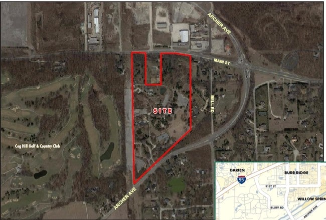

This Property Is For Sale
Property Detail
11230 Como Ct
22-23-208-014-0000
COOK
Vacantlandnec
Illinois
B and X Area of moderate flood hazard, usually the area between the limits of the 100-year and 500-year floods.
0.40 AC
2023
Joliet/Central Will
2025
Chicago
824004
Chicago-Naperville-Elgin, IL-IN
NEARBY LISTINGS FOR SALE OR LEASE
DEMOGRAPHICS near 11230 Como Ct
1 mile
3 mile
5 mile
2025 Total Population
1,303
19,772
92,153
2030 Population
1,335
20,372
93,800
Pop Growth 2025-2030
+ 2.46%
+ 3.03%
+ 1.79%
Average Age
48
43
44
2025 Total Households
469
7,200
34,728
HH Growth 2025-2030
+ 2.13%
+ 2.85%
+ 1.63%
Median Household Inc
$71,249
$109,078
$113,705
Avg Household Size
2.60
2.70
2.60
2025 Avg HH Vehicles
2.00
2.00
2.00
Median Home Value
$570,352
$533,251
$429,659
Median Year Built
1990
1991
1985
Nearby Places
Map Layers
Map Styles
 Street
 Aerial
Transit
 Traffic
 Biking
Places
Listings with unknown addresses are not visible on the map
- Restaurants
- Banks
- Shops
- Fitness
- Groceries
Nearby Properties
Address
Land Use
TOTAL SIZE
Lot Size
Zoning
Address
Land Use
TOTAL SIZE
Lot Size
Zoning
204,824 SF
15.05 AC
Address
Land Use
TOTAL SIZE
Lot Size
Zoning
18.82 AC
Address
Land Use
TOTAL SIZE
Lot Size
Zoning
74,782 SF
5.15 AC
Address
Land Use
TOTAL SIZE
Lot Size
Zoning
97,113 SF
44.53 AC
Address
Land Use
TOTAL SIZE
Lot Size
Zoning
15.21 AC
Address
Land Use
TOTAL SIZE
Lot Size
Zoning
32,044 SF
4.98 AC
C
Address
Land Use
TOTAL SIZE
Lot Size
Zoning
8.24 AC
Address
Land Use
TOTAL SIZE
Lot Size
Zoning
20,068 SF
24.55 AC
Address
Land Use
TOTAL SIZE
Lot Size
Zoning
22.03 AC
C
Address
Land Use
TOTAL SIZE
Lot Size
Zoning
51,986 SF
9.76 AC
Address
Land Use
TOTAL SIZE
Lot Size
Zoning
22,000 SF
5.50 AC
Address
Land Use
TOTAL SIZE
Lot Size
Zoning
16,897 SF
1.76 AC
C
Address
Land Use
TOTAL SIZE
Lot Size
Zoning
1,625 SF
0.82 AC
Address
Land Use
TOTAL SIZE
Lot Size
Zoning
2.33 AC
Address
Land Use
TOTAL SIZE
Lot Size
Zoning
Address
Land Use
TOTAL SIZE
Lot Size
Zoning
12,140 SF
1.72 AC
C
Address
Land Use
TOTAL SIZE
Lot Size
Zoning
33.02 AC
Address
Land Use
TOTAL SIZE
Lot Size
Zoning
4.15 AC
Address
Land Use
TOTAL SIZE
Lot Size
Zoning
20.83 AC
Address
Land Use
TOTAL SIZE
Lot Size
Zoning
36,110 SF
10.07 AC
Address
Land Use
TOTAL SIZE
Lot Size
Zoning
15,633 SF
2.52 AC
Address
Land Use
TOTAL SIZE
Lot Size
Zoning
16.45 AC
Address
Land Use
TOTAL SIZE
Lot Size
Zoning
4,284 SF
16.10 AC
Address
Land Use
TOTAL SIZE
Lot Size
Zoning
11,613 SF
0.69 AC
M
Address
Land Use
TOTAL SIZE
Lot Size
Zoning
11,613 SF
0.70 AC
M
Address
Land Use
TOTAL SIZE
Lot Size
Zoning
11,613 SF
0.60 AC
M
Address
Land Use
TOTAL SIZE
Lot Size
Zoning
11,613 SF
0.55 AC
M
Address
Land Use
TOTAL SIZE
Lot Size
Zoning
11,613 SF
0.55 AC
M
Address
Land Use
TOTAL SIZE
Lot Size
Zoning
3,770 SF
2.16 AC
N
Address
Land Use
TOTAL SIZE
Lot Size
Zoning
3,520 SF
1.29 AC
R-4
The World's #1 Commercial Real Estate Marketplace
Connect with us
© 2026 CoStar Group
The information above has been obtained from sources believed reliable. While we do not doubt its accuracy we have not verified it and make no guarantee, warranty or representation about it. It is your responsibility to independently confirm its accuracy and completeness. Any projections, opinions, assumptions, or estimates used are for example only and do not represent the current or future performance of the property. The value of this transaction to you depends on tax and other factors which should be evaluated by your tax, financial, and legal advisors. You and your advisors should conduct a careful, independent investigation of the property to determine to your satisfaction the suitability of the property for your needs.