Property Record
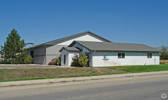
11230 W Joplin Rd, Garden City, ID 83714


NEARBY LISTINGS FOR SALE OR LEASE
Property Detail
11230 W Joplin Rd
S0522438925
Subd Code: 0522438
Foundry
PAR #8925 OF SW4SE4 SEC 22 4N 1E #438920-B
X
Ada
16001C0162J
Idaho
2024
5.81 AC
2025
Eagle
002412
Boise City/Nampa
32,323 SF
Boise City, ID
DEMOGRAPHICS near 11230 W Joplin Rd
1 Mile
3 Mile
5 Mile
2024 Total Population
4,234
88,400
204,555
2029 Population
4,830
99,952
231,223
Pop Growth 2024-2029
+ 14.08%
+ 13.07%
+ 13.04%
Average Age
45
43
41
2024 Total Households
1,475
34,549
78,992
HH Growth 2024-2029
+ 14.51%
+ 13.39%
+ 13.34%
Median Household Inc
$89,091
$80,032
$76,596
Avg Household Size
2.70
2.50
2.50
2024 Avg HH Vehicles
2.00
2.00
2.00
Median Home Value
$461,655
$447,421
$446,185
Median Year Built
1991
1995
1995
Nearby Places
Map Layers
Map Styles
 Street
 Aerial
- Restaurants
- Banks
- Shops
- Fitness
- Groceries
PUBLIC TRANSPORTATION
AIRPORT
Boise Air Trml/Gowen Field
DRIVE
WALK
Distance
Boise Air Trml/Gowen Field
26 min
11.4 mi
Nearby Properties
Address
Land Use
TOTAL SIZE
Lot Size
Zoning
Address
Land Use
TOTAL SIZE
Lot Size
Zoning
789,114 SF
11.38 AC
C-G
Address
Land Use
TOTAL SIZE
Lot Size
Zoning
386,225 SF
13.46 AC
ZC-270
Address
Land Use
TOTAL SIZE
Lot Size
Zoning
301,800 SF
12.70 AC
R-3
Address
Land Use
TOTAL SIZE
Lot Size
Zoning
305,889 SF
9.91 AC
R-40
Address
Land Use
TOTAL SIZE
Lot Size
Zoning
310,580 SF
2.44 AC
C-G
Address
Land Use
TOTAL SIZE
Lot Size
Zoning
239,991 SF
8.09 AC
MU-DA
Address
Land Use
TOTAL SIZE
Lot Size
Zoning
216,950 SF
9.03 AC
R-3
Address
Land Use
TOTAL SIZE
Lot Size
Zoning
150,584 SF
6.77 AC
M
Address
Land Use
TOTAL SIZE
Lot Size
Zoning
203,635 SF
4.76 AC
ZC-245
Address
Land Use
TOTAL SIZE
Lot Size
Zoning
176,494 SF
10.16 AC
R-1C
Address
Land Use
TOTAL SIZE
Lot Size
Zoning
167,603 SF
6.60 AC
C-2DA
Address
Land Use
TOTAL SIZE
Lot Size
Zoning
98,738 SF
4.25 AC
CBD
Address
Land Use
TOTAL SIZE
Lot Size
Zoning
138,828 SF
4.22 AC
ZC-245
Address
Land Use
TOTAL SIZE
Lot Size
Zoning
151,365 SF
12.03 AC
ZC-243
Address
Land Use
TOTAL SIZE
Lot Size
Zoning
129,827 SF
3.08 AC
MU-DA
Address
Land Use
TOTAL SIZE
Lot Size
Zoning
124,286 SF
5 AC
R-3
Address
Land Use
TOTAL SIZE
Lot Size
Zoning
130,060 SF
3.42 AC
C-G
Address
Land Use
TOTAL SIZE
Lot Size
Zoning
102,272 SF
7.18 AC
R-20
Address
Land Use
TOTAL SIZE
Lot Size
Zoning
152,123 SF
6 AC
MU-DA
Address
Land Use
TOTAL SIZE
Lot Size
Zoning
69,546 SF
4.26 AC
MU-DA
Address
Land Use
TOTAL SIZE
Lot Size
Zoning
65,034 SF
4.44 AC
MU-DA
Address
Land Use
TOTAL SIZE
Lot Size
Zoning
89,693 SF
2.43 AC
R-3
Address
Land Use
TOTAL SIZE
Lot Size
Zoning
204,033 SF
12.88 AC
C-1
Address
Land Use
TOTAL SIZE
Lot Size
Zoning
98,612 SF
5.38 AC
MU-DA
Address
Land Use
TOTAL SIZE
Lot Size
Zoning
159,839 SF
16.94 AC
C-2
Address
Land Use
TOTAL SIZE
Lot Size
Zoning
97,655 SF
7.74 AC
ZC-243
Address
Land Use
TOTAL SIZE
Lot Size
Zoning
36,454 SF
3.18 AC
MU
Address
Land Use
TOTAL SIZE
Lot Size
Zoning
81,591 SF
2.88 AC
MU-DA
Address
Land Use
TOTAL SIZE
Lot Size
Zoning
165,295 SF
7.01 AC
MU-DA
Address
Land Use
TOTAL SIZE
Lot Size
Zoning
123,324 SF
2.22 AC
R-3
The World's #1 Commercial Real Estate Marketplace
Connect with us
© 2026 CoStar Group
The information above has been obtained from sources believed reliable. While we do not doubt its accuracy we have not verified it and make no guarantee, warranty or representation about it. It is your responsibility to independently confirm its accuracy and completeness. Any projections, opinions, assumptions, or estimates used are for example only and do not represent the current or future performance of the property. The value of this transaction to you depends on tax and other factors which should be evaluated by your tax, financial, and legal advisors. You and your advisors should conduct a careful, independent investigation of the property to determine to your satisfaction the suitability of the property for your needs.