Property Record
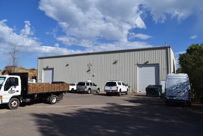
1125 Depew Ct, Lakewood, CO 80214


NEARBY LISTINGS FOR SALE OR LEASE
Property Detail
1125 Depew Ct
49-011-00-056
Acreage
Industrialgeneral
SECTION 01 TOWNSHIP 04 RANGE 69 QTR NE SIZE: 38115 VALUE: .875 KEY=227
AE
Jefferson
0800460181H
Colorado
2023
0.88 AC
2024
West Denver
011552
Denver
14,000 SF
Denver-Aurora-Lakewood, CO
DEMOGRAPHICS near 1125 Depew Ct
1 Mile
3 Mile
5 Mile
2024 Total Population
22,093
165,040
469,837
2029 Population
22,336
165,773
473,380
Pop Growth 2024-2029
+ 1.10%
+ 0.44%
+ 0.75%
Average Age
38
38
38
2024 Total Households
9,647
70,673
217,948
HH Growth 2024-2029
+ 0.94%
+ 0.47%
+ 0.89%
Median Household Inc
$48,745
$70,161
$77,877
Avg Household Size
2.10
2.20
2.10
2024 Avg HH Vehicles
1.00
2.00
2.00
Median Home Value
$482,725
$516,501
$522,670
Median Year Built
1971
1964
1969
Nearby Places
Map Layers
Map Styles
 Street
 Aerial
- Restaurants
- Banks
- Shops
- Fitness
- Groceries
PUBLIC TRANSPORTATION
TRANSIT/SUBWAY
Sheridan (W Line - Denver Regional Transportation District Light Rail (TheRide))
DRIVE
WALK
Distance
Sheridan (W Line - Denver Regional Transportation District Light Rail (TheRide))
2 min
9 min
0.4 mi
Lamar (W Line - Denver Regional Transportation District Light Rail (TheRide))
DRIVE
WALK
Distance
Lamar (W Line - Denver Regional Transportation District Light Rail (TheRide))
2 min
13 min
0.6 mi
COMMUTER RAIL
Union Station: LoDo-Coors Field-16th Street Mall (C Line - Denver Regional Transportation District Light Rail (TheRide), E Line - Denver Regional Transportation District Light Rail (TheRide), W Line - Denver Regional Transportation District Light Rail (TheRide))
DRIVE
WALK
Distance
Union Station: LoDo-Coors Field-16th Street Mall (C Line - Denver Regional Transportation District Light Rail (TheRide), E Line - Denver Regional Transportation District Light Rail (TheRide), W Line - Denver Regional Transportation District Light Rail (TheRide))
12 min
5.7 mi
DRIVE
WALK
Distance
12 min
5.7 mi
AIRPORT
Denver International
DRIVE
WALK
Distance
Denver International
42 min
29.8 mi
SALE & LEASE HISTORY
LISTING DATE
SALE/LEASE

Sep 07, 2022
For Lease
Nearby Properties
Address
Land Use
TOTAL SIZE
Lot Size
Zoning
Address
Land Use
TOTAL SIZE
Lot Size
Zoning
1,721,086 SF
21.34 AC
C-MU-30
Address
Land Use
TOTAL SIZE
Lot Size
Zoning
1,078,109 SF
36.79 AC
CMP-EI
Address
Land Use
TOTAL SIZE
Lot Size
Zoning
424,862 SF
32.28 AC
G-MU-3
Address
Land Use
TOTAL SIZE
Lot Size
Zoning
729,679 SF
C-MX
Address
Land Use
TOTAL SIZE
Lot Size
Zoning
113,932 SF
9.60 AC
I-B
Address
Land Use
TOTAL SIZE
Lot Size
Zoning
33.40 AC
C-MU-30
Address
Land Use
TOTAL SIZE
Lot Size
Zoning
323,426 SF
29.84 AC
I-B
Address
Land Use
TOTAL SIZE
Lot Size
Zoning
44.93 AC
CPV-C
Address
Land Use
TOTAL SIZE
Lot Size
Zoning
514,899 SF
15.51 AC
CMP-EI
Address
Land Use
TOTAL SIZE
Lot Size
Zoning
168,523 SF
44.89 AC
CPV-R
Address
Land Use
TOTAL SIZE
Lot Size
Zoning
333,925 SF
3.34 AC
C-MX-5
Address
Land Use
TOTAL SIZE
Lot Size
Zoning
8,295 SF
2.57 AC
C-RX
Address
Land Use
TOTAL SIZE
Lot Size
Zoning
827,707 SF
19 AC
C-MU-30
Address
Land Use
TOTAL SIZE
Lot Size
Zoning
107,351 SF
5.67 AC
C-MX-5
Address
Land Use
TOTAL SIZE
Lot Size
Zoning
144,383 SF
10.26 AC
CMP-EI
Address
Land Use
TOTAL SIZE
Lot Size
Zoning
111,673 SF
29.06 AC
Address
Land Use
TOTAL SIZE
Lot Size
Zoning
565,418 SF
4.07 AC
C-RX
Address
Land Use
TOTAL SIZE
Lot Size
Zoning
127,933 SF
3.52 AC
CMP-EI
Address
Land Use
TOTAL SIZE
Lot Size
Zoning
232,678 SF
27.50 AC
Address
Land Use
TOTAL SIZE
Lot Size
Zoning
132,874 SF
6.53 AC
G-MU-3
Address
Land Use
TOTAL SIZE
Lot Size
Zoning
175,000 SF
2.99 AC
C-MX
Address
Land Use
TOTAL SIZE
Lot Size
Zoning
233,688 SF
22.37 AC
Address
Land Use
TOTAL SIZE
Lot Size
Zoning
325,844 SF
4.08 AC
C-MX-12
Address
Land Use
TOTAL SIZE
Lot Size
Zoning
199,685 SF
27.73 AC
Address
Land Use
TOTAL SIZE
Lot Size
Zoning
392,996 SF
7.39 AC
C-MX-12
Address
Land Use
TOTAL SIZE
Lot Size
Zoning
176,514 SF
6.15 AC
CMP-EI
Address
Land Use
TOTAL SIZE
Lot Size
Zoning
81,896 SF
0.61 AC
C-MX-5
Address
Land Use
TOTAL SIZE
Lot Size
Zoning
247,459 SF
2.31 AC
C-MX-8
Address
Land Use
TOTAL SIZE
Lot Size
Zoning
273,044 SF
3.51 AC
R-MU-30
Address
Land Use
TOTAL SIZE
Lot Size
Zoning
350,765 SF
11.61 AC
CMP-EI
The World's #1 Commercial Real Estate Marketplace
Connect with us
© 2026 CoStar Group
The information above has been obtained from sources believed reliable. While we do not doubt its accuracy we have not verified it and make no guarantee, warranty or representation about it. It is your responsibility to independently confirm its accuracy and completeness. Any projections, opinions, assumptions, or estimates used are for example only and do not represent the current or future performance of the property. The value of this transaction to you depends on tax and other factors which should be evaluated by your tax, financial, and legal advisors. You and your advisors should conduct a careful, independent investigation of the property to determine to your satisfaction the suitability of the property for your needs.