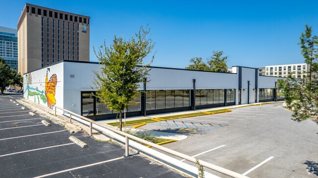
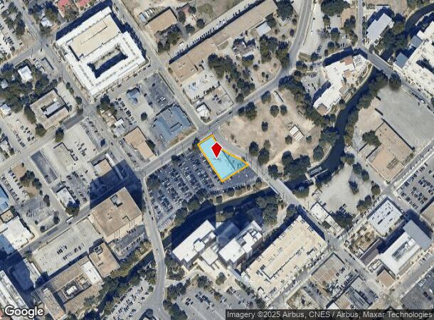
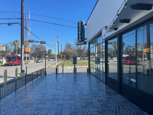
Property Record
1126 N Saint Marys St, San Antonio, TX 78215
NEARBY LISTINGS FOR SALE OR LEASE
Property Detail
1126 N Saint Marys St
San Antonio-New Braunfels, TX
Conv A/S Code
00819-030-0060
NCB 819 BLK 30 LOT N IRR 200 FT OF A2 NCB 834 BLK 19 LOT S TRI 156.35 OF N 205 OF A1
Officebuilding
Bexar
X
Texas
48029C0415G
6
2024
0.49 AC
2025
CBD
110100
San Antonio
15,760 SF
DEMOGRAPHICS near 1126 N Saint Marys St
1 Mile
3 Mile
5 Mile
2024 Total Population
13,997
138,213
356,819
2029 Population
15,373
148,838
380,782
Pop Growth 2024-2029
+ 9.83%
+ 7.69%
+ 6.72%
Average Age
41
38
38
2024 Total Households
7,842
53,341
131,474
HH Growth 2024-2029
+ 10.44%
+ 8.26%
+ 7.09%
Median Household Inc
$56,558
$42,121
$43,114
Avg Household Size
1.60
2.30
2.50
2024 Avg HH Vehicles
1.00
1.00
2.00
Median Home Value
$385,384
$187,934
$154,515
Median Year Built
1999
1954
1957
Nearby Places
Map Layers
Map Styles
 Street
 Aerial
- Restaurants
- Banks
- Shops
- Fitness
- Groceries
PUBLIC TRANSPORTATION
COMMUTER RAIL
DRIVE
WALK
Distance
4 min
1.7 mi
AIRPORT
San Antonio International
DRIVE
WALK
Distance
San Antonio International
11 min
7.0 mi
SALE & LEASE HISTORY
LISTING DATE
SALE/LEASE

Nov 05, 2018
For Lease
Jan 11, 2024
For Lease
Aug 27, 2024
For Lease
Apr 15, 2024
For Lease
Apr 09, 2024
For Lease
Nearby Properties
Address
Land Use
TOTAL SIZE
Lot Size
Zoning
Address
Land Use
TOTAL SIZE
Lot Size
Zoning
2,544.56 AC
Address
Land Use
TOTAL SIZE
Lot Size
Zoning
26.51 AC
Address
Land Use
TOTAL SIZE
Lot Size
Zoning
443,000 SF
4.16 AC
Address
Land Use
TOTAL SIZE
Lot Size
Zoning
738,650 SF
2.93 AC
Address
Land Use
TOTAL SIZE
Lot Size
Zoning
1,049,861 SF
1.50 AC
Address
Land Use
TOTAL SIZE
Lot Size
Zoning
339,590 SF
3.12 AC
Address
Land Use
TOTAL SIZE
Lot Size
Zoning
922,468 SF
10.78 AC
Address
Land Use
TOTAL SIZE
Lot Size
Zoning
443,560 SF
2.77 AC
Address
Land Use
TOTAL SIZE
Lot Size
Zoning
400,228 SF
0.78 AC
Address
Land Use
TOTAL SIZE
Lot Size
Zoning
290,794 SF
0.62 AC
Address
Land Use
TOTAL SIZE
Lot Size
Zoning
8.10 AC
Address
Land Use
TOTAL SIZE
Lot Size
Zoning
5,106 SF
2.30 AC
Address
Land Use
TOTAL SIZE
Lot Size
Zoning
387,443 SF
0.89 AC
Address
Land Use
TOTAL SIZE
Lot Size
Zoning
43,834 SF
3.11 AC
Address
Land Use
TOTAL SIZE
Lot Size
Zoning
178,534 SF
1.32 AC
Address
Land Use
TOTAL SIZE
Lot Size
Zoning
254,108 SF
2.40 AC
Address
Land Use
TOTAL SIZE
Lot Size
Zoning
103,425 SF
4.76 AC
Address
Land Use
TOTAL SIZE
Lot Size
Zoning
521,935 SF
2.17 AC
Address
Land Use
TOTAL SIZE
Lot Size
Zoning
495,840 SF
1.20 AC
Address
Land Use
TOTAL SIZE
Lot Size
Zoning
308,878 SF
1.23 AC
Address
Land Use
TOTAL SIZE
Lot Size
Zoning
11,915 SF
4.06 AC
Address
Land Use
TOTAL SIZE
Lot Size
Zoning
254,908 SF
1.92 AC
Address
Land Use
TOTAL SIZE
Lot Size
Zoning
173,422 SF
5.85 AC
Address
Land Use
TOTAL SIZE
Lot Size
Zoning
15,468 SF
4.18 AC
Address
Land Use
TOTAL SIZE
Lot Size
Zoning
221,865 SF
3.12 AC
Address
Land Use
TOTAL SIZE
Lot Size
Zoning
262,082 SF
1.60 AC
Address
Land Use
TOTAL SIZE
Lot Size
Zoning
7,018 SF
3.24 AC
Address
Land Use
TOTAL SIZE
Lot Size
Zoning
163,858 SF
0.62 AC
Address
Land Use
TOTAL SIZE
Lot Size
Zoning
481,589 SF
5.29 AC
Address
Land Use
TOTAL SIZE
Lot Size
Zoning
31,334 SF
14.11 AC
The World's #1 Commercial Real Estate Marketplace
Connect with us
© 2025 CoStar Group
The information above has been obtained from sources believed reliable. While we do not doubt its accuracy we have not verified it and make no guarantee, warranty or representation about it. It is your responsibility to independently confirm its accuracy and completeness. Any projections, opinions, assumptions, or estimates used are for example only and do not represent the current or future performance of the property. The value of this transaction to you depends on tax and other factors which should be evaluated by your tax, financial, and legal advisors. You and your advisors should conduct a careful, independent investigation of the property to determine to your satisfaction the suitability of the property for your needs.