Property Record
11271 Highway 280, Sterrett, AL 35147

NEARBY LISTINGS FOR SALE OR LEASE
-
-
View all Sterrett listings for lease on LoopNet.com
Property Detail
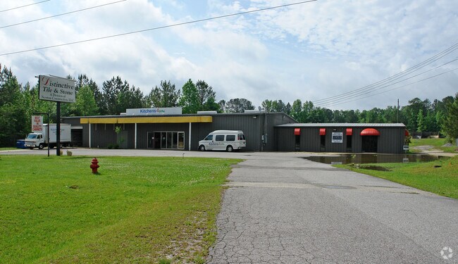
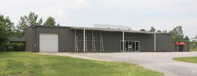
11271 Highway 280
088280001034003
201.16'X535'IRR COMM NE COR NW1/4 SE1/4 W TO US 280 SW ALG SAME 858.99' TO POB E 201.16' S 535'(S) 595.27'(D) W 200' N 574.13(D) 514'(S) TO POB LESS RD ROW S28 T19S R1E 8/5/78 BK 314 P 522 RB365 P576 9/24/91
Storesoffices
Shelby
X
Alabama
01117C0256E
2.40 AC
2024
Chelsea/Harpersville
2024
Birmingham
030219
Birmingham-Hoover, AL
2,500 SF
DEMOGRAPHICS near 11271 Highway 280
1 Mile
3 Mile
5 Mile
2024 Total Population
523
6,656
11,688
2029 Population
571
7,375
12,892
Pop Growth 2024-2029
+ 9.18%
+ 10.80%
+ 10.30%
Average Age
41
39
39
2024 Total Households
198
2,465
4,316
HH Growth 2024-2029
+ 9.60%
+ 10.95%
+ 10.47%
Median Household Inc
$86,666
$93,838
$92,286
Avg Household Size
2.60
2.70
2.70
2024 Avg HH Vehicles
2.00
2.00
2.00
Median Home Value
$280,158
$303,420
$293,896
Median Year Built
2003
2006
2005
Nearby Places
Map Layers
Map Styles
 Street
 Aerial
- Restaurants
- Banks
- Shops
- Fitness
- Groceries
PUBLIC TRANSPORTATION
AIRPORT
Birmingham-Shuttlesworth International
DRIVE
WALK
Distance
Birmingham-Shuttlesworth International
40 min
27.4 mi
SALE & LEASE HISTORY
LISTING DATE
SALE/LEASE

Aug 28, 2020
For Lease
Nearby Properties
Address
Land Use
TOTAL SIZE
Lot Size
Zoning
Address
Land Use
TOTAL SIZE
Lot Size
Zoning
109,954 SF
16 AC
Address
Land Use
TOTAL SIZE
Lot Size
Zoning
15,366 SF
15 AC
Address
Land Use
TOTAL SIZE
Lot Size
Zoning
17,199 SF
10 AC
Address
Land Use
TOTAL SIZE
Lot Size
Zoning
6,930 SF
2.42 AC
Address
Land Use
TOTAL SIZE
Lot Size
Zoning
720 SF
88 AC
Address
Land Use
TOTAL SIZE
Lot Size
Zoning
14,216 SF
4.60 AC
Address
Land Use
TOTAL SIZE
Lot Size
Zoning
4,000 SF
5.03 AC
Address
Land Use
TOTAL SIZE
Lot Size
Zoning
16,450 SF
10 AC
Address
Land Use
TOTAL SIZE
Lot Size
Zoning
Address
Land Use
TOTAL SIZE
Lot Size
Zoning
3,120 SF
2.97 AC
Address
Land Use
TOTAL SIZE
Lot Size
Zoning
Address
Land Use
TOTAL SIZE
Lot Size
Zoning
5,000 SF
3.27 AC
Address
Land Use
TOTAL SIZE
Lot Size
Zoning
2,475 SF
1.82 AC
Address
Land Use
TOTAL SIZE
Lot Size
Zoning
9,037 SF
1.21 AC
Address
Land Use
TOTAL SIZE
Lot Size
Zoning
Address
Land Use
TOTAL SIZE
Lot Size
Zoning
12,100 SF
2.50 AC
Address
Land Use
TOTAL SIZE
Lot Size
Zoning
3,200 SF
1.96 AC
Address
Land Use
TOTAL SIZE
Lot Size
Zoning
2,254 SF
8.60 AC
Address
Land Use
TOTAL SIZE
Lot Size
Zoning
7,000 SF
5.10 AC
Address
Land Use
TOTAL SIZE
Lot Size
Zoning
5,440 SF
4.70 AC
Address
Land Use
TOTAL SIZE
Lot Size
Zoning
1,988 SF
5 AC
Address
Land Use
TOTAL SIZE
Lot Size
Zoning
3,092 SF
3 AC
Address
Land Use
TOTAL SIZE
Lot Size
Zoning
Address
Land Use
TOTAL SIZE
Lot Size
Zoning
6,000 SF
2.54 AC
Address
Land Use
TOTAL SIZE
Lot Size
Zoning
600 SF
1.42 AC
Address
Land Use
TOTAL SIZE
Lot Size
Zoning
6,385 SF
0.93 AC
Address
Land Use
TOTAL SIZE
Lot Size
Zoning
6,161 SF
1.04 AC
Address
Land Use
TOTAL SIZE
Lot Size
Zoning
1,752 SF
2 AC
The World's #1 Commercial Real Estate Marketplace
Connect with us
© 2025 CoStar Group
The information above has been obtained from sources believed reliable. While we do not doubt its accuracy we have not verified it and make no guarantee, warranty or representation about it. It is your responsibility to independently confirm its accuracy and completeness. Any projections, opinions, assumptions, or estimates used are for example only and do not represent the current or future performance of the property. The value of this transaction to you depends on tax and other factors which should be evaluated by your tax, financial, and legal advisors. You and your advisors should conduct a careful, independent investigation of the property to determine to your satisfaction the suitability of the property for your needs.