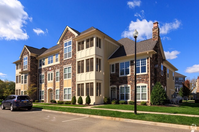
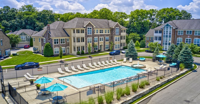
Property Record
11289 Hoosier Rd, Fishers, IN 46037

NEARBY LISTINGS FOR SALE OR LEASE
Property Detail
11289 Hoosier Rd
Indianapolis-Carmel-Anderson, IN
Per Plat Thereof Recorded May 17 2013 In
29-15-04-000-005.203-020
ACREAGE 14.81, SECTION 4, TOWNSHIP 17, RANGE 5, THE HAMILTON, LOT 1, IRREGULAR SHAPE
Apartment
Hamilton
X
Indiana
18057C0254G
1
2023
14.81 AC
2024
Fishers/Hawthorn Hills
110822
Indianapolis
313,348 SF
DEMOGRAPHICS near 11289 Hoosier Rd
1 Mile
3 Mile
5 Mile
2024 Total Population
6,368
69,543
162,096
2029 Population
7,065
77,107
177,960
Pop Growth 2024-2029
+ 10.95%
+ 10.88%
+ 9.79%
Average Age
37
37
38
2024 Total Households
2,131
24,631
59,378
HH Growth 2024-2029
+ 10.93%
+ 10.82%
+ 9.47%
Median Household Inc
$152,053
$118,655
$107,982
Avg Household Size
3.00
2.80
2.70
2024 Avg HH Vehicles
2.00
2.00
2.00
Median Home Value
$411,279
$339,150
$304,034
Median Year Built
2000
2001
2000
Nearby Places
Map Layers
Map Styles
 Street
 Aerial
- Restaurants
- Banks
- Shops
- Fitness
- Groceries
PUBLIC TRANSPORTATION
AIRPORT
Indianapolis International
DRIVE
WALK
Distance
Indianapolis International
54 min
32.9 mi
Freight Ports
Port of Toledo
DRIVE
WALK
Distance
Port of Toledo
249 min
208.9 mi
Nearby Properties
Address
Land Use
TOTAL SIZE
Lot Size
Zoning
Address
Land Use
TOTAL SIZE
Lot Size
Zoning
683,795 SF
25.53 AC
Address
Land Use
TOTAL SIZE
Lot Size
Zoning
555,234 SF
36.07 AC
Address
Land Use
TOTAL SIZE
Lot Size
Zoning
528,117 SF
57.02 AC
Address
Land Use
TOTAL SIZE
Lot Size
Zoning
172,571 SF
36.77 AC
Address
Land Use
TOTAL SIZE
Lot Size
Zoning
426,525 SF
16.44 AC
Address
Land Use
TOTAL SIZE
Lot Size
Zoning
434,376 SF
35.75 AC
Address
Land Use
TOTAL SIZE
Lot Size
Zoning
286,120 SF
8.03 AC
Address
Land Use
TOTAL SIZE
Lot Size
Zoning
176,103 SF
0.90 AC
Address
Land Use
TOTAL SIZE
Lot Size
Zoning
289,664 SF
35.22 AC
Address
Land Use
TOTAL SIZE
Lot Size
Zoning
391,181 SF
23.82 AC
Address
Land Use
TOTAL SIZE
Lot Size
Zoning
224,368 SF
0.73 AC
Address
Land Use
TOTAL SIZE
Lot Size
Zoning
185,155 SF
18.54 AC
Address
Land Use
TOTAL SIZE
Lot Size
Zoning
140,987 SF
13.99 AC
Address
Land Use
TOTAL SIZE
Lot Size
Zoning
288,939 SF
34.29 AC
Address
Land Use
TOTAL SIZE
Lot Size
Zoning
167,734 SF
3.69 AC
Address
Land Use
TOTAL SIZE
Lot Size
Zoning
224,860 SF
18.52 AC
Address
Land Use
TOTAL SIZE
Lot Size
Zoning
188,840 SF
10.49 AC
Address
Land Use
TOTAL SIZE
Lot Size
Zoning
54,344 SF
9.57 AC
Address
Land Use
TOTAL SIZE
Lot Size
Zoning
241,325 SF
26 AC
Address
Land Use
TOTAL SIZE
Lot Size
Zoning
120,839 SF
Address
Land Use
TOTAL SIZE
Lot Size
Zoning
79,925 SF
16.39 AC
Address
Land Use
TOTAL SIZE
Lot Size
Zoning
643,957 SF
34.93 AC
Address
Land Use
TOTAL SIZE
Lot Size
Zoning
87,125 SF
7.40 AC
Address
Land Use
TOTAL SIZE
Lot Size
Zoning
122,094 SF
0.80 AC
Address
Land Use
TOTAL SIZE
Lot Size
Zoning
154,237 SF
9.09 AC
Address
Land Use
TOTAL SIZE
Lot Size
Zoning
526,520 SF
15.45 AC
Address
Land Use
TOTAL SIZE
Lot Size
Zoning
136,774 SF
3.96 AC
Address
Land Use
TOTAL SIZE
Lot Size
Zoning
67,674 SF
24.91 AC
Address
Land Use
TOTAL SIZE
Lot Size
Zoning
107,364 SF
29.96 AC
The World's #1 Commercial Real Estate Marketplace
Connect with us
© 2025 CoStar Group
The information above has been obtained from sources believed reliable. While we do not doubt its accuracy we have not verified it and make no guarantee, warranty or representation about it. It is your responsibility to independently confirm its accuracy and completeness. Any projections, opinions, assumptions, or estimates used are for example only and do not represent the current or future performance of the property. The value of this transaction to you depends on tax and other factors which should be evaluated by your tax, financial, and legal advisors. You and your advisors should conduct a careful, independent investigation of the property to determine to your satisfaction the suitability of the property for your needs.