Property Record
1129 Bartow Rd, Lakeland, FL 33801

Current Lease Availabilities
NEARBY LISTINGS FOR SALE OR LEASE
Property Detail
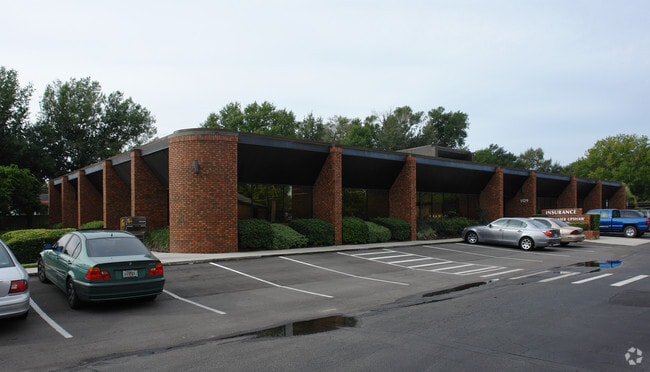
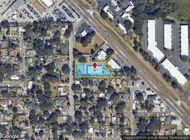
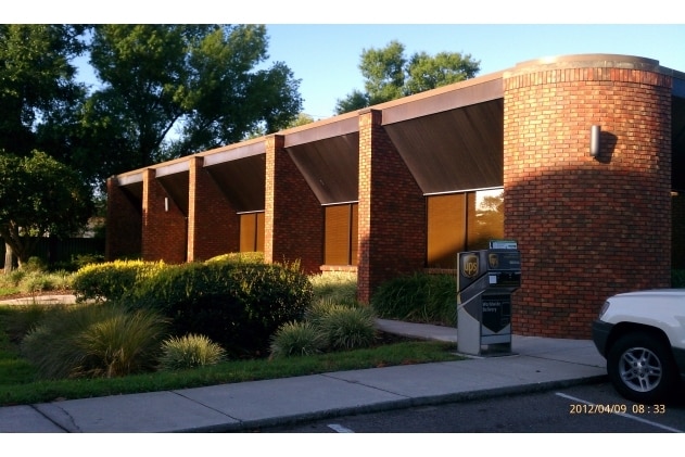
1129 Bartow Rd
24-28-20-000000-024050
Blantons Island
Officebuilding
COMM SW COR SE1/4 RUN N 990.67 FT E 30 FT FOR POB ON ELY R/W NEW JERSEY RD N 134 FT E 336.39 FT S 20 FT S 43 DEG 55 MIN 20 SEC E 100 FT S 41.96 FT W 405.77 FT TO POB & COMM SW COR OF SE1/4 OF SEC RUN N 1124.67 FT RUN E 30 FT TO PT ON ELY R/W LN OF NE
X
Polk
12105C0320G
Florida
2024
1.39 AC
2025
Polk County
010402
Tampa/St Petersburg
10,500 SF
Lakeland-Winter Haven, FL
DEMOGRAPHICS near 1129 Bartow Rd
1 Mile
3 Mile
5 Mile
2024 Total Population
9,916
73,141
140,065
2029 Population
11,533
86,838
167,110
Pop Growth 2024-2029
+ 16.31%
+ 18.73%
+ 19.31%
Average Age
34
38
40
2024 Total Households
3,013
28,437
54,565
HH Growth 2024-2029
+ 17.89%
+ 19.25%
+ 19.59%
Median Household Inc
$53,429
$47,584
$51,109
Avg Household Size
2.40
2.30
2.40
2024 Avg HH Vehicles
2.00
2.00
2.00
Median Home Value
$196,738
$164,038
$175,377
Median Year Built
1969
1972
1978
Nearby Places
Map Layers
Map Styles
 Street
 Aerial
- Restaurants
- Banks
- Shops
- Fitness
- Groceries
PUBLIC TRANSPORTATION
COMMUTER RAIL
DRIVE
WALK
Distance
4 min
1.9 mi
Nearby Properties
Address
Land Use
TOTAL SIZE
Lot Size
Zoning
Address
Land Use
TOTAL SIZE
Lot Size
Zoning
2,325,080 SF
27.05 AC
PUD
Address
Land Use
TOTAL SIZE
Lot Size
Zoning
414,112 SF
13.60 AC
MF22
Address
Land Use
TOTAL SIZE
Lot Size
Zoning
333,455 SF
11.90 AC
Address
Land Use
TOTAL SIZE
Lot Size
Zoning
263,185 SF
32.20 AC
C6
Address
Land Use
TOTAL SIZE
Lot Size
Zoning
417,661 SF
39.48 AC
Address
Land Use
TOTAL SIZE
Lot Size
Zoning
24,871 SF
54.24 AC
RB1
Address
Land Use
TOTAL SIZE
Lot Size
Zoning
295,706 SF
1.19 AC
Address
Land Use
TOTAL SIZE
Lot Size
Zoning
394,631 SF
32.27 AC
XX
Address
Land Use
TOTAL SIZE
Lot Size
Zoning
277,272 SF
19.35 AC
RA4
Address
Land Use
TOTAL SIZE
Lot Size
Zoning
282,596 SF
27.51 AC
RA3
Address
Land Use
TOTAL SIZE
Lot Size
Zoning
84,824 SF
163.73 AC
I2
Address
Land Use
TOTAL SIZE
Lot Size
Zoning
132,716 SF
20.62 AC
Address
Land Use
TOTAL SIZE
Lot Size
Zoning
165,743 SF
17.11 AC
PUD
Address
Land Use
TOTAL SIZE
Lot Size
Zoning
155,735 SF
24.24 AC
XX
Address
Land Use
TOTAL SIZE
Lot Size
Zoning
202,378 SF
14.39 AC
PUD
Address
Land Use
TOTAL SIZE
Lot Size
Zoning
342,987 SF
16.81 AC
Address
Land Use
TOTAL SIZE
Lot Size
Zoning
103,446 SF
2.12 AC
RB1
Address
Land Use
TOTAL SIZE
Lot Size
Zoning
135,189 SF
2.57 AC
RB1
Address
Land Use
TOTAL SIZE
Lot Size
Zoning
96,412 SF
11.03 AC
I1
Address
Land Use
TOTAL SIZE
Lot Size
Zoning
218,162 SF
16.32 AC
MF12
Address
Land Use
TOTAL SIZE
Lot Size
Zoning
77,358 SF
8.34 AC
PUD
Address
Land Use
TOTAL SIZE
Lot Size
Zoning
286,120 SF
2.49 AC
C6
Address
Land Use
TOTAL SIZE
Lot Size
Zoning
175,230 SF
7.23 AC
MF22
Address
Land Use
TOTAL SIZE
Lot Size
Zoning
242,284 SF
22.90 AC
C4
Address
Land Use
TOTAL SIZE
Lot Size
Zoning
148,182 SF
24.15 AC
Address
Land Use
TOTAL SIZE
Lot Size
Zoning
109,883 SF
12.40 AC
C4
Address
Land Use
TOTAL SIZE
Lot Size
Zoning
171,629 SF
14.91 AC
RA4
Address
Land Use
TOTAL SIZE
Lot Size
Zoning
130,375 SF
14.51 AC
Address
Land Use
TOTAL SIZE
Lot Size
Zoning
218,911 SF
39.21 AC
Address
Land Use
TOTAL SIZE
Lot Size
Zoning
119,141 SF
15.04 AC
RA4
The World's #1 Commercial Real Estate Marketplace
Connect with us
© 2026 CoStar Group
The information above has been obtained from sources believed reliable. While we do not doubt its accuracy we have not verified it and make no guarantee, warranty or representation about it. It is your responsibility to independently confirm its accuracy and completeness. Any projections, opinions, assumptions, or estimates used are for example only and do not represent the current or future performance of the property. The value of this transaction to you depends on tax and other factors which should be evaluated by your tax, financial, and legal advisors. You and your advisors should conduct a careful, independent investigation of the property to determine to your satisfaction the suitability of the property for your needs.