Property Record
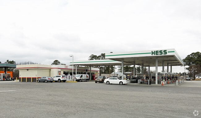
1129 Carolina Rd, Suffolk, VA 23434

NEARBY LISTINGS FOR SALE OR LEASE
-
-
View all Suffolk listings for sale on LoopNet.com
Property Detail
1129 Carolina Rd
103437500
BRANTON,C&P SUFFOLK WATER CO, HINES,RTS.1332
Commercialnec
Suffolk City
X
Virginia
5101560230E
2.62 AC
2025
Suffolk
2025
Hampton Roads
075703
Virginia Beach-Norfolk-Newport News, VA-NC
3,857 SF
DEMOGRAPHICS near 1129 Carolina Rd
1 Mile
3 Mile
5 Mile
2024 Total Population
556
12,931
31,429
2029 Population
630
14,425
35,100
Pop Growth 2024-2029
+ 13.31%
+ 11.55%
+ 11.68%
Average Age
43
39
40
2024 Total Households
228
5,114
12,403
HH Growth 2024-2029
+ 13.60%
+ 11.89%
+ 12.02%
Median Household Inc
$69,886
$57,968
$57,913
Avg Household Size
2.30
2.50
2.50
2024 Avg HH Vehicles
2.00
2.00
2.00
Median Home Value
$247,222
$242,244
$242,524
Median Year Built
1983
1973
1973
Nearby Places
Map Layers
Map Styles
 Street
 Aerial
- Restaurants
- Banks
- Shops
- Fitness
- Groceries
PUBLIC TRANSPORTATION
AIRPORT
Norfolk International
DRIVE
WALK
Distance
Norfolk International
47 min
30.4 mi
Freight Ports
Virginia Port Authority - Portsmouth
DRIVE
WALK
Distance
Virginia Port Authority - Portsmouth
37 min
23.3 mi
Nearby Properties
Address
Land Use
TOTAL SIZE
Lot Size
Zoning
Address
Land Use
TOTAL SIZE
Lot Size
Zoning
4,800 SF
71.72 AC
HEAVY INDU
Address
Land Use
TOTAL SIZE
Lot Size
Zoning
72.52 AC
LIGHT INDU
Address
Land Use
TOTAL SIZE
Lot Size
Zoning
6,000 SF
68.33 AC
HEAVY INDU
Address
Land Use
TOTAL SIZE
Lot Size
Zoning
10,255 SF
35.42 AC
HEAVY INDU
Address
Land Use
TOTAL SIZE
Lot Size
Zoning
3,600 SF
655 AC
HEAVY INDU
Address
Land Use
TOTAL SIZE
Lot Size
Zoning
4.70 AC
RESIDENTIA
Address
Land Use
TOTAL SIZE
Lot Size
Zoning
9,800 SF
8.22 AC
HEAVY INDU
Address
Land Use
TOTAL SIZE
Lot Size
Zoning
20,844 SF
2.26 AC
CENTRAL BU
Address
Land Use
TOTAL SIZE
Lot Size
Zoning
209.55 AC
HEAVY INDU
Address
Land Use
TOTAL SIZE
Lot Size
Zoning
58,439 SF
15.27 AC
RES LOW-ME
Address
Land Use
TOTAL SIZE
Lot Size
Zoning
86,213 SF
61.69 AC
RES LOW-ME
Address
Land Use
TOTAL SIZE
Lot Size
Zoning
54,100 SF
18.51 AC
HEAVY INDU
Address
Land Use
TOTAL SIZE
Lot Size
Zoning
25,000 SF
13.90 AC
LIGHT INDU
Address
Land Use
TOTAL SIZE
Lot Size
Zoning
57,600 SF
7.83 AC
HEAVY INDU
Address
Land Use
TOTAL SIZE
Lot Size
Zoning
1,800 SF
905.32 AC
CONSERVATI
Address
Land Use
TOTAL SIZE
Lot Size
Zoning
144 SF
4.75 AC
GENERAL CO
Address
Land Use
TOTAL SIZE
Lot Size
Zoning
49,020 SF
37.44 AC
RESIDENTIA
Address
Land Use
TOTAL SIZE
Lot Size
Zoning
39,000 SF
3.89 AC
HEAVY INDU
Address
Land Use
TOTAL SIZE
Lot Size
Zoning
20,520 SF
9.22 AC
GENERAL CO
Address
Land Use
TOTAL SIZE
Lot Size
Zoning
88,625 SF
9.50 AC
HEAVY INDU
Address
Land Use
TOTAL SIZE
Lot Size
Zoning
78,405 SF
6.77 AC
HEAVY INDU
Address
Land Use
TOTAL SIZE
Lot Size
Zoning
2.75 AC
HEAVY INDU
Address
Land Use
TOTAL SIZE
Lot Size
Zoning
100,800 SF
11.40 AC
HEAVY INDU
Address
Land Use
TOTAL SIZE
Lot Size
Zoning
600 SF
6.76 AC
HEAVY INDU
Address
Land Use
TOTAL SIZE
Lot Size
Zoning
2,640 SF
7.06 AC
GENERAL CO
Address
Land Use
TOTAL SIZE
Lot Size
Zoning
4.24 AC
HEAVY INDU
Address
Land Use
TOTAL SIZE
Lot Size
Zoning
14,635 SF
2.58 AC
GENERAL CO
Address
Land Use
TOTAL SIZE
Lot Size
Zoning
41,344 SF
5.80 AC
HEAVY INDU
The World's #1 Commercial Real Estate Marketplace
Connect with us
© 2025 CoStar Group
The information above has been obtained from sources believed reliable. While we do not doubt its accuracy we have not verified it and make no guarantee, warranty or representation about it. It is your responsibility to independently confirm its accuracy and completeness. Any projections, opinions, assumptions, or estimates used are for example only and do not represent the current or future performance of the property. The value of this transaction to you depends on tax and other factors which should be evaluated by your tax, financial, and legal advisors. You and your advisors should conduct a careful, independent investigation of the property to determine to your satisfaction the suitability of the property for your needs.