Property Record
1129 N 54Th St, Enid, OK 73701

NEARBY LISTINGS FOR SALE OR LEASE
Property Detail
1129 N 54Th St
Enid, OK
Enid Energy Ctr 1St
2015-00-000-007-0-008-50
S 310.24' LOT 7 SD-E56 ENID ENERGY CENTER 1ST SW/4 1-22-6 ET AL DUSTIN L HOLDING 1/2 INT EACH
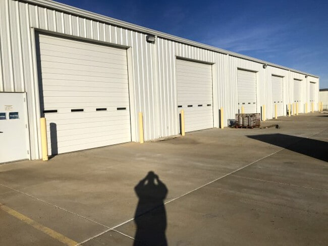
Warehouse
Garfield
X
Oklahoma
40047C0220E
7
2024
2.80 AC
2025
Oklahoma West Area
001500
Other Market Areas
11,400 SF
DEMOGRAPHICS near 1129 N 54Th St
1 Mile
3 Mile
5 Mile
2024 Total Population
17
7,036
23,884
2029 Population
17
6,933
23,744
Pop Growth 2024-2029
0.00%
(1.46%)
(0.59%)
Average Age
42
37
36
2024 Total Households
7
2,399
8,487
HH Growth 2024-2029
0.00%
(1.42%)
(0.61%)
Median Household Inc
$99,999
$47,723
$46,715
Avg Household Size
2.50
2.60
2.60
2024 Avg HH Vehicles
2.00
2.00
2.00
Median Home Value
$150,000
$77,475
$82,736
Median Year Built
1959
1963
1958
Nearby Places
Map Layers
Map Styles
 Street
 Aerial
- Restaurants
- Banks
- Shops
- Fitness
- Groceries
SALE & LEASE HISTORY
LISTING DATE
SALE/LEASE

Jan 15, 2021
For Lease
Nearby Properties
Address
Land Use
TOTAL SIZE
Lot Size
Zoning
Address
Land Use
TOTAL SIZE
Lot Size
Zoning
40,172 SF
18.93 AC
Address
Land Use
TOTAL SIZE
Lot Size
Zoning
51,476 SF
160 AC
NP
Address
Land Use
TOTAL SIZE
Lot Size
Zoning
6,719 SF
24.54 AC
Address
Land Use
TOTAL SIZE
Lot Size
Zoning
61,567 SF
34 AC
Address
Land Use
TOTAL SIZE
Lot Size
Zoning
77,102 SF
15.78 AC
Address
Land Use
TOTAL SIZE
Lot Size
Zoning
3,773 SF
156.30 AC
CR
Address
Land Use
TOTAL SIZE
Lot Size
Zoning
205,504 SF
16.46 AC
Address
Land Use
TOTAL SIZE
Lot Size
Zoning
1,408 SF
33.26 AC
Address
Land Use
TOTAL SIZE
Lot Size
Zoning
43,596 SF
2.77 AC
Address
Land Use
TOTAL SIZE
Lot Size
Zoning
176,696 SF
78.06 AC
CR
Address
Land Use
TOTAL SIZE
Lot Size
Zoning
7,200 SF
16.50 AC
Address
Land Use
TOTAL SIZE
Lot Size
Zoning
4,800 SF
19.41 AC
Address
Land Use
TOTAL SIZE
Lot Size
Zoning
18,232 SF
0.72 AC
Address
Land Use
TOTAL SIZE
Lot Size
Zoning
77,140 SF
11.24 AC
Address
Land Use
TOTAL SIZE
Lot Size
Zoning
14,653 SF
1.39 AC
Address
Land Use
TOTAL SIZE
Lot Size
Zoning
9,534 SF
19.17 AC
Address
Land Use
TOTAL SIZE
Lot Size
Zoning
40,800 SF
24.33 AC
Address
Land Use
TOTAL SIZE
Lot Size
Zoning
6,511 SF
82.81 AC
Address
Land Use
TOTAL SIZE
Lot Size
Zoning
150.18 AC
CR
Address
Land Use
TOTAL SIZE
Lot Size
Zoning
10,268 SF
1.40 AC
Address
Land Use
TOTAL SIZE
Lot Size
Zoning
1,920 SF
0.03 AC
Address
Land Use
TOTAL SIZE
Lot Size
Zoning
9,435 SF
0.52 AC
Address
Land Use
TOTAL SIZE
Lot Size
Zoning
1,350 SF
57.20 AC
Address
Land Use
TOTAL SIZE
Lot Size
Zoning
3,696 SF
1.02 AC
Address
Land Use
TOTAL SIZE
Lot Size
Zoning
7,260 SF
1.13 AC
Address
Land Use
TOTAL SIZE
Lot Size
Zoning
1,560 SF
23.24 AC
Address
Land Use
TOTAL SIZE
Lot Size
Zoning
46,630 SF
10 AC
CR
Address
Land Use
TOTAL SIZE
Lot Size
Zoning
1,575 SF
0.89 AC
Address
Land Use
TOTAL SIZE
Lot Size
Zoning
4,992 SF
0.01 AC
NP
Address
Land Use
TOTAL SIZE
Lot Size
Zoning
92,432 SF
8.30 AC
The World's #1 Commercial Real Estate Marketplace
Connect with us
© 2025 CoStar Group
The information above has been obtained from sources believed reliable. While we do not doubt its accuracy we have not verified it and make no guarantee, warranty or representation about it. It is your responsibility to independently confirm its accuracy and completeness. Any projections, opinions, assumptions, or estimates used are for example only and do not represent the current or future performance of the property. The value of this transaction to you depends on tax and other factors which should be evaluated by your tax, financial, and legal advisors. You and your advisors should conduct a careful, independent investigation of the property to determine to your satisfaction the suitability of the property for your needs.