Property Record
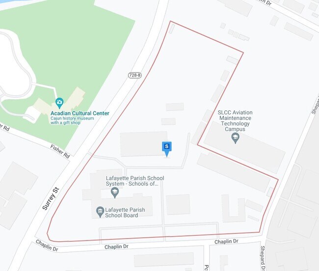
113 Chaplin Dr, Lafayette, LA 70508

Property Detail
113 Chaplin Dr
6001736
PARCEL B SEC 141/142 T10S R5E (3.053 AC)(22-19832 PLAT) TR A SEC 141/142 T10S R5E (1.441 AC)(22-19832 PLAT) PARCEL A SEC
Officebuilding
Lafayette
B and X Area of moderate flood hazard, usually the area between the limits of the 100-year and 500-year floods.
Louisiana
2025
10.87 AC
2025
Greater Lafayette
001408
Lafayette
36,000 SF
Lafayette, LA
NEARBY LISTINGS FOR SALE OR LEASE
DEMOGRAPHICS near 113 Chaplin Dr
1 mile
3 mile
5 mile
2025 Total Population
3,802
42,842
114,415
2030 Population
3,979
45,041
119,502
Pop Growth 2025-2030
+ 4.66%
+ 5.13%
+ 4.45%
Average Age
42
40
40
2025 Total Households
1,659
18,477
49,713
HH Growth 2025-2030
+ 4.58%
+ 5.29%
+ 4.56%
Median Household Inc
$38,903
$41,176
$54,835
Avg Household Size
2.20
2.20
2.20
2025 Avg HH Vehicles
1.00
1.00
2.00
Median Home Value
$169,921
$219,986
$240,374
Median Year Built
1966
1972
1979
Nearby Places
Map Layers
Map Styles
 Street
 Aerial
Layers
 Traffic
 Biking
Places
Listings with unknown addresses are not visible on the map
- Restaurants
- Banks
- Shops
- Fitness
- Groceries
PUBLIC TRANSPORTATION
COMMUTER RAIL
Lafayette Amtrak Station (Sunset Limited - Amtrak)
Drive
Walk
Distance
Lafayette Amtrak Station (Sunset Limited - Amtrak)
5 min
2.4 mi
AIRPORT
Lafayette Regional/Paul Fournet Field
Drive
Walk
Distance
Lafayette Regional/Paul Fournet Field
1 min
0.3 mi
Freight Ports
Port of Iberia
Drive
Walk
Distance
Port of Iberia
30 min
22.7 mi
Nearby Properties
Address
Land Use
TOTAL SIZE
Lot Size
Zoning
Address
Land Use
TOTAL SIZE
Lot Size
Zoning
800,608 SF
6.64 AC
Address
Land Use
TOTAL SIZE
Lot Size
Zoning
82,329 SF
1 AC
Address
Land Use
TOTAL SIZE
Lot Size
Zoning
51,132 SF
11.07 AC
Address
Land Use
TOTAL SIZE
Lot Size
Zoning
273,165 SF
15.14 AC
Address
Land Use
TOTAL SIZE
Lot Size
Zoning
141,706 SF
3.44 AC
Address
Land Use
TOTAL SIZE
Lot Size
Zoning
70,972 SF
921.26 AC
Address
Land Use
TOTAL SIZE
Lot Size
Zoning
231,380 SF
4.20 AC
Address
Land Use
TOTAL SIZE
Lot Size
Zoning
273,675 SF
6.38 AC
Address
Land Use
TOTAL SIZE
Lot Size
Zoning
158,272 SF
Address
Land Use
TOTAL SIZE
Lot Size
Zoning
119,726 SF
25.22 AC
Address
Land Use
TOTAL SIZE
Lot Size
Zoning
221,760 SF
0.67 AC
Address
Land Use
TOTAL SIZE
Lot Size
Zoning
67,949 SF
0.92 AC
Address
Land Use
TOTAL SIZE
Lot Size
Zoning
182,700 SF
25.62 AC
Address
Land Use
TOTAL SIZE
Lot Size
Zoning
98,973 SF
9.91 AC
Address
Land Use
TOTAL SIZE
Lot Size
Zoning
900 SF
12.41 AC
Address
Land Use
TOTAL SIZE
Lot Size
Zoning
92,556 SF
10.75 AC
Address
Land Use
TOTAL SIZE
Lot Size
Zoning
84,225 SF
Address
Land Use
TOTAL SIZE
Lot Size
Zoning
194,912 SF
13.73 AC
Address
Land Use
TOTAL SIZE
Lot Size
Zoning
106,686 SF
7.03 AC
Address
Land Use
TOTAL SIZE
Lot Size
Zoning
151,863 SF
1.43 AC
Address
Land Use
TOTAL SIZE
Lot Size
Zoning
123,164 SF
2.11 AC
Address
Land Use
TOTAL SIZE
Lot Size
Zoning
205,096 SF
21.71 AC
Address
Land Use
TOTAL SIZE
Lot Size
Zoning
87,868 SF
3.02 AC
Address
Land Use
TOTAL SIZE
Lot Size
Zoning
120,500 SF
20 AC
Address
Land Use
TOTAL SIZE
Lot Size
Zoning
164,478 SF
40 AC
Address
Land Use
TOTAL SIZE
Lot Size
Zoning
77,245 SF
24.08 AC
Address
Land Use
TOTAL SIZE
Lot Size
Zoning
95,667 SF
4.30 AC
Address
Land Use
TOTAL SIZE
Lot Size
Zoning
83,756 SF
Address
Land Use
TOTAL SIZE
Lot Size
Zoning
150,000 SF
1 AC
Address
Land Use
TOTAL SIZE
Lot Size
Zoning
47,310 SF
3.80 AC
The World's #1 Commercial Real Estate Marketplace
Connect with us
© 2026 CoStar Group
The information above has been obtained from sources believed reliable. While we do not doubt its accuracy we have not verified it and make no guarantee, warranty or representation about it. It is your responsibility to independently confirm its accuracy and completeness. Any projections, opinions, assumptions, or estimates used are for example only and do not represent the current or future performance of the property. The value of this transaction to you depends on tax and other factors which should be evaluated by your tax, financial, and legal advisors. You and your advisors should conduct a careful, independent investigation of the property to determine to your satisfaction the suitability of the property for your needs.