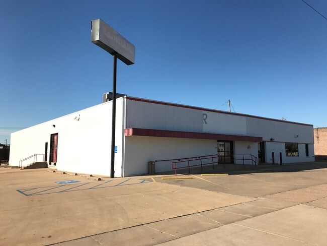
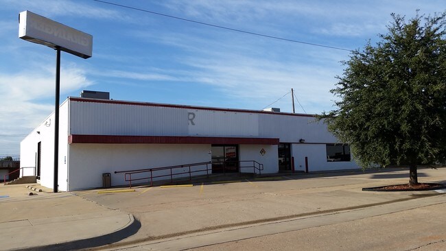
Property Record
113 Henrietta St, Wichita Falls, TX 76301
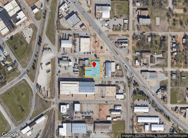
NEARBY LISTINGS FOR SALE OR LEASE
Property Detail
113 Henrietta St
Wichita Falls, TX
Mcbride 1
138370
S 97 OF LT 6 ALL LOTS 7 & 8 BLK 2 MCBRIDE 1
Wholesaleoutletdiscountstore
Wichita
X
Texas
48485C0340G
6,7,8
2024
0.58 AC
2025
Southwest Wichita Falls
010100
Other Market Areas
18,810 SF
DEMOGRAPHICS near 113 Henrietta St
1 Mile
3 Mile
5 Mile
2024 Total Population
4,718
38,834
76,831
2029 Population
4,961
40,080
78,886
Pop Growth 2024-2029
+ 5.15%
+ 3.21%
+ 2.67%
Average Age
39
38
38
2024 Total Households
1,871
15,879
31,015
HH Growth 2024-2029
+ 5.61%
+ 3.31%
+ 2.76%
Median Household Inc
$24,957
$40,878
$46,244
Avg Household Size
2.20
2.30
2.30
2024 Avg HH Vehicles
1.00
2.00
2.00
Median Home Value
$69,795
$90,328
$118,068
Median Year Built
1949
1959
1967
Nearby Places
Map Layers
Map Styles
 Street
 Aerial
- Restaurants
- Banks
- Shops
- Fitness
- Groceries
SALE & LEASE HISTORY
LISTING DATE
SALE/LEASE

Oct 14, 2016
For Sale
Mar 13, 2019
For Lease
Mar 13, 2019
For Sale
Jul 27, 2017
For Sale
Nearby Properties
Address
Land Use
TOTAL SIZE
Lot Size
Zoning
Address
Land Use
TOTAL SIZE
Lot Size
Zoning
1,172,641 SF
100 AC
Address
Land Use
TOTAL SIZE
Lot Size
Zoning
400,968 SF
123.30 AC
Address
Land Use
TOTAL SIZE
Lot Size
Zoning
164,255 SF
5.23 AC
Address
Land Use
TOTAL SIZE
Lot Size
Zoning
398,646 SF
7.51 AC
GC
Address
Land Use
TOTAL SIZE
Lot Size
Zoning
203,569 SF
27.74 AC
Address
Land Use
TOTAL SIZE
Lot Size
Zoning
245,152 SF
5.12 AC
GC
Address
Land Use
TOTAL SIZE
Lot Size
Zoning
356,863 SF
26.90 AC
HI
Address
Land Use
TOTAL SIZE
Lot Size
Zoning
24,741 SF
37.75 AC
Address
Land Use
TOTAL SIZE
Lot Size
Zoning
132,937 SF
21.85 AC
Address
Land Use
TOTAL SIZE
Lot Size
Zoning
266,509 SF
14.25 AC
SF2
Address
Land Use
TOTAL SIZE
Lot Size
Zoning
167,247 SF
2.61 AC
CBD
Address
Land Use
TOTAL SIZE
Lot Size
Zoning
51,240 SF
3.46 AC
GC
Address
Land Use
TOTAL SIZE
Lot Size
Zoning
125,992 SF
4.22 AC
Address
Land Use
TOTAL SIZE
Lot Size
Zoning
80,294 SF
9.17 AC
Address
Land Use
TOTAL SIZE
Lot Size
Zoning
226,866 SF
12.10 AC
MFR
Address
Land Use
TOTAL SIZE
Lot Size
Zoning
136,522 SF
4.11 AC
Address
Land Use
TOTAL SIZE
Lot Size
Zoning
82,217 SF
10.57 AC
SF2
Address
Land Use
TOTAL SIZE
Lot Size
Zoning
95,926 SF
1.21 AC
CBD
Address
Land Use
TOTAL SIZE
Lot Size
Zoning
62,292 SF
14.61 AC
Address
Land Use
TOTAL SIZE
Lot Size
Zoning
179,865 SF
11.46 AC
Address
Land Use
TOTAL SIZE
Lot Size
Zoning
107,872 SF
4.02 AC
LC
Address
Land Use
TOTAL SIZE
Lot Size
Zoning
70,577 SF
8.22 AC
Address
Land Use
TOTAL SIZE
Lot Size
Zoning
125,809 SF
2.01 AC
GC
Address
Land Use
TOTAL SIZE
Lot Size
Zoning
109,536 SF
27.02 AC
Address
Land Use
TOTAL SIZE
Lot Size
Zoning
54,320 SF
4.64 AC
SF2
Address
Land Use
TOTAL SIZE
Lot Size
Zoning
148,532 SF
7.56 AC
Address
Land Use
TOTAL SIZE
Lot Size
Zoning
108,972 SF
1.41 AC
CBD
Address
Land Use
TOTAL SIZE
Lot Size
Zoning
56,599 SF
4.82 AC
LC
Address
Land Use
TOTAL SIZE
Lot Size
Zoning
115,350 SF
4.86 AC
SF2
Address
Land Use
TOTAL SIZE
Lot Size
Zoning
34,268 SF
1.27 AC
The World's #1 Commercial Real Estate Marketplace
Connect with us
© 2025 CoStar Group
The information above has been obtained from sources believed reliable. While we do not doubt its accuracy we have not verified it and make no guarantee, warranty or representation about it. It is your responsibility to independently confirm its accuracy and completeness. Any projections, opinions, assumptions, or estimates used are for example only and do not represent the current or future performance of the property. The value of this transaction to you depends on tax and other factors which should be evaluated by your tax, financial, and legal advisors. You and your advisors should conduct a careful, independent investigation of the property to determine to your satisfaction the suitability of the property for your needs.