Property Record
113 N Fish Trap Rd, Easley, SC 29640
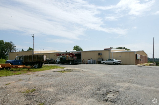

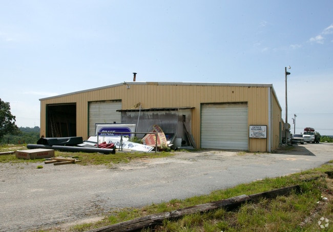
Property Detail
113 N Fish Trap Rd
5059-14-24-6476
W/SIDE N FISH TRAP RD
Commercialnec
PICKENS
B and X Area of moderate flood hazard, usually the area between the limits of the 100-year and 500-year floods.
South Carolina
2025
5 AC
2025
Rt 153/Rt 123 Corr
010802
Greenville/Spartanburg
14,400 SF
Greenville-Anderson-Greer, SC
NEARBY LISTINGS FOR SALE OR LEASE
DEMOGRAPHICS near 113 N Fish Trap Rd
1 mile
3 mile
5 mile
2025 Total Population
2,186
25,784
99,035
2030 Population
2,321
27,412
106,380
Pop Growth 2025-2030
+ 6.18%
+ 6.31%
+ 7.42%
Average Age
39
39
39
2025 Total Households
820
9,902
39,249
HH Growth 2025-2030
+ 6.34%
+ 6.53%
+ 7.79%
Median Household Inc
$53,298
$57,886
$58,423
Avg Household Size
2.60
2.50
2.40
2025 Avg HH Vehicles
2.00
2.00
2.00
Median Home Value
$129,747
$210,755
$252,003
Median Year Built
1989
1985
1987
Nearby Places
Map Layers
Map Styles
 Street
 Aerial
Layers
 Traffic
 Biking
Places
Listings with unknown addresses are not visible on the map
- Restaurants
- Banks
- Shops
- Fitness
- Groceries
PUBLIC TRANSPORTATION
COMMUTER RAIL
Drive
Walk
Distance
12 min
5.8 mi
AIRPORT
Greenville Spartanburg International
Drive
Walk
Distance
Greenville Spartanburg International
32 min
20.0 mi
Nearby Properties
Address
Land Use
TOTAL SIZE
Lot Size
Zoning
Address
Land Use
TOTAL SIZE
Lot Size
Zoning
20.04 AC
RM
Address
Land Use
TOTAL SIZE
Lot Size
Zoning
10.10 AC
RM
Address
Land Use
TOTAL SIZE
Lot Size
Zoning
13.87 AC
RM20
Address
Land Use
TOTAL SIZE
Lot Size
Zoning
5.60 AC
RM
Address
Land Use
TOTAL SIZE
Lot Size
Zoning
4.70 AC
RM
Address
Land Use
TOTAL SIZE
Lot Size
Zoning
50.95 AC
R75
Address
Land Use
TOTAL SIZE
Lot Size
Zoning
14,544 SF
22.61 AC
Address
Land Use
TOTAL SIZE
Lot Size
Zoning
18.22 AC
RM
Address
Land Use
TOTAL SIZE
Lot Size
Zoning
13.10 AC
RM
Address
Land Use
TOTAL SIZE
Lot Size
Zoning
105.62 AC
RS
Address
Land Use
TOTAL SIZE
Lot Size
Zoning
1.43 AC
C1N
Address
Land Use
TOTAL SIZE
Lot Size
Zoning
11.70 AC
R10
Address
Land Use
TOTAL SIZE
Lot Size
Zoning
5,321 SF
3.38 AC
Address
Land Use
TOTAL SIZE
Lot Size
Zoning
1,410 SF
10.17 AC
R10
Address
Land Use
TOTAL SIZE
Lot Size
Zoning
24.69 AC
S1
Address
Land Use
TOTAL SIZE
Lot Size
Zoning
59.60 AC
RS
Address
Land Use
TOTAL SIZE
Lot Size
Zoning
3,008 SF
25.76 AC
C1
Address
Land Use
TOTAL SIZE
Lot Size
Zoning
36.37 AC
Address
Land Use
TOTAL SIZE
Lot Size
Zoning
72.10 AC
RS
Address
Land Use
TOTAL SIZE
Lot Size
Zoning
1,621 SF
50.70 AC
RS
Address
Land Use
TOTAL SIZE
Lot Size
Zoning
70,058 SF
17.05 AC
Address
Land Use
TOTAL SIZE
Lot Size
Zoning
28.82 AC
RS,S1
Address
Land Use
TOTAL SIZE
Lot Size
Zoning
135,439 SF
13.80 AC
GC
Address
Land Use
TOTAL SIZE
Lot Size
Zoning
4 AC
C-2
Address
Land Use
TOTAL SIZE
Lot Size
Zoning
60,436 SF
8.40 AC
Address
Land Use
TOTAL SIZE
Lot Size
Zoning
15.59 AC
S1
Address
Land Use
TOTAL SIZE
Lot Size
Zoning
4.03 AC
RS
Address
Land Use
TOTAL SIZE
Lot Size
Zoning
13.09 AC
RM
Address
Land Use
TOTAL SIZE
Lot Size
Zoning
18.60 AC
RS
Address
Land Use
TOTAL SIZE
Lot Size
Zoning
1.29 AC
C2
The World's #1 Commercial Real Estate Marketplace
Connect with us
© 2026 CoStar Group
The information above has been obtained from sources believed reliable. While we do not doubt its accuracy we have not verified it and make no guarantee, warranty or representation about it. It is your responsibility to independently confirm its accuracy and completeness. Any projections, opinions, assumptions, or estimates used are for example only and do not represent the current or future performance of the property. The value of this transaction to you depends on tax and other factors which should be evaluated by your tax, financial, and legal advisors. You and your advisors should conduct a careful, independent investigation of the property to determine to your satisfaction the suitability of the property for your needs.