Property Record
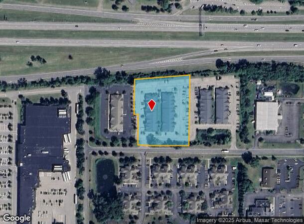
1120 Crosspointe Ln, Webster, NY 14580

NEARBY LISTINGS FOR SALE OR LEASE
Property Detail
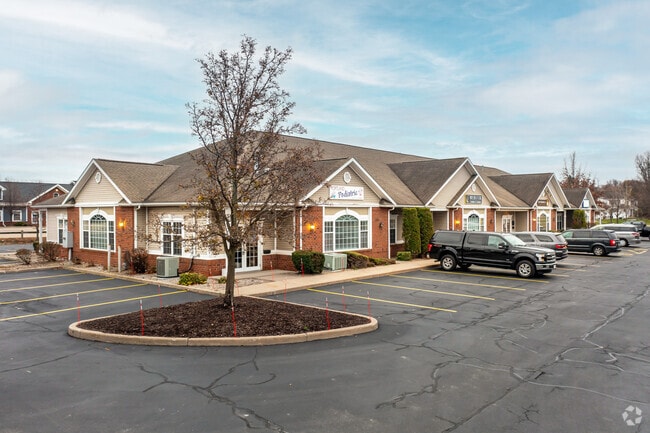
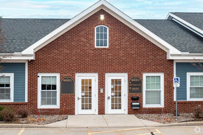
1120 Crosspointe Ln
265489-080-090-0003-001-001
Ridgewood Office Park
Officebuilding
Monroe
X
New York
36055C0229G
1.001
2025
2.74 AC
2024
Northeast
011403
Rochester
12,772 SF
Rochester, NY
DEMOGRAPHICS near 1120 Crosspointe Ln
1 Mile
3 Mile
5 Mile
2024 Total Population
7,655
36,915
68,730
2029 Population
7,560
36,326
67,781
Pop Growth 2024-2029
(1.24%)
(1.60%)
(1.38%)
Average Age
44
44
44
2024 Total Households
3,625
15,646
28,300
HH Growth 2024-2029
(1.30%)
(1.67%)
(1.43%)
Median Household Inc
$64,609
$86,348
$92,460
Avg Household Size
2.10
2.30
2.40
2024 Avg HH Vehicles
2.00
2.00
2.00
Median Home Value
$213,019
$239,603
$247,189
Median Year Built
1987
1985
1983
Nearby Places
Map Layers
Map Styles
 Street
 Aerial
- Restaurants
- Banks
- Shops
- Fitness
- Groceries
PUBLIC TRANSPORTATION
AIRPORT
Frederick Douglass/Greater Rochester International
DRIVE
WALK
Distance
Frederick Douglass/Greater Rochester International
26 min
20.2 mi
Freight Ports
Albany, NY Port
DRIVE
WALK
Distance
Albany, NY Port
1 min
190.8 mi
SALE & LEASE HISTORY
LISTING DATE
SALE/LEASE

Sep 25, 2016
For Lease
Nov 11, 2021
For Lease
Jun 23, 2017
For Lease
Nearby Properties
Address
Land Use
TOTAL SIZE
Lot Size
Zoning
Address
Land Use
TOTAL SIZE
Lot Size
Zoning
39.21 AC
Address
Land Use
TOTAL SIZE
Lot Size
Zoning
32,868 SF
46.85 AC
Address
Land Use
TOTAL SIZE
Lot Size
Zoning
5,400 SF
37.90 AC
Address
Land Use
TOTAL SIZE
Lot Size
Zoning
278,538 SF
53.90 AC
09200
Address
Land Use
TOTAL SIZE
Lot Size
Zoning
10,573 SF
84.26 AC
Address
Land Use
TOTAL SIZE
Lot Size
Zoning
168,660 SF
42.78 AC
Address
Land Use
TOTAL SIZE
Lot Size
Zoning
98,258 SF
28.47 AC
23550
Address
Land Use
TOTAL SIZE
Lot Size
Zoning
185,429 SF
5.81 AC
Address
Land Use
TOTAL SIZE
Lot Size
Zoning
80,405 SF
15.14 AC
Address
Land Use
TOTAL SIZE
Lot Size
Zoning
2,617 SF
27.13 AC
Address
Land Use
TOTAL SIZE
Lot Size
Zoning
7,424 SF
41.69 AC
Address
Land Use
TOTAL SIZE
Lot Size
Zoning
205,258 SF
40 AC
Address
Land Use
TOTAL SIZE
Lot Size
Zoning
11,862 SF
35.80 AC
26340
Address
Land Use
TOTAL SIZE
Lot Size
Zoning
97,055 SF
15.73 AC
Address
Land Use
TOTAL SIZE
Lot Size
Zoning
380,600 SF
44.14 AC
06 - INDUS
Address
Land Use
TOTAL SIZE
Lot Size
Zoning
129,951 SF
29.16 AC
Address
Land Use
TOTAL SIZE
Lot Size
Zoning
93,520 SF
37.91 AC
Address
Land Use
TOTAL SIZE
Lot Size
Zoning
8,526 SF
26.46 AC
Address
Land Use
TOTAL SIZE
Lot Size
Zoning
Address
Land Use
TOTAL SIZE
Lot Size
Zoning
5,693 SF
17.28 AC
Address
Land Use
TOTAL SIZE
Lot Size
Zoning
127,521 SF
13.16 AC
Address
Land Use
TOTAL SIZE
Lot Size
Zoning
137,980 SF
18.21 AC
Address
Land Use
TOTAL SIZE
Lot Size
Zoning
82,349 SF
13.96 AC
Address
Land Use
TOTAL SIZE
Lot Size
Zoning
104,934 SF
17.03 AC
01 - NOT Z
Address
Land Use
TOTAL SIZE
Lot Size
Zoning
2,898 SF
7.50 AC
06
Address
Land Use
TOTAL SIZE
Lot Size
Zoning
Address
Land Use
TOTAL SIZE
Lot Size
Zoning
19,314 SF
8.90 AC
53710
Address
Land Use
TOTAL SIZE
Lot Size
Zoning
Address
Land Use
TOTAL SIZE
Lot Size
Zoning
62,104 SF
11.17 AC
Address
Land Use
TOTAL SIZE
Lot Size
Zoning
67,220 SF
2.85 AC
The World's #1 Commercial Real Estate Marketplace
Connect with us
© 2025 CoStar Group
The information above has been obtained from sources believed reliable. While we do not doubt its accuracy we have not verified it and make no guarantee, warranty or representation about it. It is your responsibility to independently confirm its accuracy and completeness. Any projections, opinions, assumptions, or estimates used are for example only and do not represent the current or future performance of the property. The value of this transaction to you depends on tax and other factors which should be evaluated by your tax, financial, and legal advisors. You and your advisors should conduct a careful, independent investigation of the property to determine to your satisfaction the suitability of the property for your needs.