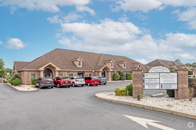
Property Record
1130 Opal Ct, Hagerstown, MD 21740


Save to a Folder
{{folder.Name}}
{{folder.ListingIds.length}} Properties
{{folder.ListingIds.length}} Property
Create a New Folder
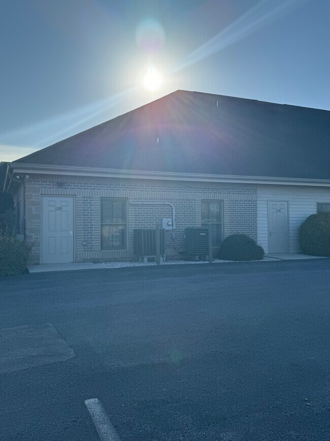
Property Detail
1130 Opal Ct
17-028286
LOT 18E 0.337 ACRES 1130 OPAL COURT
Officebuilding
Washington
POM
Maryland
B and X Area of moderate flood hazard, usually the area between the limits of the 100-year and 500-year floods.
18e
2025
0.34 AC
2025
Washington County
000601
Washington, DC
3,996 SF
Hagerstown-Martinsburg, MD-WV
NEARBY LISTINGS FOR SALE OR LEASE
DEMOGRAPHICS near 1130 Opal Ct
1 mile
3 mile
5 mile
2025 Total Population
7,540
61,837
93,512
2030 Population
7,667
63,096
95,341
Pop Growth 2025-2030
+ 1.68%
+ 2.04%
+ 1.96%
Average Age
39
40
40
2025 Total Households
2,984
25,406
37,287
HH Growth 2025-2030
+ 1.71%
+ 2.06%
+ 1.97%
Median Household Inc
$57,172
$56,777
$67,197
Avg Household Size
2.40
2.30
2.40
2025 Avg HH Vehicles
2.00
2.00
2.00
Median Home Value
$229,884
$238,212
$263,864
Median Year Built
1975
1967
1972
Nearby Places
Map Layers
Map Styles
 Street
 Aerial
Layers
 Traffic
 Biking
Places
Listings with unknown addresses are not visible on the map
- Restaurants
- Banks
- Shops
- Fitness
- Groceries
PUBLIC TRANSPORTATION
AIRPORT
Hagerstown Regional/Richard A Henson Field
Drive
Walk
Distance
Hagerstown Regional/Richard A Henson Field
14 min
6.3 mi
SALE & LEASE HISTORY
LISTING DATE
SALE/LEASE

Mar 25, 2024
For Sale
Feb 07, 2024
For Sale
Nearby Properties
Address
Land Use
TOTAL SIZE
Lot Size
Zoning
Address
Land Use
TOTAL SIZE
Lot Size
Zoning
502,262 SF
36.64 AC
ORI
Address
Land Use
TOTAL SIZE
Lot Size
Zoning
1,236,085 SF
134.31 AC
IMU
Address
Land Use
TOTAL SIZE
Lot Size
Zoning
77,027 SF
310.67 AC
ERT
Address
Land Use
TOTAL SIZE
Lot Size
Zoning
1,247,111 SF
74.55 AC
IMU
Address
Land Use
TOTAL SIZE
Lot Size
Zoning
103,131 SF
53.74 AC
RMOD
Address
Land Use
TOTAL SIZE
Lot Size
Zoning
200,815 SF
9.14 AC
ORI
Address
Land Use
TOTAL SIZE
Lot Size
Zoning
216 SF
52.93 AC
RH
Address
Land Use
TOTAL SIZE
Lot Size
Zoning
277,977 SF
68.60 AC
IG
Address
Land Use
TOTAL SIZE
Lot Size
Zoning
12,580 SF
1.73 AC
CCMU
Address
Land Use
TOTAL SIZE
Lot Size
Zoning
151,660 SF
56.24 AC
RMOD
Address
Land Use
TOTAL SIZE
Lot Size
Zoning
167,084 SF
64.62 AC
RMOD
Address
Land Use
TOTAL SIZE
Lot Size
Zoning
77,934 SF
12.79 AC
RMED
Address
Land Use
TOTAL SIZE
Lot Size
Zoning
267,424 SF
21.44 AC
IMU
Address
Land Use
TOTAL SIZE
Lot Size
Zoning
82,403 SF
1.32 AC
CCMU
Address
Land Use
TOTAL SIZE
Lot Size
Zoning
127,315 SF
26.65 AC
RMOD
Address
Land Use
TOTAL SIZE
Lot Size
Zoning
290,600 SF
51.35 AC
IMU
Address
Land Use
TOTAL SIZE
Lot Size
Zoning
52,259 SF
60.86 AC
HI
Address
Land Use
TOTAL SIZE
Lot Size
Zoning
7,427 SF
79.25 AC
RS
Address
Land Use
TOTAL SIZE
Lot Size
Zoning
94,185 SF
9.25 AC
RMED
Address
Land Use
TOTAL SIZE
Lot Size
Zoning
88,116 SF
18.44 AC
RMOD
Address
Land Use
TOTAL SIZE
Lot Size
Zoning
218,568 SF
51.64 AC
U
Address
Land Use
TOTAL SIZE
Lot Size
Zoning
5,090 SF
25.27 AC
RMOD
Address
Land Use
TOTAL SIZE
Lot Size
Zoning
71,928 SF
24.77 AC
RMOD
Address
Land Use
TOTAL SIZE
Lot Size
Zoning
67,434 SF
4.30 AC
RS
Address
Land Use
TOTAL SIZE
Lot Size
Zoning
80,816 SF
19.68 AC
ORI
Address
Land Use
TOTAL SIZE
Lot Size
Zoning
123,120 SF
28.54 AC
ORT
Address
Land Use
TOTAL SIZE
Lot Size
Zoning
17,574 SF
13.98 AC
RH
Address
Land Use
TOTAL SIZE
Lot Size
Zoning
23,086 SF
19.36 AC
CR
Address
Land Use
TOTAL SIZE
Lot Size
Zoning
3,159 SF
14.99 AC
CR
Address
Land Use
TOTAL SIZE
Lot Size
Zoning
198 SF
7.04 AC
RH
The World's #1 Commercial Real Estate Marketplace
Connect with us
© 2026 CoStar Group
The information above has been obtained from sources believed reliable. While we do not doubt its accuracy we have not verified it and make no guarantee, warranty or representation about it. It is your responsibility to independently confirm its accuracy and completeness. Any projections, opinions, assumptions, or estimates used are for example only and do not represent the current or future performance of the property. The value of this transaction to you depends on tax and other factors which should be evaluated by your tax, financial, and legal advisors. You and your advisors should conduct a careful, independent investigation of the property to determine to your satisfaction the suitability of the property for your needs.