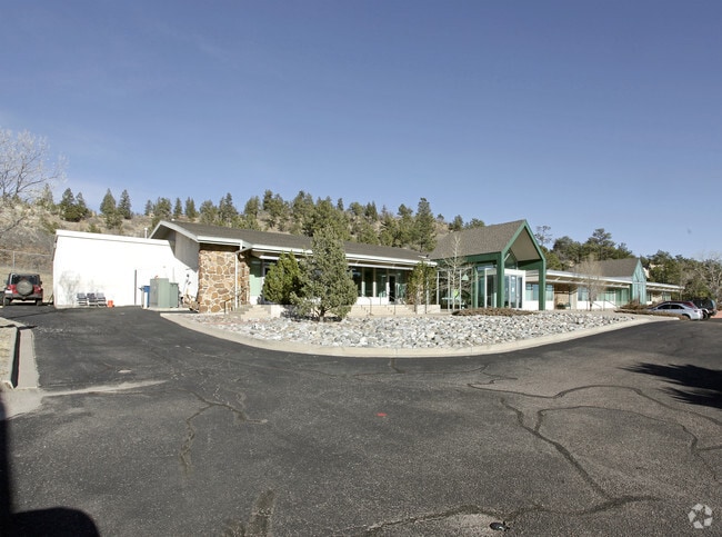
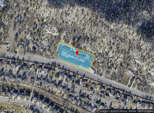
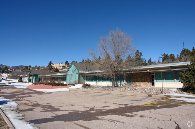
Property Record
1130 W Woodmen Rd, Colorado Springs, CO 80919

NEARBY LISTINGS FOR SALE OR LEASE
Property Detail
1130 W Woodmen Rd
Colorado Springs, CO
Woodmen Roberts Sub
73010-01-025
LOT 1 WOODMEN ROBERTS SUB
Charitableorganization
El Paso
X
Colorado
08041C0503G
1
0
2.10 AC
2025
Northwest
003705
Colorado Springs
11,951 SF
DEMOGRAPHICS near 1130 W Woodmen Rd
1 Mile
3 Mile
5 Mile
2024 Total Population
4,608
36,944
108,490
2029 Population
4,812
38,605
113,235
Pop Growth 2024-2029
+ 4.43%
+ 4.50%
+ 4.37%
Average Age
45
40
40
2024 Total Households
1,663
14,534
43,737
HH Growth 2024-2029
+ 4.69%
+ 4.77%
+ 4.62%
Median Household Inc
$130,033
$98,305
$85,378
Avg Household Size
2.70
2.40
2.40
2024 Avg HH Vehicles
2.00
2.00
2.00
Median Home Value
$633,301
$490,897
$436,772
Median Year Built
1988
1988
1987
Nearby Places
Map Layers
Map Styles
 Street
 Aerial
- Restaurants
- Banks
- Shops
- Fitness
- Groceries
PUBLIC TRANSPORTATION
AIRPORT
City of Colorado Springs Municipal
DRIVE
WALK
Distance
City of Colorado Springs Municipal
32 min
16.0 mi
Nearby Properties
Address
Land Use
TOTAL SIZE
Lot Size
Zoning
Address
Land Use
TOTAL SIZE
Lot Size
Zoning
625 SF
7.15 AC
RR-5
Address
Land Use
TOTAL SIZE
Lot Size
Zoning
62,201 SF
5.68 AC
MX-N
Address
Land Use
TOTAL SIZE
Lot Size
Zoning
409,164 SF
19.26 AC
PUD
Address
Land Use
TOTAL SIZE
Lot Size
Zoning
117,227 SF
12.28 AC
PDZ HS
Address
Land Use
TOTAL SIZE
Lot Size
Zoning
103,166 SF
8.88 AC
BP
Address
Land Use
TOTAL SIZE
Lot Size
Zoning
77,655 SF
8.39 AC
MX-N MX-N/
Address
Land Use
TOTAL SIZE
Lot Size
Zoning
1,251,233 SF
17.63 AC
BP/CR HR
Address
Land Use
TOTAL SIZE
Lot Size
Zoning
113,069 SF
44.99 AC
R-E HS
Address
Land Use
TOTAL SIZE
Lot Size
Zoning
93,939 SF
112.21 AC
PDZ
Address
Land Use
TOTAL SIZE
Lot Size
Zoning
30,757 SF
6.19 AC
MX-N CU HS
Address
Land Use
TOTAL SIZE
Lot Size
Zoning
158,502 SF
5.73 AC
MX-N HS
Address
Land Use
TOTAL SIZE
Lot Size
Zoning
301,559 SF
46.67 AC
BP/CR CU H
Address
Land Use
TOTAL SIZE
Lot Size
Zoning
42,365 SF
3.86 AC
MX-M CU SS
Address
Land Use
TOTAL SIZE
Lot Size
Zoning
88.37 AC
BP/CR HS C
Address
Land Use
TOTAL SIZE
Lot Size
Zoning
249,958 SF
21.03 AC
BP/CR HS C
Address
Land Use
TOTAL SIZE
Lot Size
Zoning
409,070 SF
17.15 AC
Address
Land Use
TOTAL SIZE
Lot Size
Zoning
155,815 SF
7.06 AC
BP/CR HR
Address
Land Use
TOTAL SIZE
Lot Size
Zoning
39,807 SF
12.94 AC
MX-N CU UV
Address
Land Use
TOTAL SIZE
Lot Size
Zoning
437,714 SF
24.97 AC
BP PDZ UV
Address
Land Use
TOTAL SIZE
Lot Size
Zoning
199,901 SF
9.77 AC
MX-M/CR HS
Address
Land Use
TOTAL SIZE
Lot Size
Zoning
150,075 SF
10.78 AC
BP HS CU S
Address
Land Use
TOTAL SIZE
Lot Size
Zoning
30,874 SF
5 AC
C-2 RR-0.5
Address
Land Use
TOTAL SIZE
Lot Size
Zoning
15,543 SF
3.27 AC
BP/CR CU
Address
Land Use
TOTAL SIZE
Lot Size
Zoning
106,190 SF
8 AC
BP CU HS
Address
Land Use
TOTAL SIZE
Lot Size
Zoning
369,144 SF
11.19 AC
MX-M CU HS
Address
Land Use
TOTAL SIZE
Lot Size
Zoning
192.14 AC
PK HS
Address
Land Use
TOTAL SIZE
Lot Size
Zoning
209,774 SF
10.16 AC
MX-M/CR HS
Address
Land Use
TOTAL SIZE
Lot Size
Zoning
117,709 SF
7.99 AC
BP
Address
Land Use
TOTAL SIZE
Lot Size
Zoning
110,795 SF
5.88 AC
MX-M HS SS
Address
Land Use
TOTAL SIZE
Lot Size
Zoning
104,904 SF
5.99 AC
MX-N HS
The World's #1 Commercial Real Estate Marketplace
Connect with us
© 2026 CoStar Group
The information above has been obtained from sources believed reliable. While we do not doubt its accuracy we have not verified it and make no guarantee, warranty or representation about it. It is your responsibility to independently confirm its accuracy and completeness. Any projections, opinions, assumptions, or estimates used are for example only and do not represent the current or future performance of the property. The value of this transaction to you depends on tax and other factors which should be evaluated by your tax, financial, and legal advisors. You and your advisors should conduct a careful, independent investigation of the property to determine to your satisfaction the suitability of the property for your needs.