Property Record
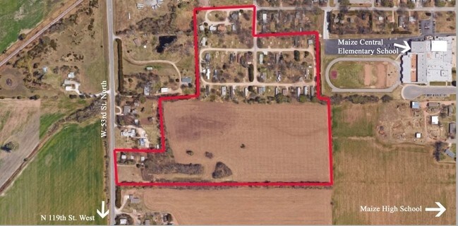
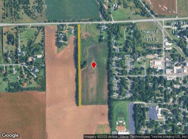
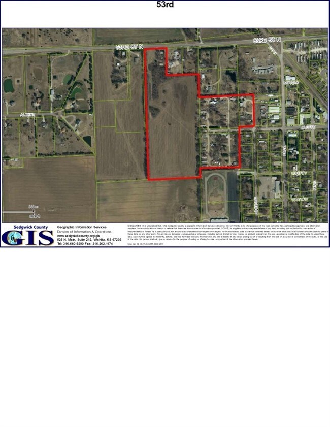
11321 W 53Rd St N, Maize, KS 67101
NEARBY LISTINGS FOR SALE OR LEASE
Property Detail
11321 W 53Rd St N
084-19-0-21-00-003.00
E1/2 N 50A E1/2 NW1/4 EXC BEG NE COR NW1/4 S 375 FT W 401 FT N 375 FT E TO BEG. SEC 19-26-1W
Farms
Sedgwick
X
Kansas
20173C0188G
21.55 AC
2024
Outlying Sedgwick County
2025
Wichita
010302
Wichita, KS
2,169 SF
DEMOGRAPHICS near 11321 W 53Rd St N
1 Mile
3 Mile
5 Mile
2024 Total Population
2,451
12,555
45,003
2029 Population
2,510
12,904
45,532
Pop Growth 2024-2029
+ 2.41%
+ 2.78%
+ 1.18%
Average Age
35
36
39
2024 Total Households
888
4,442
16,308
HH Growth 2024-2029
+ 2.36%
+ 2.79%
+ 1.13%
Median Household Inc
$60,656
$86,754
$90,213
Avg Household Size
2.70
2.80
2.70
2024 Avg HH Vehicles
2.00
2.00
2.00
Median Home Value
$175,561
$279,153
$241,086
Median Year Built
1998
2010
1997
Nearby Places
Map Layers
Map Styles
 Street
 Aerial
- Restaurants
- Banks
- Shops
- Fitness
- Groceries
PUBLIC TRANSPORTATION
AIRPORT
Wichita Dwight D Eisenhower Ntl
DRIVE
WALK
Distance
Wichita Dwight D Eisenhower Ntl
21 min
10.9 mi
Freight Ports
Tulsa Port Of Catoosa
DRIVE
WALK
Distance
Tulsa Port Of Catoosa
221 min
206.2 mi
SALE & LEASE HISTORY
LISTING DATE
SALE/LEASE

May 03, 2017
For Sale
Nearby Properties
Address
Land Use
TOTAL SIZE
Lot Size
Zoning
Address
Land Use
TOTAL SIZE
Lot Size
Zoning
662,237 SF
179.74 AC
SF-5
Address
Land Use
TOTAL SIZE
Lot Size
Zoning
558,228 SF
126.95 AC
SF-5
Address
Land Use
TOTAL SIZE
Lot Size
Zoning
160,112 SF
58.49 AC
AA
Address
Land Use
TOTAL SIZE
Lot Size
Zoning
175,639 SF
22.91 AC
SF-5
Address
Land Use
TOTAL SIZE
Lot Size
Zoning
104,252 SF
7.24 AC
SF-5
Address
Land Use
TOTAL SIZE
Lot Size
Zoning
89,126 SF
34.29 AC
R6
Address
Land Use
TOTAL SIZE
Lot Size
Zoning
38,927 SF
5 AC
LC
Address
Land Use
TOTAL SIZE
Lot Size
Zoning
77,159 SF
5.97 AC
SF-5
Address
Land Use
TOTAL SIZE
Lot Size
Zoning
84,317 SF
7.18 AC
SF-5
Address
Land Use
TOTAL SIZE
Lot Size
Zoning
68,496 SF
18.11 AC
LC
Address
Land Use
TOTAL SIZE
Lot Size
Zoning
34,963 SF
6.13 AC
Address
Land Use
TOTAL SIZE
Lot Size
Zoning
24,134 SF
8.78 AC
B1
Address
Land Use
TOTAL SIZE
Lot Size
Zoning
54,158 SF
6.74 AC
RR
Address
Land Use
TOTAL SIZE
Lot Size
Zoning
36,818 SF
14.91 AC
SF-5
Address
Land Use
TOTAL SIZE
Lot Size
Zoning
70,160 SF
13.48 AC
AA
Address
Land Use
TOTAL SIZE
Lot Size
Zoning
22,644 SF
3.50 AC
Address
Land Use
TOTAL SIZE
Lot Size
Zoning
171,301 SF
22.05 AC
Address
Land Use
TOTAL SIZE
Lot Size
Zoning
183,905 SF
18.93 AC
GC,LC
Address
Land Use
TOTAL SIZE
Lot Size
Zoning
18,410 SF
10.41 AC
LC
Address
Land Use
TOTAL SIZE
Lot Size
Zoning
53,446 SF
6.67 AC
LC
Address
Land Use
TOTAL SIZE
Lot Size
Zoning
136,383 SF
14.22 AC
LC
Address
Land Use
TOTAL SIZE
Lot Size
Zoning
62,886 SF
3.98 AC
GO
Address
Land Use
TOTAL SIZE
Lot Size
Zoning
34,983 SF
4.51 AC
LC
Address
Land Use
TOTAL SIZE
Lot Size
Zoning
8,796 SF
1.71 AC
LC
Address
Land Use
TOTAL SIZE
Lot Size
Zoning
29,299 SF
2.35 AC
LC
Address
Land Use
TOTAL SIZE
Lot Size
Zoning
46,450 SF
10.33 AC
LI
Address
Land Use
TOTAL SIZE
Lot Size
Zoning
14,234 SF
1.06 AC
LC
Address
Land Use
TOTAL SIZE
Lot Size
Zoning
75,422 SF
9.56 AC
SF-5
Address
Land Use
TOTAL SIZE
Lot Size
Zoning
32,063 SF
3.44 AC
LC
Address
Land Use
TOTAL SIZE
Lot Size
Zoning
54,763 SF
3.90 AC
LC
The World's #1 Commercial Real Estate Marketplace
Connect with us
© 2025 CoStar Group
The information above has been obtained from sources believed reliable. While we do not doubt its accuracy we have not verified it and make no guarantee, warranty or representation about it. It is your responsibility to independently confirm its accuracy and completeness. Any projections, opinions, assumptions, or estimates used are for example only and do not represent the current or future performance of the property. The value of this transaction to you depends on tax and other factors which should be evaluated by your tax, financial, and legal advisors. You and your advisors should conduct a careful, independent investigation of the property to determine to your satisfaction the suitability of the property for your needs.