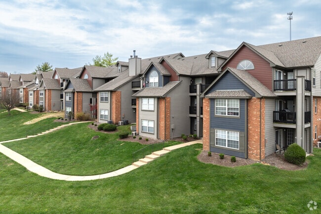
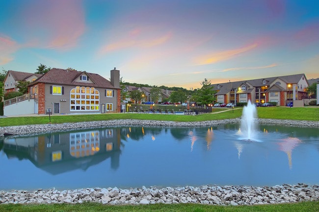
Property Record
1135 London Circle Ln, Fenton, MO 63026
NEARBY LISTINGS FOR SALE OR LEASE
-
-
View all Fenton listings for sale on LoopNet.com
Property Detail
1135 London Circle Ln
29O-14-0415
Polo Downs Apartments Plat One
Apartment
POLO DOWNS APARTMENTS PLAT TWO
X
St. Louis
29099C0050F
Missouri
2024
8.62 AC
2025
Outlying West County
221423
St. Louis
85,150 SF
St. Louis, MO-IL
DEMOGRAPHICS near 1135 London Circle Ln
1 Mile
3 Mile
5 Mile
2024 Total Population
6,944
46,235
105,237
2029 Population
6,939
46,425
105,052
Pop Growth 2024-2029
(0.07%)
+ 0.41%
(0.18%)
Average Age
41
41
43
2024 Total Households
2,710
17,869
42,711
HH Growth 2024-2029
+ 0.15%
+ 0.58%
(0.19%)
Median Household Inc
$78,579
$84,681
$83,724
Avg Household Size
2.50
2.50
2.40
2024 Avg HH Vehicles
2.00
2.00
2.00
Median Home Value
$259,976
$264,907
$276,017
Median Year Built
1987
1985
1982
Nearby Places
Map Layers
Map Styles
 Street
 Aerial
- Restaurants
- Banks
- Shops
- Fitness
- Groceries
PUBLIC TRANSPORTATION
COMMUTER RAIL
DRIVE
WALK
Distance
15 min
8.9 mi
AIRPORT
St Louis Lambert International
DRIVE
WALK
Distance
St Louis Lambert International
37 min
24.3 mi
Scott AFB/Midamerica St Louis
DRIVE
WALK
Distance
Scott AFB/Midamerica St Louis
63 min
45.0 mi
Nearby Properties
Address
Land Use
TOTAL SIZE
Lot Size
Zoning
Address
Land Use
TOTAL SIZE
Lot Size
Zoning
429,212 SF
53.13 AC
C-8
Address
Land Use
TOTAL SIZE
Lot Size
Zoning
256,956 SF
23.68 AC
21IP-1
Address
Land Use
TOTAL SIZE
Lot Size
Zoning
62.50 AC
NU
Address
Land Use
TOTAL SIZE
Lot Size
Zoning
460,421 SF
34.91 AC
21BP-2
Address
Land Use
TOTAL SIZE
Lot Size
Zoning
258,312 SF
16.34 AC
CC2
Address
Land Use
TOTAL SIZE
Lot Size
Zoning
139,212 SF
15.58 AC
21C-1
Address
Land Use
TOTAL SIZE
Lot Size
Zoning
112,840 SF
0.54 AC
C-8
Address
Land Use
TOTAL SIZE
Lot Size
Zoning
10.41 AC
21IP-1
Address
Land Use
TOTAL SIZE
Lot Size
Zoning
26.56 AC
NU
Address
Land Use
TOTAL SIZE
Lot Size
Zoning
375,522 SF
42.58 AC
C-8
Address
Land Use
TOTAL SIZE
Lot Size
Zoning
224,872 SF
34.78 AC
21BP-2
Address
Land Use
TOTAL SIZE
Lot Size
Zoning
154,844 SF
13.29 AC
21OT-3
Address
Land Use
TOTAL SIZE
Lot Size
Zoning
129,090 SF
17.78 AC
21C-1
Address
Land Use
TOTAL SIZE
Lot Size
Zoning
8.84 AC
21IP-1
Address
Land Use
TOTAL SIZE
Lot Size
Zoning
211,612 SF
41.36 AC
PB
Address
Land Use
TOTAL SIZE
Lot Size
Zoning
9.63 AC
21IP-1
Address
Land Use
TOTAL SIZE
Lot Size
Zoning
221,724 SF
21.98 AC
21OT-4
Address
Land Use
TOTAL SIZE
Lot Size
Zoning
91,465 SF
29.86 AC
21CP-1
Address
Land Use
TOTAL SIZE
Lot Size
Zoning
265,291 SF
14.91 AC
PR2
Address
Land Use
TOTAL SIZE
Lot Size
Zoning
141,806 SF
7.65 AC
C-8
Address
Land Use
TOTAL SIZE
Lot Size
Zoning
164,166 SF
16.88 AC
21C-1
Address
Land Use
TOTAL SIZE
Lot Size
Zoning
118,820 SF
13.30 AC
Address
Land Use
TOTAL SIZE
Lot Size
Zoning
156,592 SF
9.80 AC
PR2
Address
Land Use
TOTAL SIZE
Lot Size
Zoning
261,299 SF
17.73 AC
21BP-2
Address
Land Use
TOTAL SIZE
Lot Size
Zoning
187,710 SF
7.65 AC
21IP-1
Address
Land Use
TOTAL SIZE
Lot Size
Zoning
396 SF
61.20 AC
A
Address
Land Use
TOTAL SIZE
Lot Size
Zoning
250,500 SF
12 AC
J-1
Address
Land Use
TOTAL SIZE
Lot Size
Zoning
99,230 SF
17.56 AC
HP1
Address
Land Use
TOTAL SIZE
Lot Size
Zoning
36,344 SF
7.73 AC
21IP-1
Address
Land Use
TOTAL SIZE
Lot Size
Zoning
90,300 SF
9.42 AC
21OT-3
The World's #1 Commercial Real Estate Marketplace
Connect with us
© 2026 CoStar Group
The information above has been obtained from sources believed reliable. While we do not doubt its accuracy we have not verified it and make no guarantee, warranty or representation about it. It is your responsibility to independently confirm its accuracy and completeness. Any projections, opinions, assumptions, or estimates used are for example only and do not represent the current or future performance of the property. The value of this transaction to you depends on tax and other factors which should be evaluated by your tax, financial, and legal advisors. You and your advisors should conduct a careful, independent investigation of the property to determine to your satisfaction the suitability of the property for your needs.