Property Record
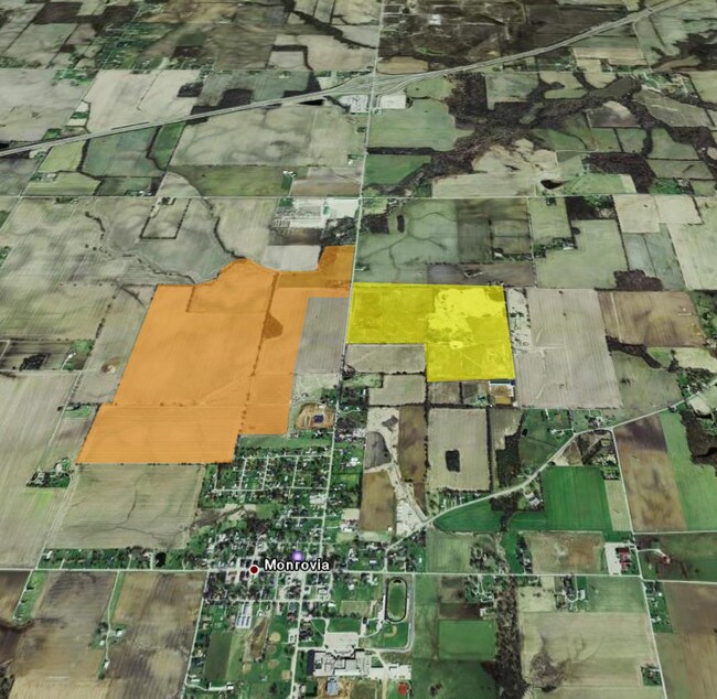
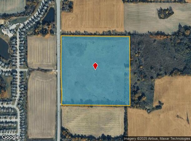
11373 N State Road 39, Monrovia, IN 46157

NEARBY LISTINGS FOR SALE OR LEASE
Property Detail
11373 N State Road 39
55-04-01-300-002.000-022
S1 T13 R1W PT NE SW 40 AC
Agriculturalland
Morgan
X
Indiana
18109C0130E
40 AC
2024
Morgan County
2024
Indianapolis
510402
Indianapolis-Carmel-Anderson, IN
DEMOGRAPHICS near 11373 N State Road 39
1 Mile
3 Mile
5 Mile
2024 Total Population
1,739
5,782
10,887
2029 Population
1,798
5,946
11,262
Pop Growth 2024-2029
+ 3.39%
+ 2.84%
+ 3.44%
Average Age
37
41
42
2024 Total Households
604
2,152
4,102
HH Growth 2024-2029
+ 3.31%
+ 2.79%
+ 3.39%
Median Household Inc
$83,296
$87,080
$85,058
Avg Household Size
2.80
2.70
2.60
2024 Avg HH Vehicles
2.00
3.00
3.00
Median Home Value
$177,287
$211,721
$232,007
Median Year Built
2004
1989
1981
Nearby Places
Map Layers
Map Styles
 Street
 Aerial
- Restaurants
- Banks
- Shops
- Fitness
- Groceries
PUBLIC TRANSPORTATION
AIRPORT
Indianapolis International
DRIVE
WALK
Distance
Indianapolis International
20 min
14.0 mi
Freight Ports
Port of Toledo
DRIVE
WALK
Distance
Port of Toledo
298 min
248.9 mi
SALE & LEASE HISTORY
LISTING DATE
SALE/LEASE

Sep 24, 2016
For Sale
Nearby Properties
Address
Land Use
TOTAL SIZE
Lot Size
Zoning
Address
Land Use
TOTAL SIZE
Lot Size
Zoning
1,049,878 SF
113.60 AC
Address
Land Use
TOTAL SIZE
Lot Size
Zoning
76.76 AC
Address
Land Use
TOTAL SIZE
Lot Size
Zoning
69.65 AC
Address
Land Use
TOTAL SIZE
Lot Size
Zoning
60.85 AC
Address
Land Use
TOTAL SIZE
Lot Size
Zoning
43.38 AC
Address
Land Use
TOTAL SIZE
Lot Size
Zoning
52.40 AC
Address
Land Use
TOTAL SIZE
Lot Size
Zoning
577,046 SF
59.48 AC
Address
Land Use
TOTAL SIZE
Lot Size
Zoning
56.08 AC
Address
Land Use
TOTAL SIZE
Lot Size
Zoning
601,744 SF
44.09 AC
Address
Land Use
TOTAL SIZE
Lot Size
Zoning
Address
Land Use
TOTAL SIZE
Lot Size
Zoning
597,500 SF
44.22 AC
Address
Land Use
TOTAL SIZE
Lot Size
Zoning
34.54 AC
Address
Land Use
TOTAL SIZE
Lot Size
Zoning
26.24 AC
Address
Land Use
TOTAL SIZE
Lot Size
Zoning
37.89 AC
Address
Land Use
TOTAL SIZE
Lot Size
Zoning
67.08 AC
Address
Land Use
TOTAL SIZE
Lot Size
Zoning
20.47 AC
Address
Land Use
TOTAL SIZE
Lot Size
Zoning
12,152 SF
10.66 AC
Address
Land Use
TOTAL SIZE
Lot Size
Zoning
190.58 AC
Address
Land Use
TOTAL SIZE
Lot Size
Zoning
17,389 SF
13.79 AC
Address
Land Use
TOTAL SIZE
Lot Size
Zoning
71,402 SF
7.07 AC
Address
Land Use
TOTAL SIZE
Lot Size
Zoning
8,256 SF
1.03 AC
Address
Land Use
TOTAL SIZE
Lot Size
Zoning
15,306 SF
4.65 AC
Address
Land Use
TOTAL SIZE
Lot Size
Zoning
7,979 SF
1.44 AC
Address
Land Use
TOTAL SIZE
Lot Size
Zoning
2,392 SF
20.36 AC
Address
Land Use
TOTAL SIZE
Lot Size
Zoning
9,230 SF
0.96 AC
Address
Land Use
TOTAL SIZE
Lot Size
Zoning
6,565 SF
3.94 AC
Address
Land Use
TOTAL SIZE
Lot Size
Zoning
6,522 SF
0.92 AC
Address
Land Use
TOTAL SIZE
Lot Size
Zoning
5,448 SF
3.97 AC
Address
Land Use
TOTAL SIZE
Lot Size
Zoning
Address
Land Use
TOTAL SIZE
Lot Size
Zoning
1,463 SF
0.35 AC
The World's #1 Commercial Real Estate Marketplace
Connect with us
© 2025 CoStar Group
The information above has been obtained from sources believed reliable. While we do not doubt its accuracy we have not verified it and make no guarantee, warranty or representation about it. It is your responsibility to independently confirm its accuracy and completeness. Any projections, opinions, assumptions, or estimates used are for example only and do not represent the current or future performance of the property. The value of this transaction to you depends on tax and other factors which should be evaluated by your tax, financial, and legal advisors. You and your advisors should conduct a careful, independent investigation of the property to determine to your satisfaction the suitability of the property for your needs.