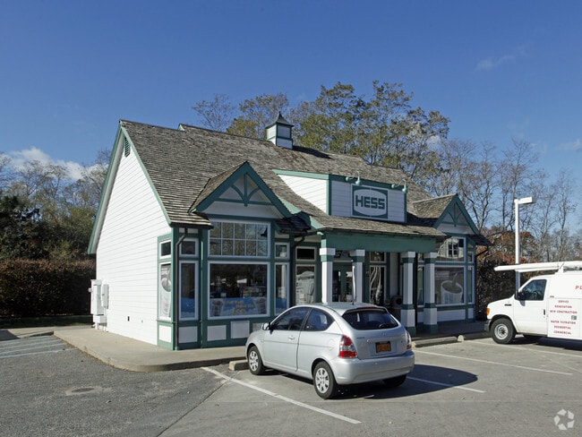
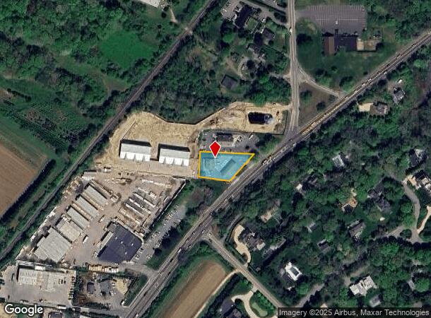
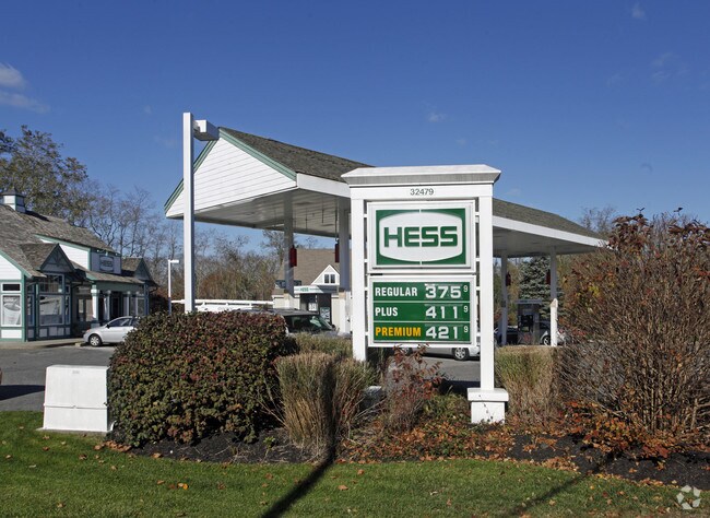
Property Record
1138 Montauk Hwy, Oakdale, NY 11769
NEARBY LISTINGS FOR SALE OR LEASE
Property Detail
1138 Montauk Hwy
0900-102-00-01-00-010-000
88 LD EQ +6000/ 89 REPLACK N/C89 BOR N/C 90 BOR
Servicestation
Suffolk
X
New York
36103C0536H
10
0
0.44 AC
2024
Eastern Suffolk
147602
Long Island (New York)
1,200 SF
Nassau County-Suffolk County, NY
DEMOGRAPHICS near 1138 Montauk Hwy
1 Mile
3 Mile
5 Mile
2024 Total Population
1,209
9,808
29,739
2029 Population
1,313
10,337
31,273
Pop Growth 2024-2029
+ 8.60%
+ 5.39%
+ 5.16%
Average Age
46
45
45
2024 Total Households
456
3,784
11,460
HH Growth 2024-2029
+ 8.77%
+ 5.31%
+ 5.10%
Median Household Inc
$230,112
$170,058
$136,545
Avg Household Size
2.50
2.50
2.50
2024 Avg HH Vehicles
2.00
2.00
2.00
Median Home Value
$1,111,111
$1,101,528
$1,054,909
Median Year Built
1983
1982
1982
Nearby Places
- Restaurants
- Banks
- Shops
- Fitness
- Groceries
PUBLIC TRANSPORTATION
COMMUTER RAIL
Bridgehampton Station (Montauk Branch - Long Island Rail Road)
DRIVE
WALK
Distance
Bridgehampton Station (Montauk Branch - Long Island Rail Road)
6 min
2.6 mi
Southampton Station (Montauk Branch - Long Island Rail Road)
DRIVE
WALK
Distance
Southampton Station (Montauk Branch - Long Island Rail Road)
8 min
3.6 mi
Freight Ports
Port of New Haven
DRIVE
WALK
Distance
Port of New Haven
179 min
79.9 mi
Nearby Properties
Address
Land Use
TOTAL SIZE
Lot Size
Zoning
Address
Land Use
TOTAL SIZE
Lot Size
Zoning
138,725 SF
14.70 AC
SCB
Address
Land Use
TOTAL SIZE
Lot Size
Zoning
42 AC
VILLA
Address
Land Use
TOTAL SIZE
Lot Size
Zoning
69,043 SF
16.40 AC
SCB
Address
Land Use
TOTAL SIZE
Lot Size
Zoning
9,223 SF
11.22 AC
R60
Address
Land Use
TOTAL SIZE
Lot Size
Zoning
13,935 SF
4.07 AC
R80
Address
Land Use
TOTAL SIZE
Lot Size
Zoning
25,819 SF
2.85 AC
R80
Address
Land Use
TOTAL SIZE
Lot Size
Zoning
37,222 SF
13.77 AC
CR60
Address
Land Use
TOTAL SIZE
Lot Size
Zoning
6,516 SF
2.44 AC
R60
Address
Land Use
TOTAL SIZE
Lot Size
Zoning
12,145 SF
2.60 AC
CR60
Address
Land Use
TOTAL SIZE
Lot Size
Zoning
6.40 AC
VILLA
Address
Land Use
TOTAL SIZE
Lot Size
Zoning
5,358 SF
1.33 AC
R60
Address
Land Use
TOTAL SIZE
Lot Size
Zoning
9,372 SF
1.36 AC
R60
Address
Land Use
TOTAL SIZE
Lot Size
Zoning
73,470 SF
122.50 AC
OSC
Address
Land Use
TOTAL SIZE
Lot Size
Zoning
29,155 SF
11.12 AC
R20
Address
Land Use
TOTAL SIZE
Lot Size
Zoning
3,397 SF
1.24 AC
R60
Address
Land Use
TOTAL SIZE
Lot Size
Zoning
7,955 SF
203.49 AC
CR80
Address
Land Use
TOTAL SIZE
Lot Size
Zoning
2.66 AC
R80
Address
Land Use
TOTAL SIZE
Lot Size
Zoning
16 AC
R120
Address
Land Use
TOTAL SIZE
Lot Size
Zoning
3.60 AC
VILLA
Address
Land Use
TOTAL SIZE
Lot Size
Zoning
1.74 AC
R60
Address
Land Use
TOTAL SIZE
Lot Size
Zoning
6,304 SF
1.90 AC
R60
Address
Land Use
TOTAL SIZE
Lot Size
Zoning
16.07 AC
R80
Address
Land Use
TOTAL SIZE
Lot Size
Zoning
8.51 AC
LI40
Address
Land Use
TOTAL SIZE
Lot Size
Zoning
11,650 SF
3.10 AC
R80
Address
Land Use
TOTAL SIZE
Lot Size
Zoning
4 AC
R120
Address
Land Use
TOTAL SIZE
Lot Size
Zoning
12,486 SF
2.07 AC
R80
Address
Land Use
TOTAL SIZE
Lot Size
Zoning
11,058 SF
5.65 AC
CR80
Address
Land Use
TOTAL SIZE
Lot Size
Zoning
4.08 AC
VILLA
Address
Land Use
TOTAL SIZE
Lot Size
Zoning
25 AC
CR40
Address
Land Use
TOTAL SIZE
Lot Size
Zoning
3.88 AC
VILLA
The World's #1 Commercial Real Estate Marketplace
Connect with us
© 2025 CoStar Group
The information above has been obtained from sources believed reliable. While we do not doubt its accuracy we have not verified it and make no guarantee, warranty or representation about it. It is your responsibility to independently confirm its accuracy and completeness. Any projections, opinions, assumptions, or estimates used are for example only and do not represent the current or future performance of the property. The value of this transaction to you depends on tax and other factors which should be evaluated by your tax, financial, and legal advisors. You and your advisors should conduct a careful, independent investigation of the property to determine to your satisfaction the suitability of the property for your needs.